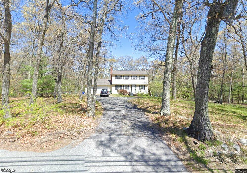
369 High Plain Rd Andover, MA 01810
Far West Andover NeighborhoodEstimated Value: $816,546 - $1,169,000
4
Beds
2
Baths
1,568
Sq Ft
$600/Sq Ft
Est. Value
About This Home
This home is located at 369 High Plain Rd, Andover, MA 01810 and is currently estimated at $941,387, approximately $600 per square foot. 369 High Plain Rd is a home located in Essex County with nearby schools including High Plain Elementary School, Wood Hill Middle School, and Andover High School.
Ownership History
Date
Name
Owned For
Owner Type
Purchase Details
Closed on
Mar 24, 2016
Sold by
Chartier-Gawlinski Ft
Bought by
Gawlinski Laura A and Chartier Steven M
Current Estimated Value
Purchase Details
Closed on
Feb 27, 2004
Sold by
Chartier Steven M and Gawlinski Laura A
Bought by
Chartier-Gawlinski Ft
Purchase Details
Closed on
Jun 28, 1996
Sold by
Larson Donald J
Bought by
Chartier Steven M
Purchase Details
Closed on
May 29, 1992
Sold by
Litchfield Edwin B
Bought by
Larson Donald J
Create a Home Valuation Report for This Property
The Home Valuation Report is an in-depth analysis detailing your home's value as well as a comparison with similar homes in the area
Home Values in the Area
Average Home Value in this Area
Purchase History
| Date | Buyer | Sale Price | Title Company |
|---|---|---|---|
| Gawlinski Laura A | -- | -- | |
| Chartier-Gawlinski Ft | -- | -- | |
| Chartier Steven M | $245,000 | -- | |
| Larson Donald J | $229,000 | -- |
Source: Public Records
Mortgage History
| Date | Status | Borrower | Loan Amount |
|---|---|---|---|
| Previous Owner | Larson Donald J | $208,000 | |
| Previous Owner | Larson Donald J | $175,000 | |
| Previous Owner | Larson Donald J | $192,300 |
Source: Public Records
Tax History
| Year | Tax Paid | Tax Assessment Tax Assessment Total Assessment is a certain percentage of the fair market value that is determined by local assessors to be the total taxable value of land and additions on the property. | Land | Improvement |
|---|---|---|---|---|
| 2024 | $9,365 | $727,100 | $447,500 | $279,600 |
| 2023 | $8,968 | $656,500 | $403,500 | $253,000 |
| 2022 | $8,459 | $579,400 | $351,200 | $228,200 |
| 2021 | $8,127 | $531,500 | $319,400 | $212,100 |
| 2020 | $7,826 | $521,400 | $311,600 | $209,800 |
| 2019 | $7,786 | $509,900 | $302,500 | $207,400 |
| 2018 | $7,570 | $484,000 | $291,100 | $192,900 |
| 2017 | $7,265 | $478,600 | $285,500 | $193,100 |
| 2016 | $7,118 | $480,300 | $285,500 | $194,800 |
| 2015 | $6,895 | $460,600 | $274,600 | $186,000 |
Source: Public Records
Map
Nearby Homes
- 322 River Rd
- 29 Stoneybrook Cir
- 18 Ravens Bluff
- 2 Francis Dr Unit 405
- 4 Francis Dr Unit 312
- 4 Francis Dr Unit 207
- 2 Francis Dr Unit 301
- 2 Weeping Willow Dr
- 46 Hopkins Cir
- 4 Weeping Willow Dr
- 5 Weeping Willow Dr
- 22 Haggetts Pond Rd
- 15 Geneva Rd
- 14 Geneva Rd
- 750 Brookside Dr Unit G
- 9 Oakland Rd
- 2 Boardwalk Dr
- 58 Chandler Rd
- 31 Varnum Ave
- 821 Merrimack Ave
- 365 High Plain Rd
- 373 High Plain Rd
- 1 Deerfield Way
- 1 Deerfield Way Unit 1
- 4 Brady Loop
- 370 High Plain Rd
- 6 Cross St
- 377 High Plain Rd
- 361 High Plain Rd
- 10 Cross St
- 386 High Plain Rd
- 366 High Plain Rd
- 4 Deerfield Way
- 8 Brady Loop
- 4 Golden Oaks Ln
- 381 High Plain Rd
- 2 Golden Oaks Ln
- 3 Brady Loop
- 16 Cross St
- 6 Golden Oaks Ln
Your Personal Tour Guide
Ask me questions while you tour the home.