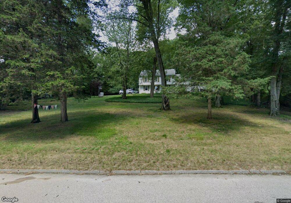
37 Coult Ln Old Lyme, CT 06371
Estimated Value: $576,000 - $767,000
4
Beds
4
Baths
1,950
Sq Ft
$335/Sq Ft
Est. Value
About This Home
This home is located at 37 Coult Ln, Old Lyme, CT 06371 and is currently estimated at $653,488, approximately $335 per square foot. 37 Coult Ln is a home located in New London County with nearby schools including Mile Creek School, Lyme-Old Lyme Middle School, and Lyme-Old Lyme High School.
Ownership History
Date
Name
Owned For
Owner Type
Purchase Details
Closed on
Jul 11, 2019
Sold by
Glass Edgar R
Bought by
Edgar R Glass Ret
Current Estimated Value
Purchase Details
Closed on
Apr 26, 1995
Sold by
Simpson Bruce L and Simpson Doreen M
Bought by
Glass Edgar R and Glass Barbara J
Home Financials for this Owner
Home Financials are based on the most recent Mortgage that was taken out on this home.
Original Mortgage
$65,000
Interest Rate
8.33%
Mortgage Type
Unknown
Purchase Details
Closed on
Sep 17, 1991
Sold by
Cardinal John R and Cardinal Sharon
Bought by
Simpson Bruce and Simpson Doreen
Create a Home Valuation Report for This Property
The Home Valuation Report is an in-depth analysis detailing your home's value as well as a comparison with similar homes in the area
Home Values in the Area
Average Home Value in this Area
Purchase History
| Date | Buyer | Sale Price | Title Company |
|---|---|---|---|
| Edgar R Glass Ret | -- | -- | |
| Glass Edgar R | $175,000 | -- | |
| Simpson Bruce | $164,000 | -- |
Source: Public Records
Mortgage History
| Date | Status | Borrower | Loan Amount |
|---|---|---|---|
| Previous Owner | Simpson Bruce | $322,100 | |
| Previous Owner | Simpson Bruce | $99,000 | |
| Previous Owner | Simpson Bruce | $48,000 | |
| Previous Owner | Simpson Bruce | $65,000 |
Source: Public Records
Tax History Compared to Growth
Tax History
| Year | Tax Paid | Tax Assessment Tax Assessment Total Assessment is a certain percentage of the fair market value that is determined by local assessors to be the total taxable value of land and additions on the property. | Land | Improvement |
|---|---|---|---|---|
| 2025 | $5,870 | $361,700 | $131,200 | $230,500 |
| 2024 | $5,324 | $218,200 | $106,200 | $112,000 |
| 2023 | $5,128 | $218,200 | $106,200 | $112,000 |
| 2022 | $5,128 | $218,200 | $106,200 | $112,000 |
| 2021 | $3,068 | $218,200 | $106,200 | $112,000 |
| 2020 | $3,068 | $218,200 | $106,200 | $112,000 |
| 2019 | $5,448 | $243,100 | $106,200 | $136,900 |
| 2018 | $2,926 | $243,100 | $106,200 | $136,900 |
| 2017 | $5,315 | $243,100 | $106,200 | $136,900 |
| 2016 | $5,154 | $243,100 | $106,200 | $136,900 |
| 2015 | $5,013 | $243,100 | $106,200 | $136,900 |
| 2014 | $4,764 | $242,300 | $111,000 | $131,300 |
Source: Public Records
Map
Nearby Homes
- 6 Tantummaheag Rd
- 30 Burr Rd
- 9 Longacre Ln
- 70 Sill Ln
- 9 Matson Ridge
- 33 Sill Ln
- 41 Watrous Point Rd
- 67 Sill Ln
- 131 Bill Hill Rd
- 30 Watrous Point Rd
- 1 Huntley Rd
- 40 A Ayers Point Rd
- 96 Ayers Point Rd
- 53 Elys Ferry Rd
- 12 Rocky Point Rd
- 5 Wyckford Ln Unit 5
- 11 Trolley Crossing
- 13 Hemlock Dr
- 11 Neck Rd
- 20 Hemlock Dr