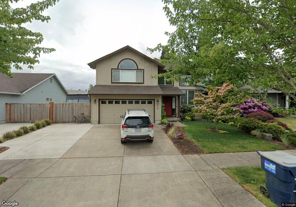
370 Briana Ln Eugene, OR 97404
River Road NeighborhoodEstimated Value: $475,000 - $569,000
4
Beds
3
Baths
2,146
Sq Ft
$239/Sq Ft
Est. Value
About This Home
This home is located at 370 Briana Ln, Eugene, OR 97404 and is currently estimated at $512,157, approximately $238 per square foot. 370 Briana Ln is a home located in Lane County with nearby schools including River Road/El Camino del Río Elementary School, Kelly Middle School, and North Eugene High School.
Ownership History
Date
Name
Owned For
Owner Type
Purchase Details
Closed on
Mar 15, 2016
Sold by
Tatsumi Sky H
Bought by
Balfrey Family 2015 Revocable Trust and Balfrey Deborah Kay
Current Estimated Value
Purchase Details
Closed on
May 29, 2012
Sold by
Federal National Mortgage Association
Bought by
Tatsumi Sky H
Home Financials for this Owner
Home Financials are based on the most recent Mortgage that was taken out on this home.
Original Mortgage
$164,000
Interest Rate
3.86%
Mortgage Type
New Conventional
Purchase Details
Closed on
Nov 16, 2011
Sold by
Mccartney Paul S
Bought by
Federal National Mortgage Association
Purchase Details
Closed on
Feb 24, 2003
Sold by
Breeden Bros Inc
Bought by
Mccartney Paul S
Home Financials for this Owner
Home Financials are based on the most recent Mortgage that was taken out on this home.
Original Mortgage
$211,196
Interest Rate
5.93%
Mortgage Type
VA
Create a Home Valuation Report for This Property
The Home Valuation Report is an in-depth analysis detailing your home's value as well as a comparison with similar homes in the area
Home Values in the Area
Average Home Value in this Area
Purchase History
| Date | Buyer | Sale Price | Title Company |
|---|---|---|---|
| Balfrey Family 2015 Revocable Trust | $295,000 | Western Title & Escrow Co | |
| Tatsumi Sky H | $205,000 | Nextitle | |
| Federal National Mortgage Association | $266,958 | First American Title | |
| Mccartney Paul S | $205,045 | Cascade Title Co |
Source: Public Records
Mortgage History
| Date | Status | Borrower | Loan Amount |
|---|---|---|---|
| Previous Owner | Tatsumi Sky H | $164,000 | |
| Previous Owner | Mccartney Paul S | $211,196 |
Source: Public Records
Tax History
| Year | Tax Paid | Tax Assessment Tax Assessment Total Assessment is a certain percentage of the fair market value that is determined by local assessors to be the total taxable value of land and additions on the property. | Land | Improvement |
|---|---|---|---|---|
| 2025 | $6,503 | $333,741 | -- | -- |
| 2024 | $6,422 | $324,021 | -- | -- |
| 2023 | $6,422 | $314,584 | $0 | $0 |
| 2022 | $6,016 | $305,422 | $0 | $0 |
| 2021 | $5,651 | $296,527 | $0 | $0 |
| 2020 | $5,550 | $287,891 | $0 | $0 |
| 2019 | $5,327 | $279,506 | $0 | $0 |
| 2018 | $5,006 | $263,462 | $0 | $0 |
| 2017 | $4,645 | $263,462 | $0 | $0 |
| 2016 | $4,404 | $255,788 | $0 | $0 |
| 2015 | $4,275 | $248,338 | $0 | $0 |
| 2014 | $4,204 | $241,105 | $0 | $0 |
Source: Public Records
Map
Nearby Homes
- 1360 Andersen Ln
- 1420 Evergreen Dr
- 1483 Barton St
- 1487 Barton St
- 1314 Dalton Dr
- 1010 Horn Ln
- 1555 Escalante St
- 1685 Evergreen Dr
- 172 Norman Ave
- 389 Maxwell Rd
- 154 Norman Ave
- 260 Greenleaf Ave
- 1880 Manihi Dr
- 1566 Maywood Ave
- 1010 N Park Ave
- 1633 Zoe Ave
- 788 Cornwall Ave
- 32 Marion Ln
- 895 Glory Dr
- 1682 Hemlock St
Your Personal Tour Guide
Ask me questions while you tour the home.