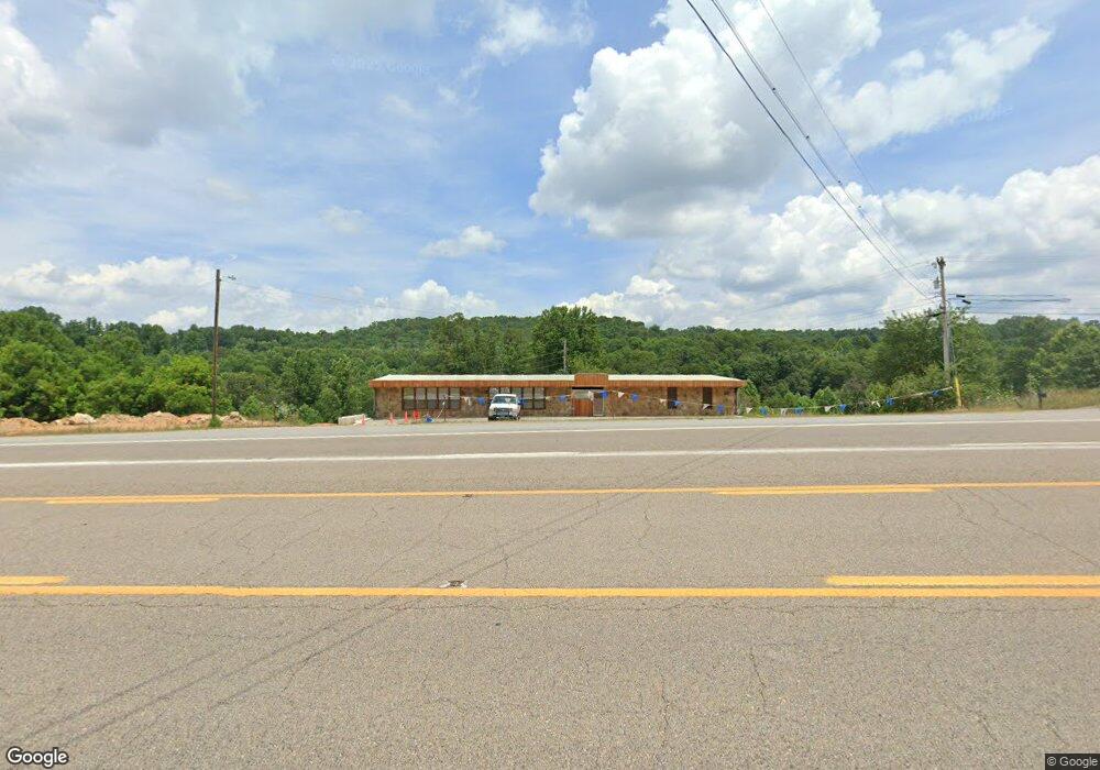
3700 Highway 25e Tazewell, TN 37879
Estimated Value: $371,781
--
Bed
--
Bath
4,000
Sq Ft
$93/Sq Ft
Est. Value
About This Home
This home is located at 3700 Highway 25e, Tazewell, TN 37879 and is currently estimated at $371,781, approximately $92 per square foot. 3700 Highway 25e is a home located in Claiborne County.
Ownership History
Date
Name
Owned For
Owner Type
Purchase Details
Closed on
May 23, 2024
Sold by
Anglin Debra and Anglin John
Bought by
Flight Leader Holdings Llc
Current Estimated Value
Purchase Details
Closed on
Feb 3, 2016
Sold by
Fultz Lenore
Bought by
Anglin Debra and Anglin John
Purchase Details
Closed on
May 25, 2010
Sold by
Anglin Debra
Bought by
Fultz Ed
Purchase Details
Closed on
Nov 6, 1997
Bought by
Anglin Debra and Anglin John
Home Financials for this Owner
Home Financials are based on the most recent Mortgage that was taken out on this home.
Original Mortgage
$115,000
Interest Rate
7.31%
Mortgage Type
Commercial
Purchase Details
Closed on
Aug 16, 1996
Sold by
Fultz Edward and Fultz Lenore
Bought by
State Of Tennessee
Purchase Details
Closed on
May 9, 1994
Bought by
Fultz Edward and Fultz Lenore
Purchase Details
Closed on
Jan 1, 1975
Bought by
Peters Everett and Peters Violet
Create a Home Valuation Report for This Property
The Home Valuation Report is an in-depth analysis detailing your home's value as well as a comparison with similar homes in the area
Home Values in the Area
Average Home Value in this Area
Purchase History
| Date | Buyer | Sale Price | Title Company |
|---|---|---|---|
| Flight Leader Holdings Llc | $500,000 | None Listed On Document | |
| Flight Leader Holdings Llc | $500,000 | None Listed On Document | |
| Anglin Debra | -- | -- | |
| Fultz Ed | -- | -- | |
| Anglin Debra | $95,000 | -- | |
| State Of Tennessee | $850 | -- | |
| Fultz Edward | $82,000 | -- | |
| Peters Everett | -- | -- |
Source: Public Records
Mortgage History
| Date | Status | Borrower | Loan Amount |
|---|---|---|---|
| Previous Owner | Peters Everett | $115,000 |
Source: Public Records
Tax History Compared to Growth
Tax History
| Year | Tax Paid | Tax Assessment Tax Assessment Total Assessment is a certain percentage of the fair market value that is determined by local assessors to be the total taxable value of land and additions on the property. | Land | Improvement |
|---|---|---|---|---|
| 2024 | $1,550 | $66,240 | $21,520 | $44,720 |
| 2023 | $1,550 | $66,240 | $21,520 | $44,720 |
| 2022 | $1,325 | $66,240 | $21,520 | $44,720 |
| 2021 | $1,451 | $56,280 | $18,800 | $37,480 |
| 2020 | $1,451 | $56,280 | $18,800 | $37,480 |
| 2019 | $1,451 | $56,280 | $18,800 | $37,480 |
| 2018 | $1,451 | $56,280 | $18,800 | $37,480 |
| 2017 | $1,451 | $56,280 | $18,800 | $37,480 |
| 2016 | $1,327 | $51,440 | $18,800 | $32,640 |
| 2015 | $1,276 | $51,440 | $18,800 | $32,640 |
| 2014 | $1,276 | $51,419 | $0 | $0 |
Source: Public Records
Map
Nearby Homes
- 450 Buffalo Ln
- 1037 Dogwood Heights Dr
- 429 Dogwood Heights Dr
- 122 Opal St
- 181 Gloria Dr
- 282 Jay Dr
- 136 Cardwell Dr
- 485 Norris Dr
- 175 Norris Dr
- 1258 Dogwood Rd
- 1814 Bacchus Rd
- 1820 Bacchus Rd
- 818 Cave Springs Rd
- Tbd Cave Springs Rd
- 0 Highway 25 Hwy E Unit 1313870
- 0 Harolds Ln
- 223 Beamer Rd
- 227 Southern Ln
- 4703 Highway 25e
- 0 Old Cave Springs Rd
- 3746 Highway 25e
- 3662 Highway 25e
- 531 Anders Rd
- 3733 Highway 25e
- 767 Old Mulberry Rd
- 452 Anders Rd
- 727 Old Mulberry Rd
- 746 Old Mulberry Rd
- 0 Us 25e Unit 442944
- 0 Us 25e Unit 443734
- 0 Us 25e Unit 774769
- 920 Old Mulberry Rd
- 920 Old Mulberry Rd
- 3561 Highway 25e
- 729 Old Mulberry Rd
- 123 Kersey Ln
- 149 Kersey Ln
- 3539 Highway 25e
- 150 Kersey Ln
- 115 Bussell Ln