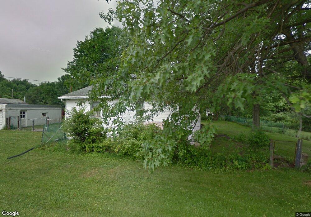
3702 Haskell Ave Youngstown, OH 44515
Austintown NeighborhoodEstimated Value: $94,000 - $109,000
2
Beds
1
Bath
812
Sq Ft
$128/Sq Ft
Est. Value
About This Home
This home is located at 3702 Haskell Ave, Youngstown, OH 44515 and is currently estimated at $104,000, approximately $128 per square foot. 3702 Haskell Ave is a home located in Mahoning County with nearby schools including Austintown Elementary School, Austintown Intermediate School, and Austintown Middle School.
Ownership History
Date
Name
Owned For
Owner Type
Purchase Details
Closed on
Feb 25, 2022
Bought by
Rising Valley Residential
Current Estimated Value
Purchase Details
Closed on
Feb 19, 2020
Sold by
Cramer Patricia
Bought by
Zembower Michael Paul
Purchase Details
Closed on
Dec 4, 2019
Sold by
Carson Sarah
Bought by
Cramer Patricia
Purchase Details
Closed on
Nov 19, 2019
Sold by
Carson Sarah and Cramer Patricia
Bought by
Carson Sarah and Cramer Patricia
Purchase Details
Closed on
May 13, 1975
Bought by
Sweeney Rose E
Create a Home Valuation Report for This Property
The Home Valuation Report is an in-depth analysis detailing your home's value as well as a comparison with similar homes in the area
Home Values in the Area
Average Home Value in this Area
Purchase History
| Date | Buyer | Sale Price | Title Company |
|---|---|---|---|
| Rising Valley Residential | -- | -- | |
| Zembower Michael Paul | -- | None Available | |
| Cramer Patricia | $12,300 | None Available | |
| Carson Sarah | -- | None Available | |
| Sweeney Rose E | -- | -- |
Source: Public Records
Tax History Compared to Growth
Tax History
| Year | Tax Paid | Tax Assessment Tax Assessment Total Assessment is a certain percentage of the fair market value that is determined by local assessors to be the total taxable value of land and additions on the property. | Land | Improvement |
|---|---|---|---|---|
| 2024 | $573 | $12,180 | $910 | $11,270 |
| 2023 | $564 | $12,180 | $910 | $11,270 |
| 2022 | $536 | $9,260 | $810 | $8,450 |
| 2021 | $536 | $9,260 | $810 | $8,450 |
| 2020 | $538 | $9,260 | $810 | $8,450 |
| 2019 | $456 | $7,100 | $700 | $6,400 |
| 2018 | $6 | $7,100 | $700 | $6,400 |
| 2017 | $45 | $7,100 | $700 | $6,400 |
| 2016 | $87 | $10,150 | $700 | $9,450 |
| 2015 | $84 | $10,150 | $700 | $9,450 |
| 2014 | $85 | $10,150 | $700 | $9,450 |
| 2013 | $84 | $10,150 | $700 | $9,450 |
Source: Public Records
Map
Nearby Homes
- 4028 Lanterman Rd
- 0 W Liberty Unit 5153649
- 2700 W Liberty St
- 2442 Oregon Ave
- 2416 Oregon Ave
- 2555 Walnut St
- W Liberty St Unit LotWP001
- 2453 Eddie St
- 453 N Dunlap Ave
- 460 N Osborn Ave
- 212 N Navarre Ave
- 423 Imperial St
- 2208 Cherry Hill Ave
- 69 Abbey St
- 635 N Hazelwood Ave
- 50 Abbey St
- 446 N Schenley Ave
- 3129 Dearborn St
- 2101 Cherry Hill Ave
- 403 W Liberty St
- 1249 Mildred St
- 3704 Annetta Ave
- 3685 Lanterman Rd
- 1230 N Meridian Rd
- 3619 Lanterman Rd
- 1214 N Meridian Rd
- 3848 Lanterman Rd
- 3825 Lanterman Rd
- 3690 Riblett Rd
- 3850 Lanterman Rd
- 3851 Lanterman Rd
- 1191 N Meridian Rd
- 3738 Riblett Rd
- 1185 N Meridian Rd
- 0 N Meridian Rd Unit 3461990
- 0 N Meridian Rd Unit 4122655
- 3853 Lanterman Rd
- 3686 Riblett Rd
- 3890 Lanterman Rd
- 3648 Riblett Rd