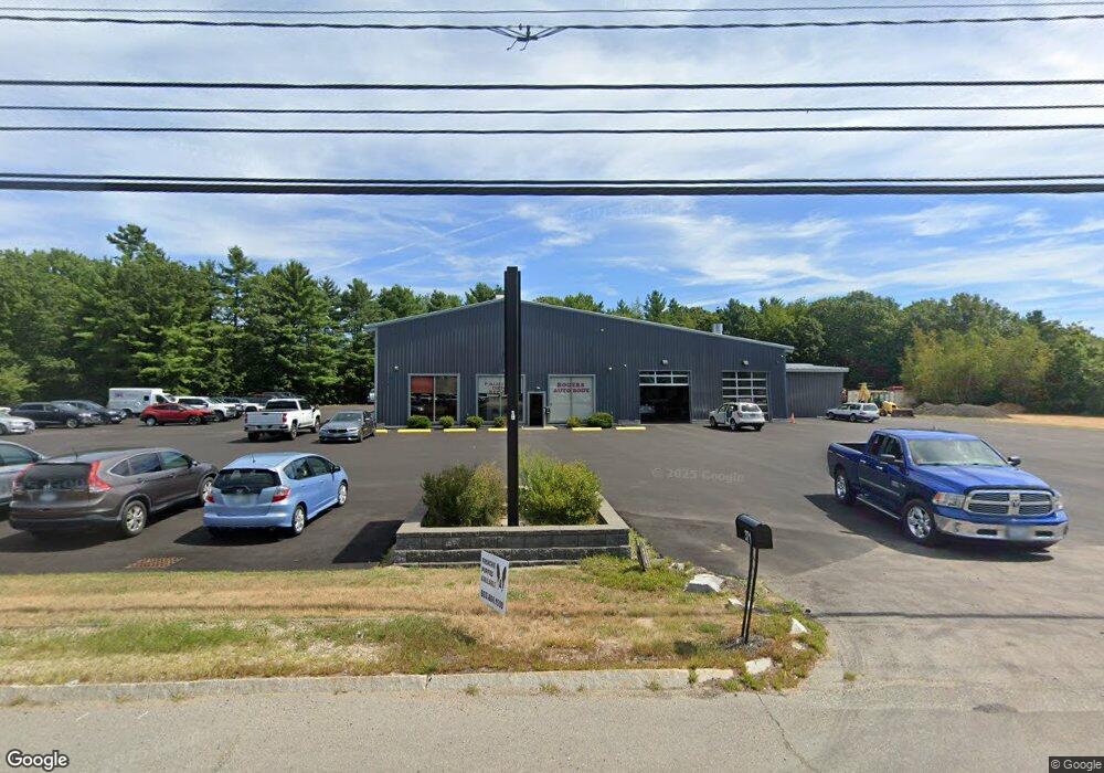
371 Route 108 Somersworth, NH 03878
Estimated Value: $992,718
--
Bed
--
Bath
14,745
Sq Ft
$67/Sq Ft
Est. Value
About This Home
This home is located at 371 Route 108, Somersworth, NH 03878 and is currently priced at $992,718, approximately $67 per square foot. 371 Route 108 is a home located in Strafford County with nearby schools including Maple Wood Elementary School, Somersworth High School, and Tri-City Christian Academy.
Ownership History
Date
Name
Owned For
Owner Type
Purchase Details
Closed on
Jan 10, 2024
Sold by
Therrien Roger R
Bought by
Rogers Auto Body Re Llc
Current Estimated Value
Purchase Details
Closed on
Nov 2, 2012
Sold by
Houde Roland E and Houde Ora M
Bought by
Therrien Roger R
Purchase Details
Closed on
Jul 19, 2011
Sold by
Bushongs Property Mgmt
Bought by
Houde Roland E and Houde Ora M
Purchase Details
Closed on
Apr 29, 2005
Sold by
Houde Roland E and Houde Ora M
Bought by
Bushongs Property Mgmt
Home Financials for this Owner
Home Financials are based on the most recent Mortgage that was taken out on this home.
Original Mortgage
$450,000
Interest Rate
5.95%
Mortgage Type
Commercial
Create a Home Valuation Report for This Property
The Home Valuation Report is an in-depth analysis detailing your home's value as well as a comparison with similar homes in the area
Home Values in the Area
Average Home Value in this Area
Purchase History
| Date | Buyer | Sale Price | Title Company |
|---|---|---|---|
| Rogers Auto Body Re Llc | -- | None Available | |
| Therrien Roger R | $450,000 | -- | |
| Therrien Roger R | $450,000 | -- | |
| Houde Roland E | $335,000 | -- | |
| Houde Roland E | $335,000 | -- | |
| Bushongs Property Mgmt | $500,000 | -- | |
| Bushongs Property Mgmt | $500,000 | -- |
Source: Public Records
Mortgage History
| Date | Status | Borrower | Loan Amount |
|---|---|---|---|
| Previous Owner | Bushongs Property Mgmt | $450,000 | |
| Closed | Bushongs Property Mgmt | $0 |
Source: Public Records
Tax History Compared to Growth
Tax History
| Year | Tax Paid | Tax Assessment Tax Assessment Total Assessment is a certain percentage of the fair market value that is determined by local assessors to be the total taxable value of land and additions on the property. | Land | Improvement |
|---|---|---|---|---|
| 2024 | $47,588 | $2,544,800 | $497,400 | $2,047,400 |
| 2023 | $25,450 | $868,600 | $307,000 | $561,600 |
| 2022 | $24,399 | $868,600 | $307,000 | $561,600 |
| 2021 | $23,874 | $867,200 | $307,000 | $560,200 |
| 2020 | $24,152 | $867,200 | $307,000 | $560,200 |
| 2019 | $23,524 | $862,300 | $307,000 | $555,300 |
| 2018 | $25,956 | $776,900 | $340,200 | $436,700 |
| 2017 | $25,714 | $777,100 | $340,200 | $436,900 |
| 2016 | $21,145 | $658,300 | $340,200 | $318,100 |
| 2015 | $20,153 | $624,900 | $340,200 | $284,700 |
| 2014 | $16,763 | $538,300 | $253,600 | $284,700 |
Source: Public Records
Map
Nearby Homes
- 395 Route 108
- 159 W High St
- 43 Otis Rd
- 45 Crystal Springs Way
- 203 New Hampshire 108
- 320 Old Dover Rd
- 38 Laurel Ln
- 407 Blackwater Rd
- 163 Rochester St
- 187 Old Rochester Rd
- 18 Lenox Dr Unit C
- 301 Sherwood Glen
- 200 Sherwood Glen
- 229 Sherwood Glen
- 206 Sherwood Glen
- 29 Chadwick Ln
- 19B Birch Hill Ln Unit 19B
- 23A Birch Hill Ln Unit 23A
- 14 Cherokee St
- 23B Birch Hill Ln Unit 23B
- 214 W High St
- 212 W High St
- 219 W High St
- 210 W High St
- 215 W High St
- 208 W High St
- 206 W High St
- 213 W High St
- 350 Route 108
- 350 Route 108
- 350 Route 108
- 350 Route 108 Unit 11B & 12B
- 350 Route 108 Unit 12B
- 350 Route 108 Unit 11B
- 350 Route 108
- 350 Route 108
- 350 Route 108 Unit 2A
- 350 Route 108 Unit 6A
- 350 Route 108 Unit 3B
- 350 Route 108