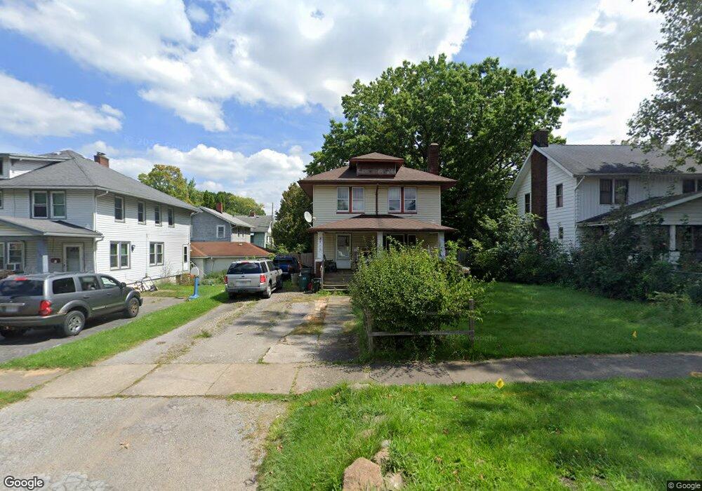
3711 Loveland Rd Youngstown, OH 44502
Buckeye Plat NeighborhoodEstimated Value: $60,046 - $91,000
3
Beds
1
Bath
1,344
Sq Ft
$60/Sq Ft
Est. Value
About This Home
This home is located at 3711 Loveland Rd, Youngstown, OH 44502 and is currently estimated at $80,762, approximately $60 per square foot. 3711 Loveland Rd is a home located in Mahoning County with nearby schools including Paul C. Bunn Elementary School, Chaney High School, and Summit Academy Secondary School - Youngstown.
Ownership History
Date
Name
Owned For
Owner Type
Purchase Details
Closed on
Jan 30, 2020
Sold by
Sharp Anthony Wayne
Bought by
Sharp Martha Cecilia and Olmeda Martha C
Current Estimated Value
Purchase Details
Closed on
Mar 21, 1995
Sold by
Anzevino Michael
Bought by
Sharp Anthony W and Ohmeda Martha C
Home Financials for this Owner
Home Financials are based on the most recent Mortgage that was taken out on this home.
Original Mortgage
$17,450
Interest Rate
8.66%
Mortgage Type
New Conventional
Purchase Details
Closed on
Apr 28, 1992
Bought by
Anzevino Michael
Create a Home Valuation Report for This Property
The Home Valuation Report is an in-depth analysis detailing your home's value as well as a comparison with similar homes in the area
Home Values in the Area
Average Home Value in this Area
Purchase History
| Date | Buyer | Sale Price | Title Company |
|---|---|---|---|
| Sharp Martha Cecilia | $9,000 | None Available | |
| Sharp Anthony W | $20,200 | -- | |
| Anzevino Michael | -- | -- |
Source: Public Records
Mortgage History
| Date | Status | Borrower | Loan Amount |
|---|---|---|---|
| Previous Owner | Sharp Anthony W | $17,450 |
Source: Public Records
Tax History Compared to Growth
Tax History
| Year | Tax Paid | Tax Assessment Tax Assessment Total Assessment is a certain percentage of the fair market value that is determined by local assessors to be the total taxable value of land and additions on the property. | Land | Improvement |
|---|---|---|---|---|
| 2024 | $359 | $7,490 | $1,120 | $6,370 |
| 2023 | $356 | $7,490 | $1,120 | $6,370 |
| 2022 | $333 | $5,390 | $1,120 | $4,270 |
| 2021 | $333 | $5,390 | $1,120 | $4,270 |
| 2020 | $335 | $5,390 | $1,120 | $4,270 |
| 2019 | $342 | $4,910 | $1,020 | $3,890 |
| 2018 | $346 | $4,910 | $1,020 | $3,890 |
| 2017 | $343 | $4,910 | $1,020 | $3,890 |
| 2016 | $508 | $7,860 | $1,020 | $6,840 |
| 2015 | $498 | $7,860 | $1,020 | $6,840 |
| 2014 | $494 | $7,860 | $1,020 | $6,840 |
| 2013 | $487 | $7,860 | $1,020 | $6,840 |
Source: Public Records
Map
Nearby Homes
- 2016 Pointview Ave
- 0 Crescent Dr Unit 5124984
- 2007 E Midlothian Blvd
- 1954 Everett Ave
- 2510 E Midlothian Blvd
- 3509 Lenox Ave
- 3448 Neilson Ave
- 2562 Mount Vernon Ave
- 1928 Medford Ave
- 0 Weston Ave
- 2577 E Midlothian Blvd
- 3337 Powers Way
- 2001 Brownlee Ave
- 1646 Weston Ave
- 2743 Mount Vernon Ave
- 1653 Brownlee Ave
- 1654 Wakefield Ave
- 3222 Sheridan Rd
- 440 5th St
- 1633 Wakefield Ave
- 3717 Loveland Rd
- 3705 Loveland Rd
- 2111 Buckeye Cir
- 3721 Loveland Rd
- 2117 Buckeye Cir
- 2114 Bellfield Ave
- 3727 Loveland Rd
- 2123 Buckeye Cir
- 3704 Loveland Rd
- 2129 Buckeye Cir
- 2118 Bellfield Ave
- 3706 Loveland Rd
- 3708 Loveland Rd
- 3803 Loveland Rd
- 2122 Bellfield Ave
- 2135 Buckeye Cir
- 3710 Loveland Rd
- 3676 Powers Way
- 2117 Bellfield Ave
- 3809 Loveland Rd