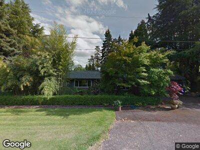
37140 NW Farmside Ln Cornelius, OR 97113
Estimated Value: $702,000 - $873,666
4
Beds
3
Baths
2,523
Sq Ft
$312/Sq Ft
Est. Value
About This Home
This home is located at 37140 NW Farmside Ln, Cornelius, OR 97113 and is currently estimated at $787,833, approximately $312 per square foot. 37140 NW Farmside Ln is a home located in Washington County with nearby schools including Free Orchards Elementary School, Evergreen Jr High School, and Glencoe High School.
Ownership History
Date
Name
Owned For
Owner Type
Purchase Details
Closed on
Jan 19, 2023
Sold by
Siebert Douglas M
Bought by
Siebert Family Trust
Current Estimated Value
Purchase Details
Closed on
May 27, 2003
Sold by
Siebert William L and Siebert Myrna J
Bought by
Siebert William L and Siebert Michael M
Create a Home Valuation Report for This Property
The Home Valuation Report is an in-depth analysis detailing your home's value as well as a comparison with similar homes in the area
Home Values in the Area
Average Home Value in this Area
Purchase History
| Date | Buyer | Sale Price | Title Company |
|---|---|---|---|
| Siebert Family Trust | -- | -- | |
| Siebert William L | -- | -- |
Source: Public Records
Mortgage History
| Date | Status | Borrower | Loan Amount |
|---|---|---|---|
| Previous Owner | Siebert Douglas M | $215,000 | |
| Previous Owner | Siebert Douglas M | $220,000 | |
| Previous Owner | Siebert Douglas M | $50,000 | |
| Previous Owner | Siebert Douglas M | $180,000 |
Source: Public Records
Tax History Compared to Growth
Tax History
| Year | Tax Paid | Tax Assessment Tax Assessment Total Assessment is a certain percentage of the fair market value that is determined by local assessors to be the total taxable value of land and additions on the property. | Land | Improvement |
|---|---|---|---|---|
| 2025 | $4,369 | $347,620 | -- | -- |
| 2024 | $3,912 | $337,500 | -- | -- |
| 2023 | $3,912 | $318,180 | $0 | $0 |
| 2022 | $3,706 | $318,180 | $0 | $0 |
| 2021 | $3,650 | $299,930 | $0 | $0 |
| 2020 | $3,440 | $291,200 | $0 | $0 |
| 2019 | $3,392 | $282,720 | $0 | $0 |
| 2018 | $3,250 | $274,490 | $0 | $0 |
| 2017 | $3,246 | $266,500 | $0 | $0 |
| 2016 | $3,173 | $258,740 | $0 | $0 |
| 2015 | $3,039 | $251,210 | $0 | $0 |
| 2014 | $3,039 | $243,900 | $0 | $0 |
Source: Public Records
Map
Nearby Homes
- 0 NW Spiesschaert Rd
- 570 N 10th Ave Unit 21
- 570 N 10th Ave Unit 75
- 570 N 10th Ave Unit 6
- 570 N 10th Ave Unit 110
- 570 N 10th Ave Unit 10
- 570 N 10th Ave Unit 56
- 570 N 10th Ave Unit 58
- 570 N 10th Ave Unit 76
- 570 N 10th St Unit 29
- 440 N 14th Ave
- 1427 N Davis St
- 507 N 19th Ave Unit 2
- 507 N 19th Ave
- 507 N 19th Ave Unit 1
- 507 N 19th Ave Unit 7
- 507 N 19th Ave Unit 37
- 507 N 19th Ave Unit 15
- 285 N 7th Ave
- 2597 N Lambert St
- 37140 NW Farmside Ln
- 37175 NW Farmside Ln
- 37085 NW Farmside Ln
- 37020 NW Farmside Ln
- 37005 NW Farmside Ln
- 37100 NW Long Rd
- 2005 NW Cornelius Schefflin Rd
- 2785 NW Cornelius Schefflin Rd
- 36682 NW Long Rd
- 2330 NW Cornelius Schefflin Rd
- 2963 N Corn St
- 2304 NW Cornelius Schefflin Rd
- 36820 NW Long Rd
- 2270 NW Cornelius Schefflin Rd
- 36785 NW Long Rd
- 36600 NW Long Rd
- 3095 NW 366th Place
- 36510 NW Long Rd
- 0 NW Long Rd
- 36543 NW Long Rd