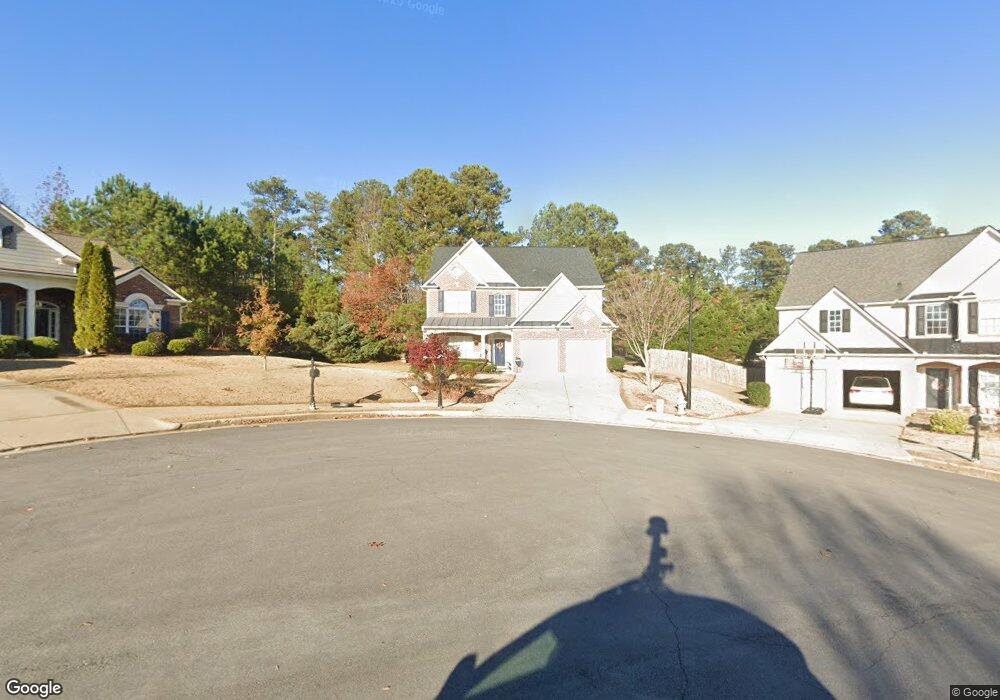
3731 Devenwood Way Buford, GA 30519
Estimated Value: $510,000 - $529,000
4
Beds
3
Baths
2,680
Sq Ft
$194/Sq Ft
Est. Value
About This Home
This home is located at 3731 Devenwood Way, Buford, GA 30519 and is currently estimated at $520,221, approximately $194 per square foot. 3731 Devenwood Way is a home located in Gwinnett County with nearby schools including Buford Elementary School, Buford Senior Academy, and Buford Academy.
Ownership History
Date
Name
Owned For
Owner Type
Purchase Details
Closed on
Jun 6, 2003
Sold by
Bowen Builders Group Inc
Bought by
Shells Byron S and Shells Alicea
Current Estimated Value
Home Financials for this Owner
Home Financials are based on the most recent Mortgage that was taken out on this home.
Original Mortgage
$178,550
Outstanding Balance
$76,964
Interest Rate
5.56%
Mortgage Type
FHA
Estimated Equity
$443,257
Create a Home Valuation Report for This Property
The Home Valuation Report is an in-depth analysis detailing your home's value as well as a comparison with similar homes in the area
Home Values in the Area
Average Home Value in this Area
Purchase History
| Date | Buyer | Sale Price | Title Company |
|---|---|---|---|
| Shells Byron S | $181,400 | -- |
Source: Public Records
Mortgage History
| Date | Status | Borrower | Loan Amount |
|---|---|---|---|
| Open | Shells Byron S | $178,550 |
Source: Public Records
Tax History Compared to Growth
Tax History
| Year | Tax Paid | Tax Assessment Tax Assessment Total Assessment is a certain percentage of the fair market value that is determined by local assessors to be the total taxable value of land and additions on the property. | Land | Improvement |
|---|---|---|---|---|
| 2024 | $959 | $202,000 | $40,000 | $162,000 |
| 2023 | $959 | $202,000 | $40,000 | $162,000 |
| 2022 | $959 | $158,840 | $28,000 | $130,840 |
| 2021 | $959 | $131,360 | $24,800 | $106,560 |
| 2020 | $959 | $128,640 | $24,800 | $103,840 |
| 2019 | $866 | $114,200 | $22,000 | $92,200 |
| 2018 | $866 | $105,920 | $22,000 | $83,920 |
| 2016 | $859 | $105,920 | $22,000 | $83,920 |
| 2015 | $812 | $70,800 | $14,000 | $56,800 |
| 2014 | $826 | $70,800 | $14,000 | $56,800 |
Source: Public Records
Map
Nearby Homes
- 3600 Devenwood Way
- 2361 Black Bear Ct Unit 2
- 3684 Heritage Crest Pkwy
- 2183 Ivy Crest Dr
- 2692 Bogan Creek Dr
- 2398 E Maddox Rd
- 2101 E Maddox Rd
- 4041 Lost Mill Ln
- 2040 Harvest Ridge Cir
- 2040 Harvest Ridge Cir NE
- 2140 Harvest Ridge Cir
- 2551 E Maddox Rd
- 190 Maddox Rd
- 4017 S South Bogan Rd
- 3685 Rolling Creek Dr
- 3476 Harvest Ridge Ln
- 2446 Thrasher Rd
- 2330 Chandler Grove Dr
- 3665 Mystic Dr Unit 2
- 3741 Devenwood Way
- 3721 Devenwood Way
- 0 S Bogan Rd
- 3711 Devenwood Way
- 3751 Devenwood Way
- 3750 Devenwood Way
- 3701 Devenwood Way
- 3761 Devenwood Way
- 3842 Silk Leaf Way
- 3839 S Bogan Rd
- 3700 Devenwood Way
- 3843 S Bogan Rd
- 3760 Devenwood Way
- 3681 Devenwood Way
- 3771 Devenwood Way
- 3852 Silk Leaf Way Unit 1
- 3690 Devenwood Way
- 3877 Silk Leaf Way
- 3862 Silk Leaf Way
- 3895 Heritage Crest Pkwy