Estimated Value: $342,000 - $358,000
4
Beds
2
Baths
970
Sq Ft
$361/Sq Ft
Est. Value
About This Home
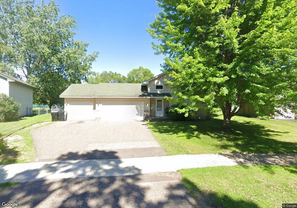
This home is located at 3738 Tower Pond Dr, Anoka, MN 55303 and is currently estimated at $350,652, approximately $361 per square foot. 3738 Tower Pond Dr is a home located in Anoka County with nearby schools including Franklin Elementary School, Anoka Middle School for the Arts - Fred Moor Campus, and Anoka Senior High School.
Ownership History
Date
Name
Owned For
Owner Type
Purchase Details
Closed on
Jul 30, 2004
Sold by
Hanson Shawn M and Hanson Nicole R
Bought by
Urey Joseph Walter and Urey Vashti D
Current Estimated Value
Purchase Details
Closed on
Apr 29, 2002
Sold by
Sornberger Edgar C and Sornberger Janice B
Bought by
Hanson Shawn M and Hanson Nicole R
Purchase Details
Closed on
Feb 22, 1999
Sold by
Cedar Ridge Homes Inc
Bought by
Sornberger Edgar C and Sornberger Janice B
Purchase Details
Closed on
Jan 15, 1998
Sold by
Ganfea Homes Inc
Bought by
Cedar Ridge Homes Inc
Purchase Details
Closed on
Dec 2, 1996
Sold by
Tiller Corp
Bought by
Gonyea Homes Inc
Create a Home Valuation Report for This Property
The Home Valuation Report is an in-depth analysis detailing your home's value as well as a comparison with similar homes in the area
Home Values in the Area
Average Home Value in this Area
Purchase History
| Date | Buyer | Sale Price | Title Company |
|---|---|---|---|
| Urey Joseph Walter | $213,500 | -- | |
| Hanson Shawn M | $1,799 | -- | |
| Sornberger Edgar C | $131,900 | -- | |
| Cedar Ridge Homes Inc | $29,900 | -- | |
| Gonyea Homes Inc | $27,900 | -- |
Source: Public Records
Tax History Compared to Growth
Tax History
| Year | Tax Paid | Tax Assessment Tax Assessment Total Assessment is a certain percentage of the fair market value that is determined by local assessors to be the total taxable value of land and additions on the property. | Land | Improvement |
|---|---|---|---|---|
| 2025 | $3,161 | $314,500 | $80,000 | $234,500 |
| 2024 | $3,161 | $303,400 | $80,000 | $223,400 |
| 2023 | $2,834 | $315,500 | $80,000 | $235,500 |
| 2022 | $2,513 | $307,600 | $63,000 | $244,600 |
| 2021 | $2,494 | $244,700 | $56,700 | $188,000 |
| 2020 | $2,567 | $237,500 | $63,000 | $174,500 |
| 2019 | $2,463 | $234,400 | $61,000 | $173,400 |
| 2018 | $2,277 | $220,300 | $0 | $0 |
| 2017 | $2,115 | $198,900 | $0 | $0 |
| 2016 | $2,082 | $177,000 | $0 | $0 |
| 2015 | $2,153 | $177,000 | $55,000 | $122,000 |
| 2014 | -- | $147,200 | $40,000 | $107,200 |
Source: Public Records
Map
Nearby Homes
- 3775 E Mineral Pond Blvd
- 14157 Cobalt Cir NW
- 3137 Zuni Way
- 3138 Zuni Way
- 3122 Zuni Way
- 3117 Zuni Way
- 3104 Zuni St NW
- 3102 Zuni Way NW
- 5061 143rd Ln NW
- 5060 Xkimo Ct NW
- 14426 Waco St NW
- 5521 144th Ave NW
- 4212 Parkview Ln
- 5431 145th Ave NW
- 2750 Euclid Ave
- 304 Rum River Way
- 3071 Rum River Way
- 14146 Neon St NW
- 3035 Cutters Grove Ave
- 2642 Yellowstone Blvd
- 3746 Tower Pond Dr
- 3730 Tower Pond Dr
- 3752 Tower Pond Dr
- 3737 Tower Pond Dr
- 3729 Tower Pond Dr
- 3801 Weaver Ct
- 3751 Tower Pond Dr
- 3803 Weaver Ct Unit 2
- 3738 Weaver Ct Unit 24
- 3805 Weaver Ct Unit 3
- 3755 Tower Pond Dr
- 3740 Weaver Ct
- 3736 Weaver Ct
- 510 Tower Pond Ct
- 524 Tower Pond Ct
- 3744 Weaver Ct
- 3807 Weaver Ct Unit 4
- 3734 Weaver Ct
- 3748 Weaver Ct
- 3752 Weaver Ct