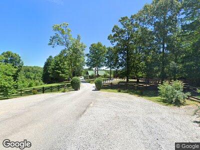
374 Briar Point Rd Allardt, TN 38504
Estimated Value: $483,000 - $645,000
--
Bed
2
Baths
1,792
Sq Ft
$306/Sq Ft
Est. Value
About This Home
This home is located at 374 Briar Point Rd, Allardt, TN 38504 and is currently estimated at $549,100, approximately $306 per square foot. 374 Briar Point Rd is a home located in Fentress County.
Ownership History
Date
Name
Owned For
Owner Type
Purchase Details
Closed on
Jul 1, 2013
Sold by
Wolf Robert J
Bought by
Webber Robert C and Webber Miriam N
Current Estimated Value
Purchase Details
Closed on
Jun 5, 2007
Purchase Details
Closed on
Mar 20, 2006
Bought by
Jeffreys Sue D
Purchase Details
Closed on
Aug 26, 2005
Sold by
Not Provided
Bought by
Webber Robert C
Create a Home Valuation Report for This Property
The Home Valuation Report is an in-depth analysis detailing your home's value as well as a comparison with similar homes in the area
Home Values in the Area
Average Home Value in this Area
Purchase History
| Date | Buyer | Sale Price | Title Company |
|---|---|---|---|
| Webber Robert C | $25,000 | -- | |
| -- | $475,000 | -- | |
| Jeffreys Sue D | $30,000 | -- | |
| Webber Robert C | $60,000 | -- |
Source: Public Records
Tax History Compared to Growth
Tax History
| Year | Tax Paid | Tax Assessment Tax Assessment Total Assessment is a certain percentage of the fair market value that is determined by local assessors to be the total taxable value of land and additions on the property. | Land | Improvement |
|---|---|---|---|---|
| 2024 | $1,720 | $127,400 | $15,300 | $112,100 |
| 2023 | $1,720 | $127,400 | $15,300 | $112,100 |
| 2022 | $1,270 | $66,475 | $15,300 | $51,175 |
| 2021 | $1,190 | $66,475 | $15,300 | $51,175 |
| 2020 | $1,190 | $62,325 | $15,300 | $47,025 |
| 2019 | $1,190 | $62,325 | $15,300 | $47,025 |
| 2018 | $1,190 | $62,325 | $15,300 | $47,025 |
| 2017 | $1,067 | $53,800 | $6,400 | $47,400 |
| 2016 | $1,067 | $53,800 | $6,400 | $47,400 |
| 2015 | $1,067 | $53,791 | $0 | $0 |
| 2014 | $849 | $42,790 | $0 | $0 |
Source: Public Records
Map
Nearby Homes
- 20 Bluff View Loop
- 0 Coyote Trail
- 145 Horse Haven Rd
- 1032 Range Cemetery Rd
- lot 17 Long Ridge Way
- 50 acres Oloff Smith Rd
- 1070 Chestnut Ridge Rd
- 0 72 Acres Cole Place Rd
- 21.31 Cole Place Rd
- 0 Sam Smith Rd Unit RTC2865905
- 0 Sam Smith Rd Unit 236295
- Lot 24 Old Mount Helen Rd
- Lot 23 Old Mount Helen Rd
- Lot 19 Old Mount Helen Rd
- Lot 13 Old Mount Helen Rd
- 0 Old Mount Helen Rd
- 3540 Stockton Rd
- 499 Stockton Chapel Rd
- 15.31 AC Rugby Pike
- 0 Lot 526 Sun Branch Dr Unit 1207676
