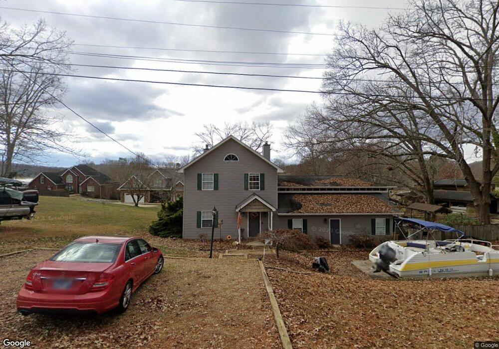
374 Center Dr Blountville, TN 37617
Estimated Value: $371,437 - $692,000
--
Bed
4
Baths
2,892
Sq Ft
$201/Sq Ft
Est. Value
About This Home
This home is located at 374 Center Dr, Blountville, TN 37617 and is currently estimated at $581,109, approximately $200 per square foot. 374 Center Dr is a home located in Sullivan County with nearby schools including Holston Elementary School, Sullivan Central Middle School, and Tri-Cities Christian Academy.
Ownership History
Date
Name
Owned For
Owner Type
Purchase Details
Closed on
Oct 21, 2021
Sold by
Straight Mary Harris and Moles Joellen Straight
Bought by
Straight Mary Harris and Moles Joellen Straight
Current Estimated Value
Home Financials for this Owner
Home Financials are based on the most recent Mortgage that was taken out on this home.
Original Mortgage
$125,000
Outstanding Balance
$114,332
Interest Rate
3.01%
Mortgage Type
New Conventional
Estimated Equity
$466,777
Purchase Details
Closed on
Mar 31, 2020
Sold by
Straight David Condee
Bought by
Straight Robert Lewis
Create a Home Valuation Report for This Property
The Home Valuation Report is an in-depth analysis detailing your home's value as well as a comparison with similar homes in the area
Home Values in the Area
Average Home Value in this Area
Purchase History
| Date | Buyer | Sale Price | Title Company |
|---|---|---|---|
| Straight Mary Harris | -- | Evergreen Ttl & Closing Llc | |
| Straight Robert Lewis | $73,600 | None Available |
Source: Public Records
Mortgage History
| Date | Status | Borrower | Loan Amount |
|---|---|---|---|
| Open | Straight Mary Harris | $125,000 |
Source: Public Records
Tax History Compared to Growth
Tax History
| Year | Tax Paid | Tax Assessment Tax Assessment Total Assessment is a certain percentage of the fair market value that is determined by local assessors to be the total taxable value of land and additions on the property. | Land | Improvement |
|---|---|---|---|---|
| 2024 | $1,460 | $58,475 | $7,875 | $50,600 |
| 2023 | $1,407 | $58,475 | $7,875 | $50,600 |
| 2022 | $1,407 | $58,475 | $7,875 | $50,600 |
| 2021 | $1,407 | $58,475 | $7,875 | $50,600 |
| 2020 | $1,432 | $58,475 | $7,875 | $50,600 |
| 2019 | $1,432 | $55,725 | $7,875 | $47,850 |
| 2018 | $1,421 | $55,725 | $7,875 | $47,850 |
| 2017 | $1,421 | $55,725 | $7,875 | $47,850 |
| 2016 | $1,458 | $56,600 | $7,875 | $48,725 |
| 2014 | $1,305 | $56,589 | $0 | $0 |
Source: Public Records
Map
Nearby Homes
- 780 Hamilton Rd Unit 6
- 780 Hamilton Rd Unit I-4
- 1033 Haw Ridge Rd
- 225 Forest Ln N
- 145 Grande Harbor Way
- 112 Cardinal Point
- 205 Forest Ct
- 164 Forest Ln N
- 500 Geisler Rd
- 156 Forest Ln N
- 148 Forest Ln S
- 417 Cope Rd
- 341 Haw Ridge Rd E
- 205 Grande Harbor Way
- 191 Grande Harbor Way
- 290 Candy Creek Private Dr
- 411 Gammon Rd
- 200 Deck Ln Unit 1105
- 200 Deck Ln Unit 803
- 200 Deck Ln Unit 802