Estimated Value: $386,618 - $401,000
4
Beds
3
Baths
1,960
Sq Ft
$200/Sq Ft
Est. Value
About This Home
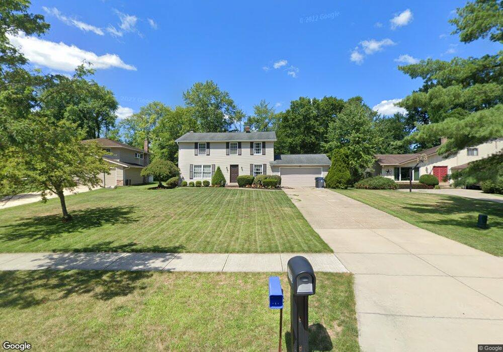
This home is located at 37415 Hunters Ridge Rd, Solon, OH 44139 and is currently estimated at $392,155, approximately $200 per square foot. 37415 Hunters Ridge Rd is a home located in Cuyahoga County with nearby schools including Orchard Middle School, Parkside Elementary School, and Solon Middle School.
Ownership History
Date
Name
Owned For
Owner Type
Purchase Details
Closed on
Aug 16, 1995
Sold by
Groya Thomas F
Bought by
Wolf Barbara A
Current Estimated Value
Home Financials for this Owner
Home Financials are based on the most recent Mortgage that was taken out on this home.
Original Mortgage
$138,000
Interest Rate
7%
Mortgage Type
New Conventional
Purchase Details
Closed on
Apr 26, 1988
Sold by
Camaglia Frederick P
Bought by
Groya Thomas F
Purchase Details
Closed on
Feb 25, 1983
Sold by
Kissack Thomas A
Bought by
Camaglia Frederick P
Purchase Details
Closed on
Jul 31, 1975
Bought by
Kissack Thomas A
Purchase Details
Closed on
Jan 1, 1975
Bought by
Colonial Forest Ests Inc
Create a Home Valuation Report for This Property
The Home Valuation Report is an in-depth analysis detailing your home's value as well as a comparison with similar homes in the area
Home Values in the Area
Average Home Value in this Area
Purchase History
| Date | Buyer | Sale Price | Title Company |
|---|---|---|---|
| Wolf Barbara A | $185,000 | -- | |
| Groya Thomas F | $135,000 | -- | |
| Camaglia Frederick P | $97,000 | -- | |
| Kissack Thomas A | $67,000 | -- | |
| Colonial Forest Ests Inc | -- | -- |
Source: Public Records
Mortgage History
| Date | Status | Borrower | Loan Amount |
|---|---|---|---|
| Closed | Wolf Barbara A | $138,000 |
Source: Public Records
Tax History Compared to Growth
Tax History
| Year | Tax Paid | Tax Assessment Tax Assessment Total Assessment is a certain percentage of the fair market value that is determined by local assessors to be the total taxable value of land and additions on the property. | Land | Improvement |
|---|---|---|---|---|
| 2024 | $6,280 | $114,765 | $24,185 | $90,580 |
| 2023 | $5,979 | $89,360 | $22,330 | $67,030 |
| 2022 | $5,966 | $89,360 | $22,330 | $67,030 |
| 2021 | $5,898 | $89,360 | $22,330 | $67,030 |
| 2020 | $5,917 | $81,970 | $20,480 | $61,500 |
| 2019 | $5,730 | $234,200 | $58,500 | $175,700 |
| 2018 | $5,073 | $81,970 | $20,480 | $61,500 |
| 2017 | $5,064 | $76,510 | $18,130 | $58,380 |
| 2016 | $5,017 | $76,510 | $18,130 | $58,380 |
| 2015 | $5,097 | $76,510 | $18,130 | $58,380 |
| 2014 | $5,097 | $70,840 | $16,800 | $54,040 |
Source: Public Records
Map
Nearby Homes
- 38280 Fox Run Dr
- 5940 Glasgow Ln
- 36265 Timberlane Dr
- 0 Glasgow Ln
- 35906 Solon Rd
- 36767 Meadowdale Dr
- 6454 Huntington Dr
- 65 Quail Ridge Dr
- 7090 Country Ln
- 5929 Som Center Rd
- 39780 Alsace Ct
- 39565 Patterson Ln
- 34600 Mcafee Dr
- 7101 Bramshill Cir
- 5721 Som Center Rd Unit 25
- 5575 Hummingbird Cir
- 16755 Bedford St
- 17581 Gates Landing Dr
- 112 Meadow Ln
- 16690 Dayton St
- 37421 Hunters Ridge Rd
- 37409 Hunters Ridge Rd
- 37425 Hunters Ridge
- 37427 Hunters Ridge Rd
- 37114 Deer Run
- 37405 Fox Run Dr
- 37108 Deer Run
- 37375 Fox Run Dr
- 37120 Deer Run
- 37102 Deer Run
- 37455 Fox Run Dr
- 37433 Hunters Ridge Rd
- 37096 Deer Run
- 37412 Hunters Ridge Rd
- 37126 Deer Run
- 37325 Fox Run Dr
- 37418 Hunters Ridge Rd
- 37475 Fox Run Dr
- 37439 Hunters Ridge Rd
- 37132 Deer Run