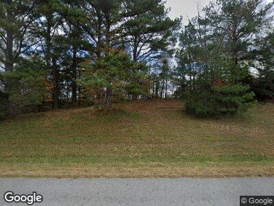
3752 Byrdstown Hwy Monroe, TN 38573
Estimated Value: $470,000 - $541,024
--
Bed
3
Baths
3,208
Sq Ft
$158/Sq Ft
Est. Value
About This Home
This home is located at 3752 Byrdstown Hwy, Monroe, TN 38573 and is currently estimated at $505,512, approximately $157 per square foot. 3752 Byrdstown Hwy is a home located in Overton County.
Ownership History
Date
Name
Owned For
Owner Type
Purchase Details
Closed on
Oct 24, 2008
Sold by
Guffey Angela
Bought by
Parrott Brian
Current Estimated Value
Home Financials for this Owner
Home Financials are based on the most recent Mortgage that was taken out on this home.
Original Mortgage
$242,204
Interest Rate
6.11%
Mortgage Type
Farmers Home Administration
Create a Home Valuation Report for This Property
The Home Valuation Report is an in-depth analysis detailing your home's value as well as a comparison with similar homes in the area
Home Values in the Area
Average Home Value in this Area
Purchase History
| Date | Buyer | Sale Price | Title Company |
|---|---|---|---|
| Parrott Brian | $10,000 | -- |
Source: Public Records
Mortgage History
| Date | Status | Borrower | Loan Amount |
|---|---|---|---|
| Open | Parrott Michelle | $100,000 | |
| Open | Parrott Brian | $288,537 | |
| Closed | Parrott Brian A | $301,000 | |
| Closed | Parrott Brian | $50,372 | |
| Closed | Parrott Brian | $242,204 |
Source: Public Records
Tax History Compared to Growth
Tax History
| Year | Tax Paid | Tax Assessment Tax Assessment Total Assessment is a certain percentage of the fair market value that is determined by local assessors to be the total taxable value of land and additions on the property. | Land | Improvement |
|---|---|---|---|---|
| 2024 | $2,097 | $93,250 | $8,300 | $84,950 |
| 2023 | $1,838 | $93,250 | $8,300 | $84,950 |
| 2022 | $1,838 | $93,250 | $8,300 | $84,950 |
| 2021 | $1,838 | $93,250 | $8,300 | $84,950 |
| 2020 | $1,838 | $93,250 | $8,300 | $84,950 |
| 2019 | $1,681 | $74,700 | $7,325 | $67,375 |
| 2018 | $1,681 | $74,700 | $7,325 | $67,375 |
| 2017 | $1,681 | $74,700 | $7,325 | $67,375 |
| 2016 | $1,681 | $74,700 | $7,325 | $67,375 |
| 2015 | $1,487 | $74,700 | $7,325 | $67,375 |
| 2014 | -- | $68,775 | $7,325 | $61,450 |
| 2013 | -- | $76,250 | $0 | $0 |
Source: Public Records
Map
Nearby Homes
- 118 Summer Ln
- Lot 9 Livingston Hwy
- 985 Beaty Swamp Rd
- 171 Deer Cliff Ln
- 1100 Eastport Dock Rd
- Lot 11 Big Hollow Rd
- 7125 Bolestown Rd
- Lot 66 Big Hollow Rd
- 434 Monroe Branch Ln
- 7456 Oak Grove Rd
- 0 Bolestown Loop
- 0 Bolestown Loop
- 00 Bolestown Loop
- 4.12 Acres Twin Peaks Ln
- 2061 Bolestown Loop
- 2059 Bolestown Loop
- 120 Dove Ln
- 0 Magnolia Ln Unit RTC2781013
- 0 Magnolia Ln Unit RTC2781011
- 3752 Byrdstown Hwy
- 3712 Byrdstown Hwy
- 161 Smith Rd
- 194 Smith Rd
- 3703 Byrdstown Hwy
- 340 Beaty Swamp Rd
- 330 Beaty Swamp Rd
- 368 Beaty Swamp Rd
- 141 Little Jay Bird Ln
- 3674 Byrdstown Hwy
- 138 Little Jay Bird Ln
- 312 Beaty Swamp Rd
- 291 Wirmingham Rd
- 3660 Byrdstown Hwy
- 152 Little Jay Bird Ln
- 359 Beaty Swamp Rd
- 307 Beaty Swamp Rd
- 301 Beaty Swamp Rd
- 319 Wirmingham Rd
- 395 Eastport Dock Rd
