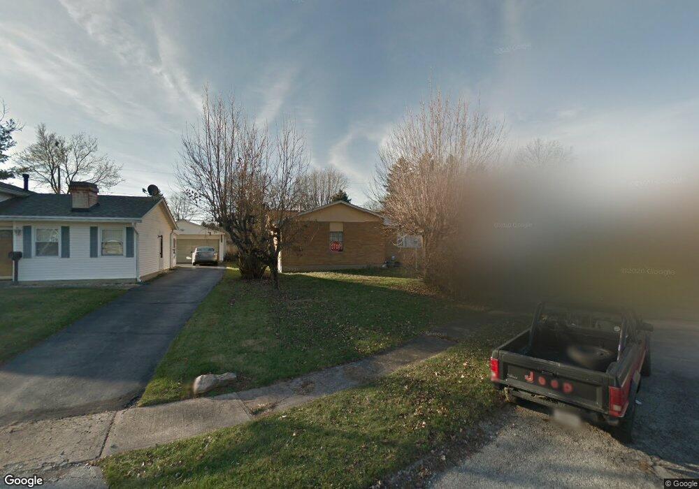
3771 Armada Rd Columbus, OH 43232
East Columbus-White Ash NeighborhoodEstimated Value: $188,000 - $220,000
3
Beds
2
Baths
1,170
Sq Ft
$174/Sq Ft
Est. Value
About This Home
This home is located at 3771 Armada Rd, Columbus, OH 43232 and is currently estimated at $203,805, approximately $174 per square foot. 3771 Armada Rd is a home located in Franklin County with nearby schools including Groveport Madison High School and Eastland Preparatory Academy.
Ownership History
Date
Name
Owned For
Owner Type
Purchase Details
Closed on
Jan 5, 2023
Sold by
Harmon Michelle D
Bought by
Lemon Michelle D and Lemon Gardner
Current Estimated Value
Purchase Details
Closed on
Dec 6, 2011
Sold by
Estate Of Charles J Linton
Bought by
Boucher Tami D and Harmon Michelle D
Purchase Details
Closed on
Jan 3, 1986
Bought by
Linton Charles J
Create a Home Valuation Report for This Property
The Home Valuation Report is an in-depth analysis detailing your home's value as well as a comparison with similar homes in the area
Home Values in the Area
Average Home Value in this Area
Purchase History
| Date | Buyer | Sale Price | Title Company |
|---|---|---|---|
| Lemon Michelle D | -- | Sas Title | |
| Boucher Tami D | -- | None Available | |
| Linton Charles J | -- | -- |
Source: Public Records
Tax History
| Year | Tax Paid | Tax Assessment Tax Assessment Total Assessment is a certain percentage of the fair market value that is determined by local assessors to be the total taxable value of land and additions on the property. | Land | Improvement |
|---|---|---|---|---|
| 2025 | $3,023 | $61,080 | $13,790 | $47,290 |
| 2024 | $3,023 | $61,080 | $13,790 | $47,290 |
| 2023 | $3,002 | $61,080 | $13,790 | $47,290 |
| 2022 | $1,717 | $27,660 | $6,340 | $21,320 |
| 2021 | $1,759 | $27,660 | $6,340 | $21,320 |
| 2020 | $1,763 | $27,660 | $6,340 | $21,320 |
| 2019 | $1,623 | $22,340 | $5,290 | $17,050 |
| 2018 | $1,802 | $22,340 | $5,290 | $17,050 |
| 2017 | $1,643 | $22,340 | $5,290 | $17,050 |
| 2016 | $1,970 | $23,810 | $3,960 | $19,850 |
| 2015 | $1,971 | $23,810 | $3,960 | $19,850 |
| 2014 | $1,767 | $23,810 | $3,960 | $19,850 |
| 2013 | $858 | $26,425 | $4,375 | $22,050 |
Source: Public Records
Map
Nearby Homes
- 3622 Alpena Rd
- 4980 Harbor Blvd
- 3856 Crestfield Dr Unit 3856
- 4995 Talford Ct
- 4473 Harrods St
- 5106 Harbor Blvd
- 4434 Harrods St
- 3860 Evanston Rd
- 4925 Wymore Dr
- 5308 Fullerton Dr
- 3851 Wade Rd
- 3493 Tremaine Rd
- 3824 Wade Rd
- 4110 Wiston Dr Unit 4110
- 3455 Tremaine Rd
- 4547 Beachworth Ct
- 4496 Reinbeau Dr
- 3492 Rodell Rd
- 4468 Reinbeau Dr
- 4296 Wincove Dr Unit 4296
- 3783 Armada Rd
- 3765 Armada Rd
- 3764 Noe Bixby Rd
- 3795 Armada Rd
- 4966 Ewald Dr
- 3788 Noe Bixby Rd
- 3790 Armada Rd
- 4972 Ewald Dr
- 3803 Armada Rd
- 3740 Noe Bixby Rd
- 4937 Brewster Dr
- 4949 Brewster Dr
- 4980 Ewald Dr
- 4979 Ewald Dr
- 3800 Noe Bixby Rd
- 3800 Armada Rd
- 3811 Armada Rd
- 4955 Brewster Dr
- 4925 Brewster Dr
- 4988 Ewald Dr
Your Personal Tour Guide
Ask me questions while you tour the home.