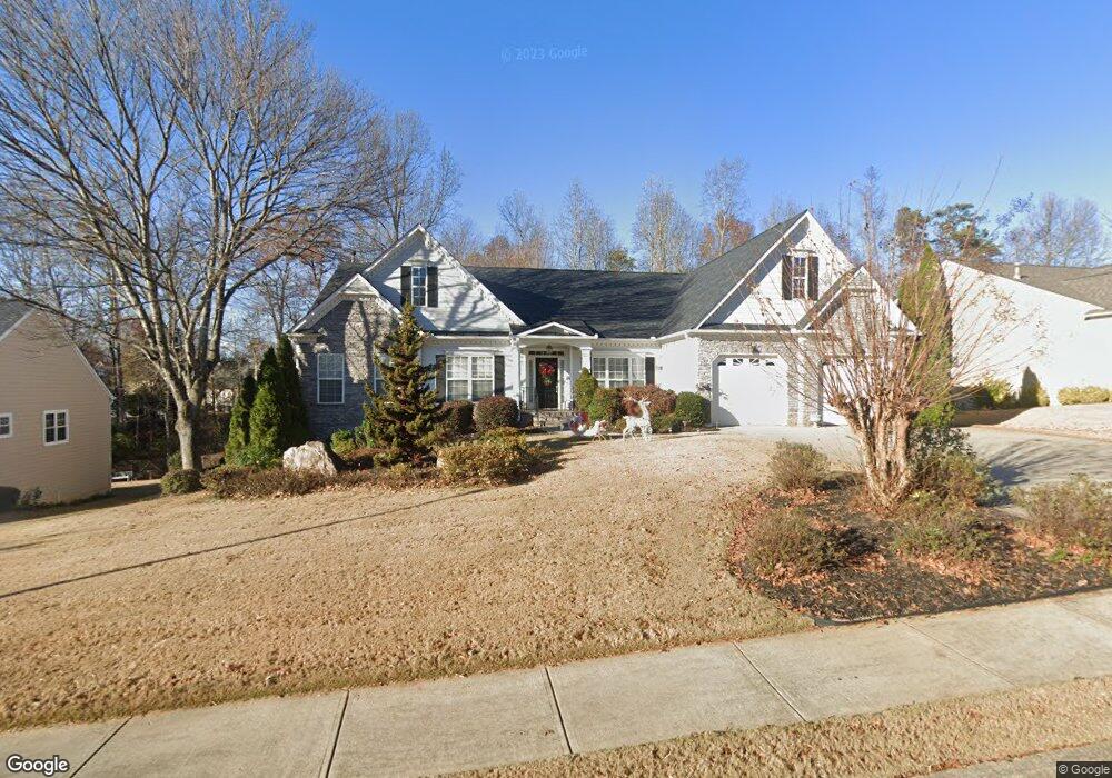
3771 Devenwood Way Buford, GA 30519
Estimated Value: $588,000 - $726,150
3
Beds
5
Baths
2,544
Sq Ft
$264/Sq Ft
Est. Value
About This Home
This home is located at 3771 Devenwood Way, Buford, GA 30519 and is currently estimated at $671,538, approximately $263 per square foot. 3771 Devenwood Way is a home located in Gwinnett County with nearby schools including Buford Elementary School, Buford Senior Academy, and Buford Academy.
Ownership History
Date
Name
Owned For
Owner Type
Purchase Details
Closed on
Jul 26, 2007
Sold by
Mcqueen Howard
Bought by
Mcqueen Howard and Worrell Beulah
Current Estimated Value
Purchase Details
Closed on
Jan 5, 2006
Sold by
Allen Chad and Allen Ashley
Bought by
Mcqueen Howard and Worrell Beulah
Home Financials for this Owner
Home Financials are based on the most recent Mortgage that was taken out on this home.
Original Mortgage
$62,800
Interest Rate
5.8%
Mortgage Type
Unknown
Create a Home Valuation Report for This Property
The Home Valuation Report is an in-depth analysis detailing your home's value as well as a comparison with similar homes in the area
Home Values in the Area
Average Home Value in this Area
Purchase History
| Date | Buyer | Sale Price | Title Company |
|---|---|---|---|
| Mcqueen Howard | -- | -- | |
| Mcqueen Howard | $314,000 | -- |
Source: Public Records
Mortgage History
| Date | Status | Borrower | Loan Amount |
|---|---|---|---|
| Previous Owner | Mcqueen Howard | $62,800 | |
| Previous Owner | Mcqueen Howard | $251,200 |
Source: Public Records
Tax History Compared to Growth
Tax History
| Year | Tax Paid | Tax Assessment Tax Assessment Total Assessment is a certain percentage of the fair market value that is determined by local assessors to be the total taxable value of land and additions on the property. | Land | Improvement |
|---|---|---|---|---|
| 2024 | $1,555 | $290,000 | $40,000 | $250,000 |
| 2023 | $1,555 | $290,000 | $40,000 | $250,000 |
| 2022 | $1,555 | $225,360 | $28,000 | $197,360 |
| 2021 | $1,555 | $189,240 | $24,800 | $164,440 |
| 2020 | $1,555 | $179,880 | $24,800 | $155,080 |
| 2019 | $1,404 | $159,680 | $22,000 | $137,680 |
| 2018 | $1,404 | $140,160 | $22,000 | $118,160 |
| 2016 | $1,394 | $140,160 | $22,000 | $118,160 |
| 2015 | $984 | $94,040 | $14,000 | $80,040 |
| 2014 | $996 | $94,040 | $14,000 | $80,040 |
Source: Public Records
Map
Nearby Homes
- 3600 Devenwood Way
- 3684 Heritage Crest Pkwy
- 2361 Black Bear Ct Unit 2
- 2040 Harvest Ridge Cir
- 2040 Harvest Ridge Cir NE
- 2183 Ivy Crest Dr
- 2140 Harvest Ridge Cir
- 190 Maddox Rd
- 2398 E Maddox Rd
- 2692 Bogan Creek Dr
- 3476 Harvest Ridge Ln
- 2101 E Maddox Rd
- 4041 Lost Mill Ln
- 2551 E Maddox Rd
- 1970 Sturbridge Ln Unit 1
- 3685 Rolling Creek Dr
- 3573 Fallen Oak Dr
- 4017 S South Bogan Rd
- 3560 Hanover Dr
- 3761 Devenwood Way
- 3781 Devenwood Way
- 3835 Moon Shadow Way
- 3751 Devenwood Way
- 3895 Heritage Crest Pkwy
- 3845 Moon Shadow Way
- 3842 Silk Leaf Way
- 3791 Devenwood Way
- 3760 Devenwood Way
- 3810 Devenwood Way
- 3741 Devenwood Way
- 3855 Moon Shadow Way
- 3750 Devenwood Way
- 3811 Devenwood Way
- 3885 Heritage Crest Pkwy
- 3852 Silk Leaf Way Unit 1
- 3830 Moon Shadow Way Unit 1
- 3700 Devenwood Way
- 3884 Heritage Crest Pkwy
- 3820 Devenwood Way