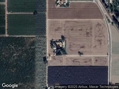
3776 12th Ave Hanford, CA 93230
Estimated Value: $1,900,848 - $2,043,000
4
Beds
3
Baths
4,536
Sq Ft
$438/Sq Ft
Est. Value
About This Home
This home is located at 3776 12th Ave, Hanford, CA 93230 and is currently estimated at $1,987,283, approximately $438 per square foot. 3776 12th Ave is a home located in Kings County with nearby schools including Kings River-Hardwick Elementary School and Hanford Christian School.
Ownership History
Date
Name
Owned For
Owner Type
Purchase Details
Closed on
Jul 24, 2024
Sold by
Joe R Garcia Family Trust and Garcia Mary D
Bought by
Warmerdam John Coelho
Current Estimated Value
Purchase Details
Closed on
Jul 3, 2012
Sold by
Garcia Mary D
Bought by
Garcia Mary D
Purchase Details
Closed on
Aug 29, 2011
Sold by
Nordstrom Michael N and Nordstrom Sandra D
Bought by
Garcia Mary D
Purchase Details
Closed on
Oct 17, 2008
Sold by
Nordstrom Michael N and Nordstrom Sandra D
Bought by
Nordstrom Michael N and Nordstrom Sandra D
Create a Home Valuation Report for This Property
The Home Valuation Report is an in-depth analysis detailing your home's value as well as a comparison with similar homes in the area
Home Values in the Area
Average Home Value in this Area
Purchase History
| Date | Buyer | Sale Price | Title Company |
|---|---|---|---|
| Warmerdam John Coelho | $2,000,000 | Chicago Title Company | |
| Garcia Mary D | $964,000 | Chicago Title Company | |
| Nordstrom Michael N | -- | None Available |
Source: Public Records
Mortgage History
| Date | Status | Borrower | Loan Amount |
|---|---|---|---|
| Previous Owner | Nordstrom Michael N | $250,000 |
Source: Public Records
Tax History Compared to Growth
Tax History
| Year | Tax Paid | Tax Assessment Tax Assessment Total Assessment is a certain percentage of the fair market value that is determined by local assessors to be the total taxable value of land and additions on the property. | Land | Improvement |
|---|---|---|---|---|
| 2023 | $10,841 | $1,066,420 | $306,196 | $760,224 |
| 2022 | $10,176 | $930,899 | $211,507 | $719,392 |
| 2021 | $10,105 | $924,738 | $211,919 | $712,819 |
| 2020 | $9,803 | $909,303 | $204,554 | $704,749 |
| 2019 | $9,755 | $890,247 | $199,208 | $691,039 |
| 2018 | $9,711 | $852,138 | $191,448 | $660,690 |
| 2017 | $8,981 | $857,248 | $196,801 | $660,447 |
| 2016 | $8,671 | $841,848 | $206,814 | $635,034 |
| 2015 | $8,584 | $834,387 | $208,892 | $625,495 |
| 2014 | $8,333 | $807,744 | $194,502 | $613,242 |
Source: Public Records
Map
Nearby Homes
- 4603 12th Ave
- 7476 E Mount Whitney Ave
- 6380 E Tache Ave
- 0 No Adress Available Unit 622842
- 5675 E Letson Ave
- 5646 11th Ave
- 5646 N 11th Ave
- 0 S Sunnyside Ave
- 0 Elder Ave W
- 9700 Excelsior Ave
- 21530 Tiburico Ave
- 21530 Tiburcio Ave
- 0 9th (West) Ave
- 0 9th (East) St
- 958 W Quail Rock Way
- 7246 12th Ave
- 14818 Flint Ave
- 3127 N Madison Way
- 0 Elder Ave Unit 231714
- 992 W Windsor Dr
- 3776 12th Ave
- 3606 12th Ave
- 3960 12th Ave
- 11950 Dover Ave
- 12284 Douglas Ave
- 12292 Douglas Ave
- 4186 12th Ave
- 4215 12th Ave
- 11750 Dover Ave
- 4292 12th Ave
- 12685 Douglas Ave
- 3985 12 3/4 Ave
- 4269 12th Ave
- 3557 12 3/4 Ave
- 12703 Douglas Ave
- 11653 Dover Ave
- 3510 12 3/4 Ave
- 7229 E Mount Whitney Ave
- 12837 Douglas Ave
- 4451 12th Ave
