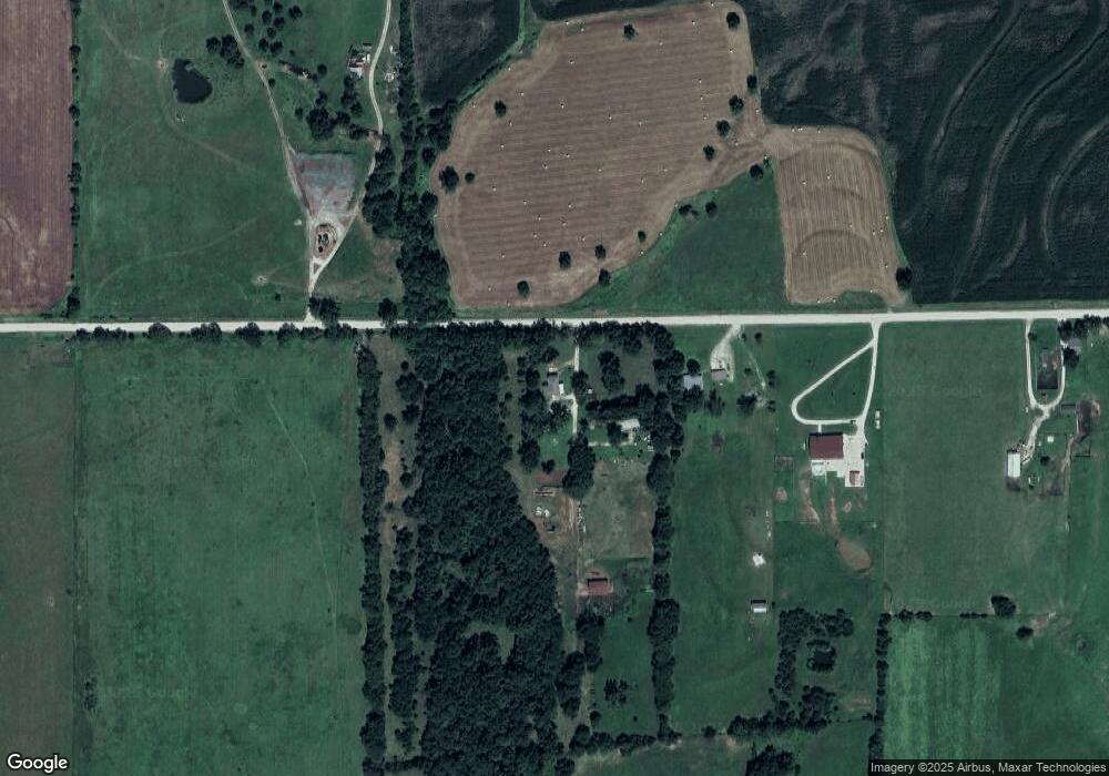
37761 W 351st St Osawatomie, KS 66064
Estimated Value: $289,000 - $565,923
2
Beds
2
Baths
1,536
Sq Ft
$271/Sq Ft
Est. Value
About This Home
This home is located at 37761 W 351st St, Osawatomie, KS 66064 and is currently estimated at $415,641, approximately $270 per square foot. 37761 W 351st St is a home located in Miami County with nearby schools including Swenson Early Childhood Education Center, Trojan Elementary School, and Osawatomie Middle School.
Ownership History
Date
Name
Owned For
Owner Type
Purchase Details
Closed on
Apr 29, 2009
Sold by
Zaman Charles F and Dupont Zaman Patricia A
Bought by
Wolverton Ronald C and Wolverton Karen S
Current Estimated Value
Home Financials for this Owner
Home Financials are based on the most recent Mortgage that was taken out on this home.
Original Mortgage
$260,101
Outstanding Balance
$163,629
Interest Rate
4.77%
Mortgage Type
FHA
Estimated Equity
$252,012
Create a Home Valuation Report for This Property
The Home Valuation Report is an in-depth analysis detailing your home's value as well as a comparison with similar homes in the area
Home Values in the Area
Average Home Value in this Area
Purchase History
| Date | Buyer | Sale Price | Title Company |
|---|---|---|---|
| Wolverton Ronald C | -- | Miami County Title Co Inc |
Source: Public Records
Mortgage History
| Date | Status | Borrower | Loan Amount |
|---|---|---|---|
| Open | Wolverton Ronald C | $260,101 |
Source: Public Records
Tax History Compared to Growth
Tax History
| Year | Tax Paid | Tax Assessment Tax Assessment Total Assessment is a certain percentage of the fair market value that is determined by local assessors to be the total taxable value of land and additions on the property. | Land | Improvement |
|---|---|---|---|---|
| 2025 | $3,466 | $37,536 | $8,177 | $29,359 |
| 2024 | $3,466 | $35,240 | $8,674 | $26,566 |
| 2023 | $3,674 | $36,219 | $8,041 | $28,178 |
| 2022 | $3,170 | $29,979 | $7,242 | $22,737 |
| 2021 | $1,496 | $0 | $0 | $0 |
| 2020 | $2,742 | $0 | $0 | $0 |
| 2019 | $2,649 | $0 | $0 | $0 |
| 2018 | $2,445 | $0 | $0 | $0 |
| 2017 | $2,334 | $0 | $0 | $0 |
| 2016 | -- | $0 | $0 | $0 |
| 2015 | -- | $0 | $0 | $0 |
| 2014 | -- | $0 | $0 | $0 |
| 2013 | -- | $0 | $0 | $0 |
Source: Public Records
Map
Nearby Homes
- 0 Indianapolis N A Unit HMS2503911
- 38500 W 339th St
- 501 18th St
- 0 W 355th St
- 1734 Main St Unit Terrace
- 1734 Main Street Terrace
- 612 17th St
- 0 Indianapolis Rd
- 33295 Bethel Church Rd
- 1612 Main St
- 1548 Brown Ave
- 1512 Charles Ave
- 1324 Pacific Ave
- 1111 Main St
- 1109 Main St
- 1117 Walnut Ave
- 1015 Main St
- 41045 W 327th St
- 716 10th St
- 934 Pacific St
- 37645 W 351st St
- 37625 W 351st St
- 37505 W 351st St
- 37367 W 351st St
- 37155 W 351st St
- 37089 W 351st St
- 37089 W 351st St
- 37969 John Brown Hwy
- 0 John Brown Hwy Unit 2082611
- 0 John Brown Hwy Unit 1461929
- 0 John Brown Hwy Unit 1478331
- 0 John Brown Hwy Unit 1508532
- 0 John Brown Hwy Unit 1515462
- 0 John Brown Hwy Unit 1628516
- 0 John Brown Hwy Unit 1699716
- 0 John Brown Hwy Unit 1776714
- 0 John Brown Hwy Unit 1855459
- 0 John Brown Hwy Unit 1877502
- 0 John Brown Hwy Unit 1442179
- 4886 W 347th St
