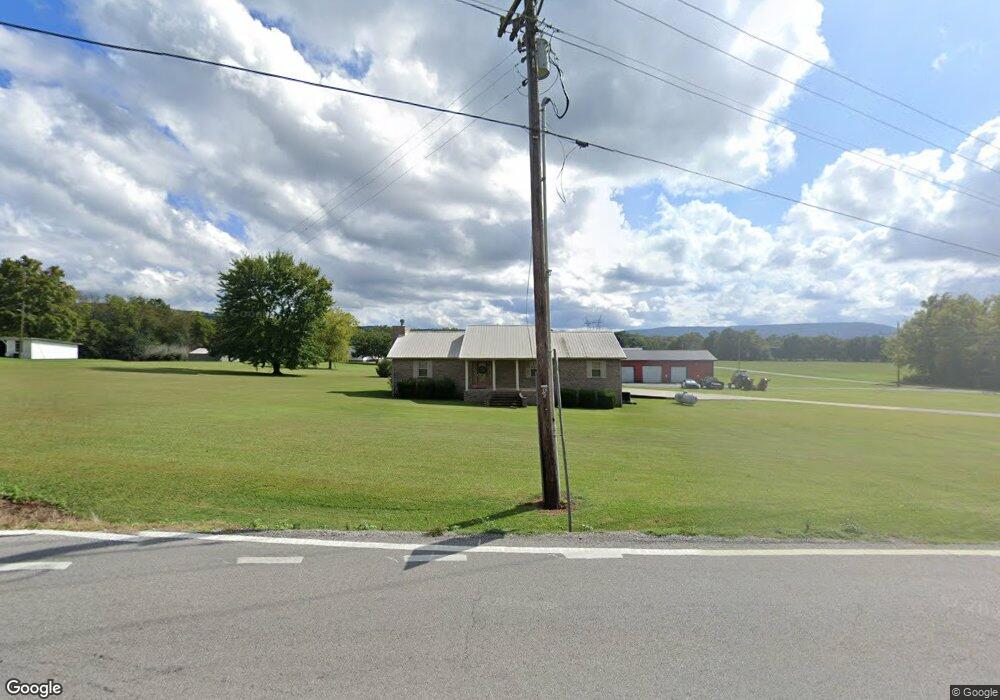
3788 Sr 50 Pelham, TN 37366
Estimated Value: $349,619 - $359,000
3
Beds
2
Baths
2,010
Sq Ft
$176/Sq Ft
Est. Value
About This Home
This home is located at 3788 Sr 50, Pelham, TN 37366 and is currently estimated at $352,873, approximately $175 per square foot. 3788 Sr 50 is a home located in Grundy County.
Ownership History
Date
Name
Owned For
Owner Type
Purchase Details
Closed on
Mar 10, 2021
Sold by
Northcutt William Earl and Northcutt Donna Jean
Bought by
Northcutt Michael Eugene
Current Estimated Value
Purchase Details
Closed on
Nov 9, 2015
Sold by
Northcutt Donna
Bought by
Northcutt Marty
Purchase Details
Closed on
Jul 2, 2009
Sold by
Northcutt Marty
Bought by
Northcutt Donna
Purchase Details
Closed on
Sep 23, 2004
Sold by
Northcutt Diana
Bought by
Northcutt Marthy
Home Financials for this Owner
Home Financials are based on the most recent Mortgage that was taken out on this home.
Original Mortgage
$104,000
Interest Rate
5.73%
Create a Home Valuation Report for This Property
The Home Valuation Report is an in-depth analysis detailing your home's value as well as a comparison with similar homes in the area
Home Values in the Area
Average Home Value in this Area
Purchase History
| Date | Buyer | Sale Price | Title Company |
|---|---|---|---|
| Northcutt Michael Eugene | -- | None Available | |
| Northcutt Marty | -- | -- | |
| Northcutt Donna | -- | -- | |
| Northcutt Marthy | -- | -- |
Source: Public Records
Mortgage History
| Date | Status | Borrower | Loan Amount |
|---|---|---|---|
| Previous Owner | Northcutt Marthy | $104,000 |
Source: Public Records
Tax History Compared to Growth
Tax History
| Year | Tax Paid | Tax Assessment Tax Assessment Total Assessment is a certain percentage of the fair market value that is determined by local assessors to be the total taxable value of land and additions on the property. | Land | Improvement |
|---|---|---|---|---|
| 2024 | $1,086 | $76,125 | $3,075 | $73,050 |
| 2023 | $1,086 | $76,125 | $3,075 | $73,050 |
| 2022 | $1,017 | $45,975 | $2,000 | $43,975 |
| 2021 | $1,017 | $45,975 | $2,000 | $43,975 |
| 2020 | $1,017 | $45,975 | $2,000 | $43,975 |
| 2019 | $1,006 | $44,500 | $2,125 | $42,375 |
| 2018 | $1,006 | $39,625 | $2,100 | $37,525 |
| 2017 | $1,012 | $39,625 | $2,100 | $37,525 |
| 2016 | $1,012 | $39,875 | $2,100 | $37,775 |
| 2015 | $1,012 | $39,875 | $2,100 | $37,775 |
| 2014 | $1,013 | $39,895 | $0 | $0 |
Source: Public Records
Map
Nearby Homes
- 0 White Ridge Rd
- 388 Charlie Roberts Rd
- 4012 Payne Cove Rd
- 0 Laxton Rd Unit RTC2957818
- 0 Providence Rd
- 0 U S Highway 64
- 1106 N Bluff Cir
- 774 Sherrell Rd
- 384 Clouse Hill Rd
- 384 Acres Clouse Hill Rd
- 72 Lady Slipper Ln
- 2271 Timberwood Trace
- Lot 123 Timberwood Trace
- 11 Jess Long Ln
- Lot 123 Timberwood Trace
- 256 Vista Vue Trail
- 0 Longview Ln Unit 1510528
- 123 Timberwood Trace
- 80 Mountain Laurel Ln
- 2266 Timberwood Trace