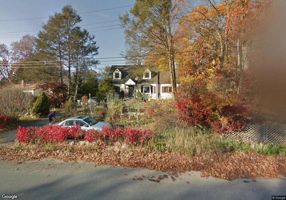
379 Broadbridge Rd Bridgeport, CT 06610
North Bridgeport NeighborhoodEstimated Value: $366,000 - $453,000
5
Beds
3
Baths
1,752
Sq Ft
$242/Sq Ft
Est. Value
About This Home
This home is located at 379 Broadbridge Rd, Bridgeport, CT 06610 and is currently estimated at $424,632, approximately $242 per square foot. 379 Broadbridge Rd is a home located in Fairfield County with nearby schools including Hooker School and Harding High School.
Ownership History
Date
Name
Owned For
Owner Type
Purchase Details
Closed on
Jan 13, 2004
Sold by
Maltais Francis and Maltais Rose Marie
Bought by
Szilagyi Gabriella
Current Estimated Value
Home Financials for this Owner
Home Financials are based on the most recent Mortgage that was taken out on this home.
Original Mortgage
$189,000
Outstanding Balance
$88,265
Interest Rate
5.88%
Estimated Equity
$336,367
Create a Home Valuation Report for This Property
The Home Valuation Report is an in-depth analysis detailing your home's value as well as a comparison with similar homes in the area
Home Values in the Area
Average Home Value in this Area
Purchase History
| Date | Buyer | Sale Price | Title Company |
|---|---|---|---|
| Szilagyi Gabriella | $195,000 | -- | |
| Szilagyi Gabriella | $195,000 | -- |
Source: Public Records
Mortgage History
| Date | Status | Borrower | Loan Amount |
|---|---|---|---|
| Open | Szilagyi Gabriella | $189,000 | |
| Closed | Szilagyi Gabriella | $189,000 | |
| Previous Owner | Szilagyi Gabriella | $71,940 | |
| Previous Owner | Szilagyi Gabriella | $110,000 |
Source: Public Records
Tax History
| Year | Tax Paid | Tax Assessment Tax Assessment Total Assessment is a certain percentage of the fair market value that is determined by local assessors to be the total taxable value of land and additions on the property. | Land | Improvement |
|---|---|---|---|---|
| 2025 | $7,057 | $162,407 | $58,937 | $103,470 |
| 2024 | $7,057 | $162,407 | $58,937 | $103,470 |
| 2023 | $7,057 | $162,407 | $58,937 | $103,470 |
| 2022 | $7,057 | $162,407 | $58,937 | $103,470 |
| 2021 | $7,057 | $162,407 | $58,937 | $103,470 |
| 2020 | $7,562 | $140,070 | $52,180 | $87,890 |
| 2019 | $7,562 | $140,070 | $52,180 | $87,890 |
| 2018 | $7,616 | $140,070 | $52,180 | $87,890 |
| 2017 | $7,616 | $140,070 | $52,180 | $87,890 |
| 2016 | $7,616 | $140,070 | $52,180 | $87,890 |
| 2015 | $6,713 | $159,070 | $49,420 | $109,650 |
| 2014 | $6,713 | $159,070 | $49,420 | $109,650 |
Source: Public Records
Map
Nearby Homes
- 11 Knollcrest Dr
- 3699 Broadbridge Ave Unit 330
- 3699 Broadbridge Ave Unit 101
- 119 Jennings Ave
- 285 Hillcrest Rd
- 250 Dayton Rd
- 9 Sunnyridge Pkwy
- 60 Quail Trail
- 207 Hillcrest Rd
- 120 Huntington Turnpike Unit 202
- 156 Dayton Rd
- 74 Hollywood Ave
- 132 Virginia Ave Unit 132
- 211 Louisiana Ave Unit D
- 186 Louisiana Ave Unit D
- 11 Nob Hill Cir
- 33 Louisiana Ave Unit 35
- 261 Pennsylvania Ave
- 30 Rolling Wood Dr
- 154 Virginia Ave Unit B
- 405 Broadbridge Rd
- 355 Broadbridge Rd
- 40 Blueberry Rd
- 370 Broadbridge Rd
- 360 Broadbridge Rd
- 25 Duane Place
- 62 Blueberry Rd
- 390 Broadbridge Rd
- 43 Blueberry Rd
- 444 Broadbridge Rd
- 15 Blueberry Rd
- 348 Broadbridge Rd
- 443 Broadbridge Rd
- 300 Broadbridge Rd
- 82 Blueberry Rd
- 75 Duane Place
- 961 Huntington Turnpike Unit 2ND
- 961 Huntington Turnpike Unit 6
- 961 Huntington Turnpike
- 961 Huntington Turnpike Unit 202, 203
Your Personal Tour Guide
Ask me questions while you tour the home.