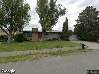
3791 Airport Way East Wenatchee, WA 98802
Estimated Value: $504,558 - $681,000
3
Beds
2
Baths
1,250
Sq Ft
$478/Sq Ft
Est. Value
About This Home
This home is located at 3791 Airport Way, East Wenatchee, WA 98802 and is currently estimated at $597,640, approximately $478 per square foot. 3791 Airport Way is a home located in Douglas County with nearby schools including Clovis Point Intermediate School, Rock Island Elementary School, and Eastmont Junior High School.
Ownership History
Date
Name
Owned For
Owner Type
Purchase Details
Closed on
Oct 11, 2024
Sold by
Golden Barbara
Bought by
Pennington Brothers Properties Llc
Current Estimated Value
Home Financials for this Owner
Home Financials are based on the most recent Mortgage that was taken out on this home.
Original Mortgage
$520,000
Outstanding Balance
$517,554
Interest Rate
6.35%
Mortgage Type
New Conventional
Estimated Equity
$75,566
Create a Home Valuation Report for This Property
The Home Valuation Report is an in-depth analysis detailing your home's value as well as a comparison with similar homes in the area
Home Values in the Area
Average Home Value in this Area
Purchase History
| Date | Buyer | Sale Price | Title Company |
|---|---|---|---|
| Pennington Brothers Properties Llc | $558,708 | First American Title |
Source: Public Records
Mortgage History
| Date | Status | Borrower | Loan Amount |
|---|---|---|---|
| Open | Pennington Brothers Properties Llc | $520,000 |
Source: Public Records
Tax History Compared to Growth
Tax History
| Year | Tax Paid | Tax Assessment Tax Assessment Total Assessment is a certain percentage of the fair market value that is determined by local assessors to be the total taxable value of land and additions on the property. | Land | Improvement |
|---|---|---|---|---|
| 2025 | $400 | $429,200 | $155,000 | $274,200 |
| 2024 | $4,458 | $477,100 | $155,000 | $322,100 |
| 2023 | $4,881 | $451,400 | $155,000 | $296,400 |
| 2022 | $3,915 | $342,100 | $105,000 | $237,100 |
| 2021 | $4,258 | $342,100 | $105,000 | $237,100 |
| 2020 | $4,133 | $345,000 | $105,000 | $240,000 |
| 2018 | $3,401 | $272,000 | $75,900 | $196,100 |
| 2017 | $2,922 | $272,000 | $75,900 | $196,100 |
| 2016 | $2,641 | $250,800 | $75,900 | $174,900 |
| 2015 | $2,628 | $232,300 | $75,900 | $156,400 |
| 2014 | -- | $221,700 | $75,900 | $145,800 |
| 2013 | -- | $208,400 | $75,900 | $132,500 |
Source: Public Records
Map
Nearby Homes
- 650 Vanwell St
- 3260 1st St SE
- 89 S Texas Ave
- 0 Ward St
- 0 N Quincy Ave
- 0 Leroy Ranch Rd Unit NWM2260029
- 3223 Martin Place
- 312 Perry Ave N
- 90 S Valiant Dr
- 2663 7th St SE
- 2575 1st St SE
- 1396 S Tyee Ave
- 0 Noble Moonbeam
- 1414 S Tyee Ave
- 2526 1st St SE
- 980 S Webb Place
- 1418 S Tyee Ave
- 2611 Paisley St SE
- 2487 3rd St SE
- 2575 Parkette St SE
- 3791 Airport Way
- 0 Airport Way Unit 1218331
- 0 Airport Way Unit 1218329
- 1327 Airport Way
- 3950 Grant Rd
- 3759 Airport Way
- 3741 Airport Way
- 3975 Airport Way
- 3721 Airport Way
- 3780 Grant Rd
- 3711 Airport Way
- 3795 N George St
- 0 NNA Grant Rd
- 0 Nna Grant Rd Unit NWM2013349
- 224 S Vanwell Ave
- 427 Urban Industrial Ave
- 300 Urban Industrial Ave
- 310 Vanwell St
- 322 S van Well Ave
- 0 Vanwell St