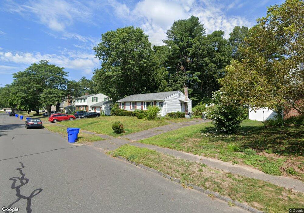
38 Armstrong Rd Enfield, CT 06082
Estimated Value: $277,000 - $314,000
3
Beds
1
Bath
1,008
Sq Ft
$296/Sq Ft
Est. Value
About This Home
This home is located at 38 Armstrong Rd, Enfield, CT 06082 and is currently estimated at $297,934, approximately $295 per square foot. 38 Armstrong Rd is a home located in Hartford County with nearby schools including Prudence Crandall Elementary School, Nathan Hale Elementary School, and Enfield High School.
Ownership History
Date
Name
Owned For
Owner Type
Purchase Details
Closed on
Feb 3, 1992
Sold by
Danser Susan
Bought by
Wellsplak Ronald and Wellsplak Lori
Current Estimated Value
Create a Home Valuation Report for This Property
The Home Valuation Report is an in-depth analysis detailing your home's value as well as a comparison with similar homes in the area
Home Values in the Area
Average Home Value in this Area
Purchase History
| Date | Buyer | Sale Price | Title Company |
|---|---|---|---|
| Wellsplak Ronald | $110,000 | -- |
Source: Public Records
Mortgage History
| Date | Status | Borrower | Loan Amount |
|---|---|---|---|
| Closed | Wellsplak Ronald | $124,000 | |
| Closed | Wellsplak Ronald | $22,000 | |
| Closed | Wellsplak Ronald | $97,500 | |
| Closed | Wellsplak Ronald | $106,785 |
Source: Public Records
Tax History Compared to Growth
Tax History
| Year | Tax Paid | Tax Assessment Tax Assessment Total Assessment is a certain percentage of the fair market value that is determined by local assessors to be the total taxable value of land and additions on the property. | Land | Improvement |
|---|---|---|---|---|
| 2025 | $4,761 | $134,100 | $56,600 | $77,500 |
| 2024 | $4,634 | $134,100 | $56,600 | $77,500 |
| 2023 | $4,608 | $134,100 | $56,600 | $77,500 |
| 2022 | $4,243 | $134,100 | $56,600 | $77,500 |
| 2021 | $4,028 | $104,260 | $46,890 | $57,370 |
| 2020 | $3,986 | $104,260 | $46,890 | $57,370 |
| 2019 | $3,882 | $104,260 | $46,890 | $57,370 |
| 2018 | $3,795 | $104,260 | $46,890 | $57,370 |
| 2017 | $3,590 | $104,260 | $46,890 | $57,370 |
| 2016 | $3,412 | $102,910 | $46,890 | $56,020 |
| 2015 | $3,313 | $102,910 | $46,890 | $56,020 |
| 2014 | $3,234 | $102,910 | $46,890 | $56,020 |
Source: Public Records
Map
Nearby Homes
- 32 Jondot Dr
- 50 Liberty Ln
- 39 Liberty Ln
- 41 Liberty Ln
- 43 Liberty Ln
- 14 W Forrest Dr
- 242 Elm St
- 5 Cranberry Hollow Unit 5
- 18 Cranberry Hollow Unit 18
- 44 Sharren Ln
- 38 Winding Ln
- 20 W View Dr
- 176 Cottage Rd
- 17 Douglas Dr
- 55 Elm Meadows Unit 55
- E6 Bradley Cir Unit 6
- 15 Robbin Rd
- 4 Georgetown Unit A
- 2 Sharren Ln
- 179 Elm St
- 36 Armstrong Rd
- 40 Armstrong Rd
- 37 Armstrong Rd
- 34 Armstrong Rd
- 35 Armstrong Rd
- 39 Armstrong Rd
- 42 Armstrong Rd
- 33 Armstrong Rd
- 41 Armstrong Rd
- 35 Brook Rd
- 32 Armstrong Rd
- 33 Brook Rd
- 37 Brook Rd
- 44 Armstrong Rd
- 43 Armstrong Rd
- 31 Brook Rd
- 31 Armstrong Rd
- 175 the Laurels
- 173 the Laurels
- 171 the Laurels