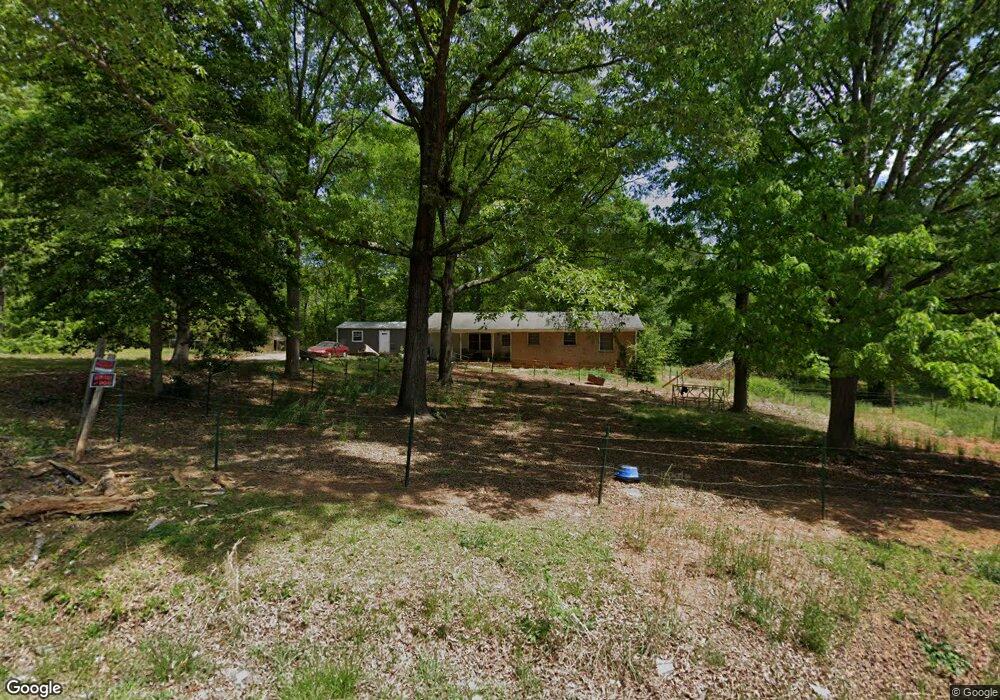
38 Deason St Griffin, GA 30223
Spalding County NeighborhoodEstimated Value: $166,000 - $204,000
3
Beds
1
Bath
1,316
Sq Ft
$143/Sq Ft
Est. Value
About This Home
This home is located at 38 Deason St, Griffin, GA 30223 and is currently estimated at $187,646, approximately $142 per square foot. 38 Deason St is a home with nearby schools including Cowan Road Elementary School, Cowan Road Middle School, and Griffin High School.
Ownership History
Date
Name
Owned For
Owner Type
Purchase Details
Closed on
Nov 16, 2022
Sold by
Holtzclaw Roger A
Bought by
Romkat Properties Llc
Current Estimated Value
Purchase Details
Closed on
Nov 5, 2008
Sold by
Lavigne Barbara D
Bought by
Countrywide Hm Lns Inc
Purchase Details
Closed on
Jan 2, 2008
Sold by
Lavigne Barbara D
Bought by
Holtzclaw Roger A and Holtzclaw Michele
Purchase Details
Closed on
Jun 16, 1979
Sold by
Tommy Payton Construction
Bought by
Harrell Charlie B
Purchase Details
Closed on
Jun 15, 1979
Sold by
Payton J R
Bought by
Tommy Payton Constructon
Purchase Details
Closed on
Mar 1, 1979
Sold by
Harrell Charlie B and Harrell Mary S
Bought by
Payton J R
Purchase Details
Closed on
Feb 3, 1962
Sold by
Deason Deason M and Deason Margaret D
Bought by
Harrell Charlie B and Harrell Mary S
Purchase Details
Closed on
Apr 16, 1960
Bought by
Deason Deason M and Deason Margaret D
Create a Home Valuation Report for This Property
The Home Valuation Report is an in-depth analysis detailing your home's value as well as a comparison with similar homes in the area
Home Values in the Area
Average Home Value in this Area
Purchase History
| Date | Buyer | Sale Price | Title Company |
|---|---|---|---|
| Romkat Properties Llc | -- | -- | |
| Countrywide Hm Lns Inc | $111,000 | -- | |
| Holtzclaw Roger A | $52,000 | -- | |
| Harrell Charlie B | -- | -- | |
| Tommy Payton Constructon | -- | -- | |
| Payton J R | $2,000 | -- | |
| Harrell Charlie B | $3,300 | -- | |
| Deason Deason M | -- | -- |
Source: Public Records
Tax History Compared to Growth
Tax History
| Year | Tax Paid | Tax Assessment Tax Assessment Total Assessment is a certain percentage of the fair market value that is determined by local assessors to be the total taxable value of land and additions on the property. | Land | Improvement |
|---|---|---|---|---|
| 2024 | $1,410 | $39,411 | $6,822 | $32,589 |
| 2023 | $1,410 | $39,411 | $6,822 | $32,589 |
| 2022 | $1,188 | $32,670 | $5,248 | $27,422 |
| 2021 | $1,076 | $29,588 | $5,248 | $24,340 |
| 2020 | $1,080 | $29,588 | $5,248 | $24,340 |
| 2019 | $1,101 | $29,588 | $5,248 | $24,340 |
| 2018 | $1,037 | $27,126 | $5,248 | $21,878 |
| 2017 | $1,008 | $27,126 | $5,248 | $21,878 |
| 2016 | $1,026 | $27,126 | $5,248 | $21,878 |
| 2015 | $1,057 | $27,126 | $5,248 | $21,878 |
| 2014 | $1,078 | $27,126 | $5,248 | $21,878 |
Source: Public Records
Map
Nearby Homes
- 265 Steele Rd
- 1115 Burgundy Dr
- 475 Edwards Rd
- 1156 Burgundy Dr
- 1972 Pinecrest Dr Unit 4
- 1019 Oakridge Dr
- 1949 Bonnie Ridge Dr
- 204 Vineyard Ridge Dr
- 3701 Fayetteville Rd
- 1022 Serene Lake Dr
- 114 King Richard Dr
- 1317 Cheatham Rd
- 110 Janie Ln
- 813 Vineyard Rd
- 105 Janie Ln
- 220 Beasley Rd
- 1100 Stiles Crossing
- 1102 Stiles Crossing
- 313 Sammy Cir
- 4920 Fayetteville Rd
- 33 Deason St
- 20 Deason St
- 8 Vickery Dr
- 45 Deason St
- 10 Vickery Dr
- 35 Vickery Dr
- 37 Vickery Dr
- 39 Vickery Dr
- 1483 Vineyard Rd
- 0 Vickery Dr Unit 7072310
- 1507 Vineyard Rd
- 1501 Vineyard Rd
- 1521 Vineyard Rd
- 1497 Vineyard Rd
- 1527 Vineyard Rd
- 36 Vickery Dr
- 1551 Vineyard Rd
- 101 Bates Rd
- 291 Steele Rd
- 95 Bates Rd