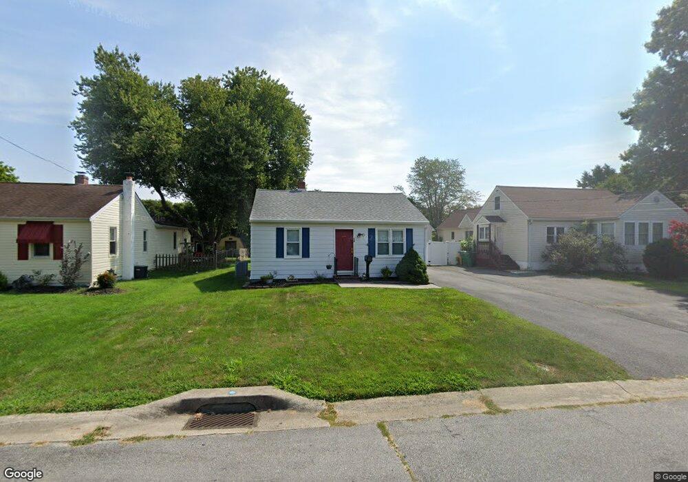
38 Laurel Ave Newark, DE 19711
Estimated Value: $218,000 - $348,000
3
Beds
1
Bath
912
Sq Ft
$316/Sq Ft
Est. Value
About This Home
This home is located at 38 Laurel Ave, Newark, DE 19711 and is currently estimated at $287,919, approximately $315 per square foot. 38 Laurel Ave is a home located in New Castle County with nearby schools including R. Elisabeth Maclary Elementary School, Shue-Medill Middle School, and Newark High School.
Ownership History
Date
Name
Owned For
Owner Type
Purchase Details
Closed on
Sep 25, 2024
Sold by
Messina Dorothy A
Bought by
Demarco Nicholas Austin
Current Estimated Value
Home Financials for this Owner
Home Financials are based on the most recent Mortgage that was taken out on this home.
Original Mortgage
$248,320
Outstanding Balance
$245,778
Interest Rate
6.49%
Mortgage Type
New Conventional
Estimated Equity
$42,141
Purchase Details
Closed on
Aug 30, 2004
Sold by
Lovett Michael A
Bought by
Messina Dorothy A
Home Financials for this Owner
Home Financials are based on the most recent Mortgage that was taken out on this home.
Original Mortgage
$119,550
Interest Rate
5.62%
Mortgage Type
Purchase Money Mortgage
Create a Home Valuation Report for This Property
The Home Valuation Report is an in-depth analysis detailing your home's value as well as a comparison with similar homes in the area
Home Values in the Area
Average Home Value in this Area
Purchase History
| Date | Buyer | Sale Price | Title Company |
|---|---|---|---|
| Demarco Nicholas Austin | $204,800 | None Listed On Document | |
| Messina Dorothy A | $159,400 | -- |
Source: Public Records
Mortgage History
| Date | Status | Borrower | Loan Amount |
|---|---|---|---|
| Open | Demarco Nicholas Austin | $248,320 | |
| Previous Owner | Messina Dorothy A | $119,550 |
Source: Public Records
Tax History
| Year | Tax Paid | Tax Assessment Tax Assessment Total Assessment is a certain percentage of the fair market value that is determined by local assessors to be the total taxable value of land and additions on the property. | Land | Improvement |
|---|---|---|---|---|
| 2024 | $1,208 | $39,200 | $8,900 | $30,300 |
| 2023 | $1,151 | $39,200 | $8,900 | $30,300 |
| 2022 | $1,151 | $39,200 | $8,900 | $30,300 |
| 2021 | $1,217 | $39,200 | $8,900 | $30,300 |
| 2020 | $1,175 | $39,200 | $8,900 | $30,300 |
| 2019 | $154 | $39,200 | $8,900 | $30,300 |
| 2018 | $960 | $39,200 | $8,900 | $30,300 |
| 2017 | $913 | $39,200 | $8,900 | $30,300 |
| 2016 | $841 | $39,200 | $8,900 | $30,300 |
| 2015 | $783 | $39,200 | $8,900 | $30,300 |
| 2014 | -- | $39,200 | $8,900 | $30,300 |
Source: Public Records
Map
Nearby Homes
- 91 Old Red Mill Rd
- 16 Pinedale Rd
- 221 S Dillwyn Rd
- 1905 Capitol Trail
- 11 Saint Regis Dr
- 35 Old Manor Rd
- 11 Aronimink Dr
- 230 Aronimink Dr
- 101 Margit Ct Unit 193
- 2101 Creekside Dr Unit 33
- 402 Stafford Ave
- 208 Capitol Trail
- 305 Poplar Ave
- 120 Diminish Dr
- 179 Rhythm Ct
- 3 Marlyn Rd
- 221 Cullen Way
- 108 Lena Dr
- 59 Valley Cir
- 18 Malvina Ln
- 40 Laurel Ave
- 36 Laurel Ave Unit RSVPK
- 36 Laurel Ave
- 32 Laurel Ave
- 23 Maple Ave
- 19 Maple Ave
- 17 Maple Ave
- 100 Laurel Ave
- 35 Laurel Ave
- 39 Laurel Ave
- 24 Chestnut Ave
- 30 Laurel Ave
- 41 Laurel Ave
- 31 Laurel Ave
- 26 Chestnut Ave
- 11 Maple Ave Unit B
- 11 Maple Ave Unit Main
- 11 Maple Ave
- 104 Laurel Ave
- 101 Maple Ave
Your Personal Tour Guide
Ask me questions while you tour the home.