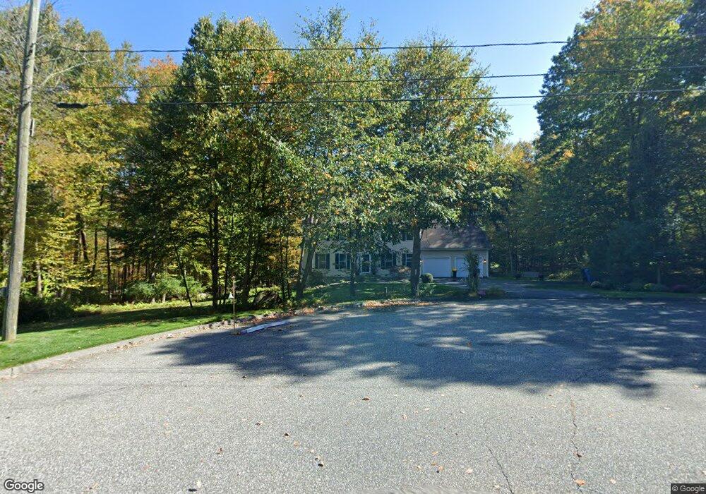
38 Rudnansky Ln Tolland, CT 06084
Estimated Value: $574,000 - $661,000
4
Beds
3
Baths
2,268
Sq Ft
$270/Sq Ft
Est. Value
About This Home
This home is located at 38 Rudnansky Ln, Tolland, CT 06084 and is currently estimated at $613,016, approximately $270 per square foot. 38 Rudnansky Ln is a home located in Tolland County with nearby schools including Birch Grove Primary School, Tolland Intermediate School, and Tolland Middle School.
Ownership History
Date
Name
Owned For
Owner Type
Purchase Details
Closed on
Apr 26, 2004
Sold by
S D Williams Llc
Bought by
Ernest Robert and Ernest Adrienne
Current Estimated Value
Home Financials for this Owner
Home Financials are based on the most recent Mortgage that was taken out on this home.
Original Mortgage
$287,900
Outstanding Balance
$123,033
Interest Rate
4.25%
Estimated Equity
$489,983
Create a Home Valuation Report for This Property
The Home Valuation Report is an in-depth analysis detailing your home's value as well as a comparison with similar homes in the area
Home Values in the Area
Average Home Value in this Area
Purchase History
| Date | Buyer | Sale Price | Title Company |
|---|---|---|---|
| Ernest Robert | $359,900 | -- | |
| Ernest Robert | $359,900 | -- |
Source: Public Records
Mortgage History
| Date | Status | Borrower | Loan Amount |
|---|---|---|---|
| Open | Ernest Robert | $83,000 | |
| Open | Ernest Robert | $287,900 | |
| Closed | Ernest Robert | $35,990 | |
| Closed | Ernest Robert | $287,900 |
Source: Public Records
Tax History Compared to Growth
Tax History
| Year | Tax Paid | Tax Assessment Tax Assessment Total Assessment is a certain percentage of the fair market value that is determined by local assessors to be the total taxable value of land and additions on the property. | Land | Improvement |
|---|---|---|---|---|
| 2025 | $9,383 | $345,100 | $78,900 | $266,200 |
| 2024 | $8,721 | $230,900 | $75,200 | $155,700 |
| 2023 | $8,619 | $230,900 | $75,200 | $155,700 |
| 2022 | $8,446 | $230,900 | $75,200 | $155,700 |
| 2021 | $8,569 | $230,900 | $75,200 | $155,700 |
| 2020 | $8,324 | $230,900 | $75,200 | $155,700 |
| 2019 | $8,576 | $237,900 | $77,500 | $160,400 |
| 2018 | $8,327 | $237,900 | $77,500 | $160,400 |
| 2017 | $8,134 | $237,900 | $77,500 | $160,400 |
| 2016 | $8,134 | $237,900 | $77,500 | $160,400 |
| 2015 | $7,936 | $237,900 | $77,500 | $160,400 |
| 2014 | $7,893 | $254,200 | $86,100 | $168,100 |
Source: Public Records
Map
Nearby Homes
- 0 Tolland Turnpike
- 487 Buff Cap Rd
- 644 Buff Cap Rd
- 745 Old Stafford Rd
- 8 Neff Hill Rd
- 15 Usher Ridge
- 68 Usher Ridge
- 36 Usher Ridge
- 110 Neff Hill Rd
- 130 Neff Hill Rd
- 105 Neff Hill Rd
- 137 Neff Hill Rd
- 77 Neff Hill Rd
- 84 Neff Hill Rd
- 65 Blair Rd
- 110 Schofield Rd
- 71 Neff Hill Rd
- 40 Buff Cap Rd
- 42 Ladd Rd
- 184 Village Hill Rd
- 30 Rudnansky Ln
- 35 Rudnansky Ln
- 34 Rudnansky Ln
- 23 Rudnansky Ln
- 22 Rudnansky Ln
- 187 Charles St
- 179 Charles St
- 149 Charles St
- 203 Charles St
- 247 Plains Rd
- 195 Charles St
- 171 Charles St
- 182 Charles St
- 163 Charles St
- 174 Charles St
- 215 Charles St
- 137 Deerwood Rd
- 166 Charles St
- 153 Charles St
- 158 Charles St