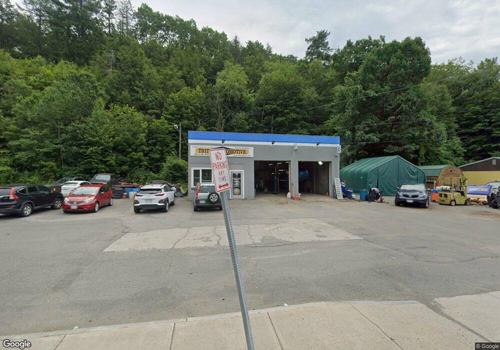
381 High St Greenfield, MA 01301
Estimated Value: $353,552
--
Bed
--
Bath
1,230
Sq Ft
$287/Sq Ft
Est. Value
About This Home
This home is located at 381 High St, Greenfield, MA 01301 and is currently estimated at $353,552, approximately $287 per square foot. 381 High St is a home located in Franklin County.
Ownership History
Date
Name
Owned For
Owner Type
Purchase Details
Closed on
May 3, 2023
Sold by
Kilgour William D and Kilgour Donna M
Bought by
King Triton Prop Llc
Current Estimated Value
Home Financials for this Owner
Home Financials are based on the most recent Mortgage that was taken out on this home.
Original Mortgage
$286,200
Outstanding Balance
$277,673
Interest Rate
6.42%
Mortgage Type
Commercial
Estimated Equity
$75,879
Purchase Details
Closed on
Feb 6, 1963
Bought by
Kilgour William D and Kilgour Donna M
Create a Home Valuation Report for This Property
The Home Valuation Report is an in-depth analysis detailing your home's value as well as a comparison with similar homes in the area
Home Values in the Area
Average Home Value in this Area
Purchase History
| Date | Buyer | Sale Price | Title Company |
|---|---|---|---|
| King Triton Prop Llc | $290,000 | None Available | |
| King Triton Prop Llc | $290,000 | None Available | |
| Kilgour William D | -- | -- |
Source: Public Records
Mortgage History
| Date | Status | Borrower | Loan Amount |
|---|---|---|---|
| Open | King Triton Prop Llc | $286,200 | |
| Closed | King Triton Prop Llc | $286,200 | |
| Previous Owner | Kilgour William D | $70,000 |
Source: Public Records
Tax History Compared to Growth
Tax History
| Year | Tax Paid | Tax Assessment Tax Assessment Total Assessment is a certain percentage of the fair market value that is determined by local assessors to be the total taxable value of land and additions on the property. | Land | Improvement |
|---|---|---|---|---|
| 2025 | $3,914 | $200,100 | $106,100 | $94,000 |
| 2024 | $3,976 | $195,000 | $101,000 | $94,000 |
| 2023 | $3,508 | $178,500 | $91,800 | $86,700 |
| 2022 | $3,781 | $169,400 | $87,500 | $81,900 |
| 2021 | $3,562 | $153,400 | $86,200 | $67,200 |
| 2020 | $3,387 | $147,700 | $86,200 | $61,500 |
| 2019 | $3,303 | $147,700 | $86,200 | $61,500 |
| 2018 | $3,077 | $137,200 | $80,600 | $56,600 |
| 2017 | $2,981 | $137,200 | $80,600 | $56,600 |
| 2016 | $2,975 | $136,400 | $80,600 | $55,800 |
| 2015 | $3,059 | $135,900 | $80,600 | $55,300 |
| 2014 | $2,821 | $137,400 | $80,600 | $56,800 |
Source: Public Records
Map
Nearby Homes
- 79 Burnham Rd
- 335 Federal St
- 35-37 Shattuck St
- 35 Shattuck St Unit 37
- 93 Maple St
- 306 Davis St
- 696 Bernardston Rd
- 254 Davis St
- 24 Pine St
- 72 Meadowood Dr
- 311 Chapman St
- 30 Park St
- 2 Orchard St
- 43 Crescent St
- 75 School St
- 23-25 Alden St
- 192 Wells St
- 24 Cypress St
- 0 Millers Falls Rd Unit 73034825
- 30 Grinnell St
- 1 French King Hwy
- 549 High St
- 110 Stone Farm Ln
- 112 Stone Farm Ln Unit 2
- 112 Stone Farm Ln
- 368 High St
- 55 Stone Ridge
- 11 Silver St
- 14 Silver St
- 10 Silver St
- 15 Silver St
- 18 Silver St
- 14 French King Hwy
- 19 Silver St
- 348 High St
- 18 French King Hwy
- 23 Mclellan Ln
- 23 Silver St
- 118 Wildwood Ave
- 24 Silver St