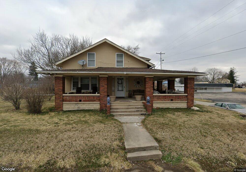
3810 W National Rd Springfield, OH 45504
Cedar Hills/Broadview NeighborhoodEstimated Value: $179,859 - $217,000
2
Beds
1
Bath
1,372
Sq Ft
$146/Sq Ft
Est. Value
About This Home
This home is located at 3810 W National Rd, Springfield, OH 45504 and is currently estimated at $200,715, approximately $146 per square foot. 3810 W National Rd is a home located in Clark County with nearby schools including Shawnee Middle School/High School, Clark Preparatory Academy, and Springfield Christian School.
Ownership History
Date
Name
Owned For
Owner Type
Purchase Details
Closed on
Mar 6, 2004
Sold by
Hice Barbara A and Hice Raymond J
Bought by
Brown Alan E and Brown Angela R
Current Estimated Value
Home Financials for this Owner
Home Financials are based on the most recent Mortgage that was taken out on this home.
Original Mortgage
$77,900
Outstanding Balance
$36,662
Interest Rate
5.77%
Mortgage Type
Purchase Money Mortgage
Estimated Equity
$164,053
Purchase Details
Closed on
Jul 11, 2002
Sold by
Hice Barbara A and Hice Raymond
Bought by
Jones Robert A and Jones Donna D
Home Financials for this Owner
Home Financials are based on the most recent Mortgage that was taken out on this home.
Original Mortgage
$75,000
Interest Rate
8.5%
Mortgage Type
Seller Take Back
Purchase Details
Closed on
Aug 1, 1985
Create a Home Valuation Report for This Property
The Home Valuation Report is an in-depth analysis detailing your home's value as well as a comparison with similar homes in the area
Home Values in the Area
Average Home Value in this Area
Purchase History
| Date | Buyer | Sale Price | Title Company |
|---|---|---|---|
| Brown Alan E | $82,000 | Ohio Real Estate Title | |
| Jones Robert A | $80,000 | -- | |
| -- | $4,000 | -- |
Source: Public Records
Mortgage History
| Date | Status | Borrower | Loan Amount |
|---|---|---|---|
| Open | Brown Alan E | $77,900 | |
| Closed | Jones Robert A | $75,000 |
Source: Public Records
Tax History Compared to Growth
Tax History
| Year | Tax Paid | Tax Assessment Tax Assessment Total Assessment is a certain percentage of the fair market value that is determined by local assessors to be the total taxable value of land and additions on the property. | Land | Improvement |
|---|---|---|---|---|
| 2024 | $1,860 | $38,090 | $10,450 | $27,640 |
| 2023 | $1,860 | $38,090 | $10,450 | $27,640 |
| 2022 | $1,845 | $38,090 | $10,450 | $27,640 |
| 2021 | $1,610 | $29,760 | $8,100 | $21,660 |
| 2020 | $1,624 | $29,760 | $8,100 | $21,660 |
| 2019 | $1,649 | $29,760 | $8,100 | $21,660 |
| 2018 | $1,264 | $22,510 | $4,380 | $18,130 |
| 2017 | $1,296 | $22,502 | $4,375 | $18,127 |
| 2016 | $1,169 | $22,502 | $4,375 | $18,127 |
| 2015 | $1,172 | $21,819 | $4,375 | $17,444 |
| 2014 | $1,176 | $21,819 | $4,375 | $17,444 |
| 2013 | $1,021 | $21,819 | $4,375 | $17,444 |
Source: Public Records
Map
Nearby Homes
- 3721 W National Rd
- 224 E Downey Dr
- 323 Saint Paul Ave
- 124 Old Mill Rd
- 3587 Lower Valley Pike
- 4461 New Carlisle Pike
- 570 Aberfelda Dr
- 709 Shrine Rd
- 201 Beech Dr
- 190 Oakridge Dr
- 245 Gordon Rd
- 2805 Cottonwood Dr
- 0 Upper Valley Pike
- 361 Upper Valley Pike
- 3161 Dayton Springfield Rd
- 3161 Dayton Rd
- 5095 W National Rd
- 1290 Red Oaks Cir
- 3939 Shrine Rd
- 3916 Glendale Ave
- 3907 Monterey Ave
- 3842 W National Rd
- 3915 Monterey Ave
- 3920 Glendale Ave
- 3770 W National Rd
- 3783 W National Rd
- 3864 W National Rd
- 109 Fairview Ave
- 3933 Monterey Ave
- 3920 Monterey Ave
- 3753 W National Rd Unit 3
- 3753 W National Rd
- 3719 W National Rd
- 0 Cherry Dr
- 3926 Monterey Ave
- 3813 W National Rd
- 3923 Glendale Ave
- 17 Cherry Dr
- 3930 Glendale Ave