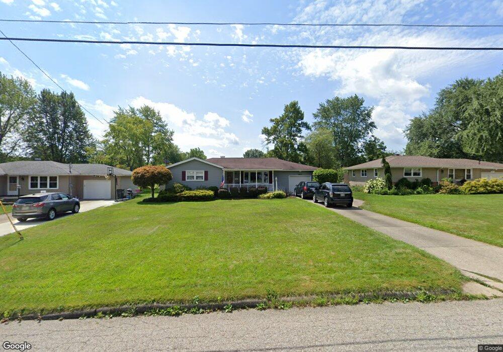
3823 Cumberland Dr Youngstown, OH 44515
Austintown NeighborhoodEstimated Value: $161,000 - $191,000
2
Beds
1
Bath
1,240
Sq Ft
$141/Sq Ft
Est. Value
About This Home
This home is located at 3823 Cumberland Dr, Youngstown, OH 44515 and is currently estimated at $174,636, approximately $140 per square foot. 3823 Cumberland Dr is a home located in Mahoning County with nearby schools including Austintown Elementary School, Austintown Intermediate School, and Austintown Middle School.
Ownership History
Date
Name
Owned For
Owner Type
Purchase Details
Closed on
Nov 29, 2005
Sold by
Stovall Todd R
Bought by
Malaska Dennis E and Marlaska Darlene
Current Estimated Value
Home Financials for this Owner
Home Financials are based on the most recent Mortgage that was taken out on this home.
Original Mortgage
$65,000
Outstanding Balance
$36,519
Interest Rate
6.36%
Mortgage Type
Fannie Mae Freddie Mac
Estimated Equity
$138,117
Purchase Details
Closed on
Jan 3, 1998
Sold by
Filban Kenneth P
Bought by
Stovall Todd R
Home Financials for this Owner
Home Financials are based on the most recent Mortgage that was taken out on this home.
Original Mortgage
$60,000
Interest Rate
7.28%
Purchase Details
Closed on
Sep 17, 1992
Bought by
Filban Kenneth P
Create a Home Valuation Report for This Property
The Home Valuation Report is an in-depth analysis detailing your home's value as well as a comparison with similar homes in the area
Home Values in the Area
Average Home Value in this Area
Purchase History
| Date | Buyer | Sale Price | Title Company |
|---|---|---|---|
| Malaska Dennis E | $95,000 | -- | |
| Stovall Todd R | $72,000 | -- | |
| Filban Kenneth P | -- | -- |
Source: Public Records
Mortgage History
| Date | Status | Borrower | Loan Amount |
|---|---|---|---|
| Open | Malaska Dennis E | $65,000 | |
| Previous Owner | Stovall Todd R | $60,000 |
Source: Public Records
Tax History Compared to Growth
Tax History
| Year | Tax Paid | Tax Assessment Tax Assessment Total Assessment is a certain percentage of the fair market value that is determined by local assessors to be the total taxable value of land and additions on the property. | Land | Improvement |
|---|---|---|---|---|
| 2024 | $1,544 | $43,200 | $6,170 | $37,030 |
| 2023 | $1,545 | $43,200 | $6,170 | $37,030 |
| 2022 | $1,123 | $28,550 | $5,800 | $22,750 |
| 2021 | $1,125 | $28,550 | $5,800 | $22,750 |
| 2020 | $1,128 | $28,550 | $5,800 | $22,750 |
| 2019 | $1,059 | $25,490 | $5,180 | $20,310 |
| 2018 | $1,020 | $25,490 | $5,180 | $20,310 |
| 2017 | $1,097 | $25,490 | $5,180 | $20,310 |
| 2016 | $1,185 | $28,280 | $6,780 | $21,500 |
| 2015 | $1,150 | $28,280 | $6,780 | $21,500 |
| 2014 | $1,155 | $28,280 | $6,780 | $21,500 |
| 2013 | $1,142 | $28,280 | $6,780 | $21,500 |
Source: Public Records
Map
Nearby Homes
- 3890 Ayrshire Dr
- 3852 Edinburgh Dr
- 1560 S Meridian Rd
- 3972 Artmar Dr
- 4102 Burkey Rd
- 532 Westgate Blvd
- 3210 Quentin Dr
- 4235 Patricia Ave
- 3913 Claridge Dr
- 3811 Artmar Dr
- 4262 Pembrook Rd
- 2108 Cranbrook Dr
- 2430 Redgate Ln
- 653 S Meridian Rd
- 4241 Wedgewood Dr
- 4234 Burkey Rd
- 565 S Meridian Rd
- 2992 Eldora Dr
- 902 S Meridian Rd
- 2922 Eldora Dr
- 3815 Cumberland Dr
- 3831 Cumberland Dr
- 3835 Cumberland Dr
- 3807 Cumberland Dr
- 3832 Cannon Rd
- 3828 Cannon Rd
- 3838 Cannon Rd
- 3828 Cumberland Dr
- 3803 Cumberland Dr
- 3841 Cumberland Dr
- 3818 Cannon Rd
- 3840 Cannon Rd
- 3816 Cumberland Dr
- 3832 Cumberland Dr
- 3808 Cumberland Dr
- 3808 Cannon Rd
- 3848 Cannon Rd
- 3838 Cumberland Dr
- 3802 Cumberland Dr
- 3801 Cumberland Dr