Estimated Value: $147,000 - $260,000
--
Bed
--
Bath
2,282
Sq Ft
$90/Sq Ft
Est. Value
About This Home
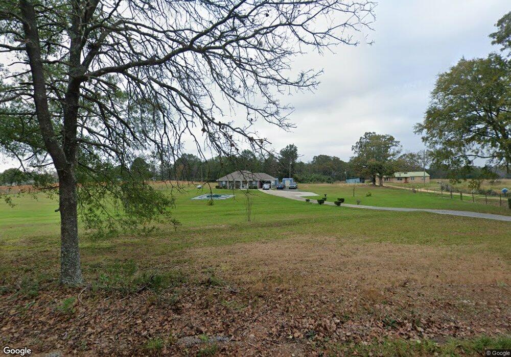
This home is located at 383 James Boyakin Barnett Rd, Magee, MS 39111 and is currently estimated at $204,555, approximately $89 per square foot. 383 James Boyakin Barnett Rd is a home located in Simpson County with nearby schools including Simpson Central School and Mendenhall High School.
Ownership History
Date
Name
Owned For
Owner Type
Purchase Details
Closed on
Jul 24, 2023
Sold by
Vanderbilt Mtg & Finance Inc
Bought by
Williamson Robert D
Current Estimated Value
Home Financials for this Owner
Home Financials are based on the most recent Mortgage that was taken out on this home.
Original Mortgage
$73,625
Outstanding Balance
$71,680
Interest Rate
6.67%
Mortgage Type
New Conventional
Estimated Equity
$132,875
Purchase Details
Closed on
May 9, 2023
Sold by
Young Georgia
Bought by
Vanderbilt Mortgage And Finance Inc
Create a Home Valuation Report for This Property
The Home Valuation Report is an in-depth analysis detailing your home's value as well as a comparison with similar homes in the area
Home Values in the Area
Average Home Value in this Area
Purchase History
| Date | Buyer | Sale Price | Title Company |
|---|---|---|---|
| Williamson Robert D | -- | Benchmark Title Llc | |
| Vanderbilt Mortgage And Finance Inc | -- | None Listed On Document |
Source: Public Records
Mortgage History
| Date | Status | Borrower | Loan Amount |
|---|---|---|---|
| Open | Williamson Robert D | $73,625 |
Source: Public Records
Tax History Compared to Growth
Tax History
| Year | Tax Paid | Tax Assessment Tax Assessment Total Assessment is a certain percentage of the fair market value that is determined by local assessors to be the total taxable value of land and additions on the property. | Land | Improvement |
|---|---|---|---|---|
| 2024 | -- | $7,867 | $0 | $0 |
| 2023 | $0 | $7,775 | $0 | $0 |
| 2022 | $29 | $7,885 | $0 | $0 |
| 2021 | $29 | $7,894 | $0 | $0 |
| 2020 | $29 | $7,478 | $0 | $0 |
| 2019 | $29 | $7,784 | $0 | $0 |
| 2018 | $31 | $7,795 | $0 | $0 |
| 2017 | $30 | $7,793 | $0 | $0 |
| 2016 | $16 | $7,661 | $0 | $0 |
| 2015 | $13 | $7,638 | $0 | $0 |
| 2014 | $11 | $7,617 | $0 | $0 |
Source: Public Records
Map
Nearby Homes
- 0 James Boyakin Barnett Rd
- 120 Memory Ln
- 110 Anse Reed Rd
- 1360 Airport Rd
- 540-578 Sol Grubbs Rd
- 00 Anse Reed Rd
- 0 Airport Rd Unit 23277891
- 0 Highway 28 Hwy Unit 1287717
- 0 Pecan Grove Dr Unit 4116202
- 143 Ashwood Ln
- 126 Batton Lake Dr
- 849 Athens Rd
- 152 Dewitt Flynt Rd
- 0 Lawrence Wigginton Rd
- 461 Highway 545
- 5219 Simpson Highway 28 W
- 125 Rosebud Trail
- 1092 Mississippi 43
- 132 Sanatorium Rd
- 000 Highway 149
- 369 James Boyakin Barnett Rd
- 379 James Boyakin Barnett Rd
- 0 James Boykin Barnett Rd
- 386 James Boyakin Barnett Rd
- 355 James Boyakin Barnett Rd
- 353 James Boyakin Barnett Rd
- 382 James Boyakin Barnett Rd
- 116 Hawpond Church Rd
- 345 James Boyakin Barnett Rd
- 142 Hawpond Church Rd
- 106 Hawpond Church Rd
- 139 Hawpond Church Rd
- 424 James Boyakin Barnett Rd
- 424 J B Barnett Rd
- 332 James Boyakin Barnett Rd
- 159 Hawpond Church Rd
- 148 Bullet Trace Dr
- 105 Hawpond Church Rd
- 160 Hawpond Church Rd
- 334 James Boyakin Barnett Rd