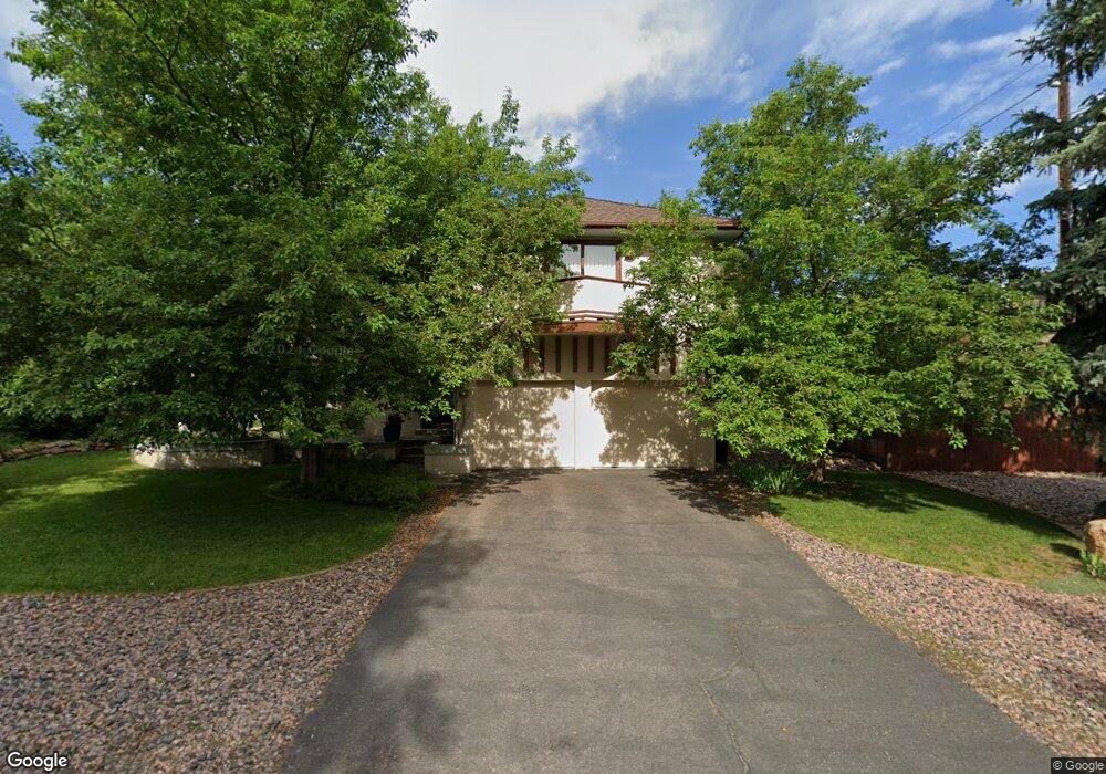
3835 17th St Boulder, CO 80304
North Boulder NeighborhoodEstimated Value: $1,455,000 - $2,200,000
4
Beds
3
Baths
2,203
Sq Ft
$755/Sq Ft
Est. Value
About This Home
This home is located at 3835 17th St, Boulder, CO 80304 and is currently estimated at $1,663,235, approximately $754 per square foot. 3835 17th St is a home located in Boulder County with nearby schools including Crest View Elementary School, Centennial Middle School, and Boulder High School.
Ownership History
Date
Name
Owned For
Owner Type
Purchase Details
Closed on
May 15, 2019
Sold by
Elmore David F and Maune Kay E
Bought by
Maune Elmore Trust
Current Estimated Value
Purchase Details
Closed on
Apr 8, 1991
Bought by
Elmore David F and Maune Kay E
Purchase Details
Closed on
Apr 5, 1982
Bought by
Elmore David F and Maune Kay E
Purchase Details
Closed on
Nov 2, 1981
Bought by
Elmore David F and Maune Kay E
Create a Home Valuation Report for This Property
The Home Valuation Report is an in-depth analysis detailing your home's value as well as a comparison with similar homes in the area
Home Values in the Area
Average Home Value in this Area
Purchase History
| Date | Buyer | Sale Price | Title Company |
|---|---|---|---|
| Maune Elmore Trust | -- | None Available | |
| Elmore David F | $64,000 | -- | |
| Elmore David F | $25,000 | -- | |
| Elmore David F | $21,800 | -- |
Source: Public Records
Tax History
| Year | Tax Paid | Tax Assessment Tax Assessment Total Assessment is a certain percentage of the fair market value that is determined by local assessors to be the total taxable value of land and additions on the property. | Land | Improvement |
|---|---|---|---|---|
| 2025 | $8,025 | $90,463 | $47,613 | $42,850 |
| 2024 | $8,025 | $90,463 | $47,613 | $42,850 |
| 2023 | $7,885 | $98,008 | $49,218 | $52,474 |
| 2022 | $6,738 | $79,508 | $39,705 | $39,803 |
| 2021 | $6,425 | $81,796 | $40,848 | $40,948 |
| 2020 | $5,197 | $66,853 | $36,537 | $30,316 |
| 2019 | $5,117 | $66,853 | $36,537 | $30,316 |
| 2018 | $4,690 | $61,294 | $27,000 | $34,294 |
| 2017 | $5,148 | $67,763 | $29,850 | $37,913 |
| 2016 | $4,856 | $56,094 | $25,392 | $30,702 |
| 2015 | $4,598 | $46,574 | $21,014 | $25,560 |
| 2014 | $3,916 | $46,574 | $21,014 | $25,560 |
Source: Public Records
Map
Nearby Homes
- 1620 Oak Ave
- 1690 Wilson Ct
- 1695 Orchard Ave
- 1505 Oak Ave
- 1945 Norwood Ave
- 1285 Meadow Place
- 3660 16th St
- 1487 Periwinkle Dr
- 3850 Broadway St Unit 24
- 3633 21st St
- 1885 Quince Ave
- 3560 16th St
- 1801 Redwood Ave
- 4893 Broadway
- 1205 Meadow Ave
- 1180 Oakdale Place
- 1152 Orange Place
- 2055 Kalmia Ave
- 3621 21st St
- 1110 Poplar Ave
Your Personal Tour Guide
Ask me questions while you tour the home.