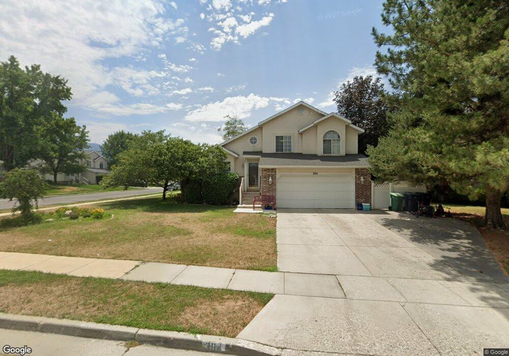
384 Sandy Land Ln Midvale, UT 84047
Estimated Value: $558,000 - $616,000
4
Beds
3
Baths
1,431
Sq Ft
$410/Sq Ft
Est. Value
About This Home
This home is located at 384 Sandy Land Ln, Midvale, UT 84047 and is currently estimated at $586,249, approximately $409 per square foot. 384 Sandy Land Ln is a home located in Salt Lake County with nearby schools including Midvalley Elementary School, Hillcrest High School, and Union Middle School.
Ownership History
Date
Name
Owned For
Owner Type
Purchase Details
Closed on
Mar 12, 2018
Sold by
Brown Carrie
Bought by
Brown Carrie and Brown Dale
Current Estimated Value
Purchase Details
Closed on
Oct 27, 2017
Sold by
Persson Donald R
Bought by
Brown Carrie
Home Financials for this Owner
Home Financials are based on the most recent Mortgage that was taken out on this home.
Original Mortgage
$266,400
Outstanding Balance
$222,816
Interest Rate
3.78%
Mortgage Type
New Conventional
Estimated Equity
$363,433
Purchase Details
Closed on
May 15, 2014
Sold by
Anderson Linda J
Bought by
Persson Donald R and The Donald Persson Living Trust
Purchase Details
Closed on
Feb 11, 1994
Sold by
Ivory Homes
Bought by
Anderson Linda J
Home Financials for this Owner
Home Financials are based on the most recent Mortgage that was taken out on this home.
Original Mortgage
$82,300
Interest Rate
7.1%
Create a Home Valuation Report for This Property
The Home Valuation Report is an in-depth analysis detailing your home's value as well as a comparison with similar homes in the area
Home Values in the Area
Average Home Value in this Area
Purchase History
| Date | Buyer | Sale Price | Title Company |
|---|---|---|---|
| Brown Carrie | -- | None Available | |
| Brown Carrie | -- | Founders Title | |
| Persson Donald R | -- | Title Guarantee S Jordan | |
| Anderson Linda J | -- | -- |
Source: Public Records
Mortgage History
| Date | Status | Borrower | Loan Amount |
|---|---|---|---|
| Open | Brown Carrie | $266,400 | |
| Previous Owner | Anderson Linda J | $82,300 |
Source: Public Records
Tax History Compared to Growth
Tax History
| Year | Tax Paid | Tax Assessment Tax Assessment Total Assessment is a certain percentage of the fair market value that is determined by local assessors to be the total taxable value of land and additions on the property. | Land | Improvement |
|---|---|---|---|---|
| 2025 | $2,911 | $535,700 | $164,200 | $371,500 |
| 2024 | $2,911 | $537,800 | $149,200 | $388,600 |
| 2023 | $2,726 | $502,100 | $141,800 | $360,300 |
| 2022 | $2,698 | $486,000 | $139,100 | $346,900 |
| 2021 | $2,373 | $363,200 | $131,600 | $231,600 |
| 2020 | $2,257 | $326,000 | $114,900 | $211,100 |
| 2019 | $2,254 | $317,000 | $108,500 | $208,500 |
| 2018 | $1,989 | $300,300 | $108,500 | $191,800 |
| 2017 | $75 | $274,000 | $108,500 | $165,500 |
| 2016 | $75 | $265,800 | $108,500 | $157,300 |
| 2015 | $1,953 | $238,500 | $113,300 | $125,200 |
| 2014 | $1,900 | $228,000 | $109,800 | $118,200 |
Source: Public Records
Map
Nearby Homes
- 210 Greenwood Ave Unit 102
- 5766 Sandy Woods Cir
- 235 E 7615 S
- 485 E 7670 S
- 7579 S 520 E
- 472 E 7670 S
- 7436 S Launa St
- 7359 S Dewmar Ct W Unit 32
- 7352 S Dewmar Ct W Unit 43
- 7367 S Dewmar Ct W Unit 34
- 7341 S Seven Tree Ln W Unit 80
- 7360 S Dewmar Ct W Unit 41
- 7363 S Dewmar Ct W Unit 33
- 7342 S Seven Tree Ln W Unit 77
- 545 E 7215 S
- 7329 S Seven Tree Ln W Unit 85
- 7371 S Dewmar Ct W Unit 35
- 7327 S Seven Tree Ln W Unit 86
- 7376 S Dewmar Ct W Unit 37
- 7337 S Seven Tree Ln W Unit 82
- 384 E Sandy Land Ln
- 374 E Sandy Land Ln S
- 374 Sandy Land Ln
- 7542 Woods Ln
- 7542 S Woods Ln
- 379 Sandy Land Ln
- 7535 Woods Ln
- 7552 S Woods Ln
- 362 Sandy Land Ln
- 7525 Woods Ln
- 7552 Woods Ln
- 367 Sandy Land Ln
- 7545 Woods Ln
- 7515 S Woods Ln
- 355 Sandy Land Ln
- 350 Sandy Land Ln
- 7515 Woods Ln
- 7555 Woods Ln
- 430 E Fisher Meadow Dr
- 7555 S Woods Ln