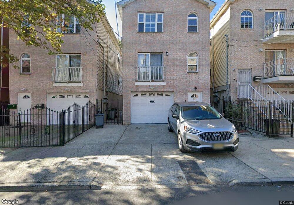
387 Forrest St Jersey City, NJ 07304
Bergen-Lafayette NeighborhoodEstimated Value: $766,234 - $932,000
8
Beds
--
Bath
3,480
Sq Ft
$247/Sq Ft
Est. Value
About This Home
This home is located at 387 Forrest St, Jersey City, NJ 07304 and is currently estimated at $861,059, approximately $247 per square foot. 387 Forrest St is a home located in Hudson County with nearby schools including Chaplain Charles Watters School, PS #24, Henry Snyder High School, and Lincoln High School.
Ownership History
Date
Name
Owned For
Owner Type
Purchase Details
Closed on
Dec 18, 2004
Sold by
Ken & L Llc
Bought by
Almonte Angel and Almonte Dina
Current Estimated Value
Home Financials for this Owner
Home Financials are based on the most recent Mortgage that was taken out on this home.
Original Mortgage
$37,086
Interest Rate
5.73%
Mortgage Type
Fannie Mae Freddie Mac
Purchase Details
Closed on
Apr 3, 2003
Sold by
Yahya Mohamed and Yotsukura Shizue
Bought by
Ken & L Llc
Create a Home Valuation Report for This Property
The Home Valuation Report is an in-depth analysis detailing your home's value as well as a comparison with similar homes in the area
Home Values in the Area
Average Home Value in this Area
Purchase History
| Date | Buyer | Sale Price | Title Company |
|---|---|---|---|
| Almonte Angel | $370,864 | -- | |
| Ken & L Llc | $65,000 | -- |
Source: Public Records
Mortgage History
| Date | Status | Borrower | Loan Amount |
|---|---|---|---|
| Closed | Almonte Angel | $37,086 | |
| Previous Owner | Almonte Angel | $296,691 |
Source: Public Records
Tax History Compared to Growth
Tax History
| Year | Tax Paid | Tax Assessment Tax Assessment Total Assessment is a certain percentage of the fair market value that is determined by local assessors to be the total taxable value of land and additions on the property. | Land | Improvement |
|---|---|---|---|---|
| 2025 | $9,542 | $427,300 | $102,000 | $325,300 |
| 2024 | $9,601 | $427,300 | $102,000 | $325,300 |
| 2023 | $9,601 | $427,300 | $102,000 | $325,300 |
| 2022 | $9,050 | $427,300 | $102,000 | $325,300 |
| 2021 | $6,854 | $427,300 | $102,000 | $325,300 |
| 2020 | $6,880 | $427,300 | $102,000 | $325,300 |
| 2019 | $6,580 | $427,300 | $102,000 | $325,300 |
| 2018 | $1,673 | $427,300 | $102,000 | $325,300 |
| 2017 | $8,767 | $112,400 | $25,000 | $87,400 |
| 2016 | $8,656 | $112,400 | $25,000 | $87,400 |
| 2015 | $8,410 | $112,400 | $25,000 | $87,400 |
| 2014 | $8,356 | $112,400 | $25,000 | $87,400 |
Source: Public Records
Map
Nearby Homes
- 159 Virginia Ave Unit 159A
- 103 Virginia Ave
- 145 Ege Ave
- 114 Oak St
- 113 Ege Ave
- 106 Oak St Unit 1
- 126 Kearney Ave
- 118 Kearney Ave
- 2380 John F. Kennedy Blvd
- 36 Boyd Ave
- 333 Forrest St
- 73 Virginia Ave
- 330 Forrest St
- 330.5 Forrest St
- 67 Virginia Ave Unit 3
- 67 Virginia Ave Unit 2
- 299 Bergen Ave
- 94 Kearney Ave
- 186 Union St
- 387 Forrest St Unit 7
- 387 Forrest St Unit 3A
- 387 Forrest St
- 387 Forrest St Unit 2
- 385 Forrest St
- 383 Forrest St
- 389 Forrest St
- 391 Forrest St
- 122 Virginia Ave Unit 2
- 122 Virginia Ave
- 374 Forrest St
- 120 Virginia Ave Unit 3F
- 120 Virginia Ave
- 120 Virginia Ave Unit 1 family
- 118 Virginia Ave
- 116 Virginia Ave
- 368 Bergen Ave
- 368 Bergen Ave Unit 2
- 368 Bergen Ave Unit 1
- 124 Virginia Ave