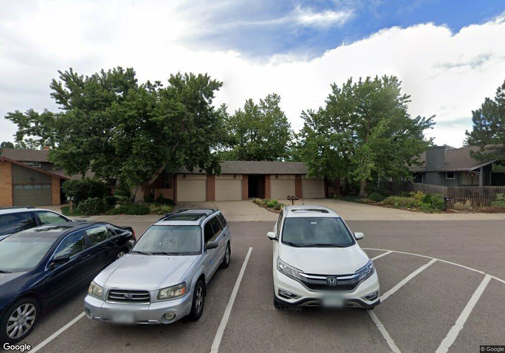
3891 Apache Ct W Unit D Boulder, CO 80303
Southeast Boulder NeighborhoodEstimated Value: $579,000 - $979,000
4
Beds
3
Baths
1,574
Sq Ft
$460/Sq Ft
Est. Value
About This Home
This home is located at 3891 Apache Ct W Unit D, Boulder, CO 80303 and is currently estimated at $723,835, approximately $459 per square foot. 3891 Apache Ct W Unit D is a home located in Boulder County with nearby schools including Eisenhower Elementary School, Manhattan Middle School of the Arts & Academics, and Fairview High School.
Ownership History
Date
Name
Owned For
Owner Type
Purchase Details
Closed on
Sep 30, 1999
Sold by
Shifflett David F
Bought by
Cooney Betty J
Current Estimated Value
Home Financials for this Owner
Home Financials are based on the most recent Mortgage that was taken out on this home.
Original Mortgage
$196,000
Outstanding Balance
$41,602
Interest Rate
3.85%
Estimated Equity
$682,233
Purchase Details
Closed on
Sep 25, 1997
Sold by
Lee Scamehorn H and Lee Rosslyn S
Bought by
Shifflett David F
Home Financials for this Owner
Home Financials are based on the most recent Mortgage that was taken out on this home.
Original Mortgage
$60,500
Interest Rate
7.48%
Purchase Details
Closed on
Dec 2, 1991
Bought by
Cooney Betty J
Create a Home Valuation Report for This Property
The Home Valuation Report is an in-depth analysis detailing your home's value as well as a comparison with similar homes in the area
Home Values in the Area
Average Home Value in this Area
Purchase History
| Date | Buyer | Sale Price | Title Company |
|---|---|---|---|
| Cooney Betty J | $245,000 | -- | |
| Shifflett David F | $209,500 | -- | |
| Cooney Betty J | $135,000 | -- |
Source: Public Records
Mortgage History
| Date | Status | Borrower | Loan Amount |
|---|---|---|---|
| Open | Cooney Betty J | $196,000 | |
| Previous Owner | Shifflett David F | $60,500 |
Source: Public Records
Tax History
| Year | Tax Paid | Tax Assessment Tax Assessment Total Assessment is a certain percentage of the fair market value that is determined by local assessors to be the total taxable value of land and additions on the property. | Land | Improvement |
|---|---|---|---|---|
| 2025 | $3,350 | $44,969 | -- | $44,969 |
| 2024 | $3,350 | $44,969 | -- | $44,969 |
| 2023 | $3,291 | $44,814 | -- | $48,499 |
| 2022 | $3,066 | $39,963 | $0 | $39,963 |
| 2021 | $3,539 | $41,113 | $0 | $41,113 |
| 2020 | $3,836 | $44,065 | $0 | $44,065 |
| 2019 | $3,777 | $44,065 | $0 | $44,065 |
| 2018 | $2,694 | $31,068 | $0 | $31,068 |
| 2017 | $2,609 | $41,981 | $0 | $41,981 |
| 2016 | $2,594 | $29,969 | $0 | $29,969 |
| 2015 | $2,457 | $25,671 | $0 | $25,671 |
| 2014 | $2,158 | $25,671 | $0 | $25,671 |
Source: Public Records
Map
Nearby Homes
- 3685 Chase Ct
- 3805 Martin Dr
- 3505 Moorhead Ave
- 4195 Chippewa Dr
- 265 S 39th St
- 4453 Hamilton Ct
- 4521 Navajo Place
- 4595 Moorhead Ave
- 405 S 43rd St
- 80 S 33rd St
- 375 S 40th St
- 345 S 38th St
- 230 Pawnee Dr
- 4475 Laguna Place Unit 206
- 4475 Laguna Place Unit 201
- 4415 Laguna Place Unit 201
- 770 36th St
- 4835 Moorhead Ave
- 4500 Baseline Rd Unit 1208
- 15 Pawnee Dr
- 3885 Apache Ct W Unit C
- 3881 Apache Ct W Unit B
- 3875 Apache Ct W Unit A
- 3861 Apache Ct W
- 3909 Apache Ct E
- 3905 Apache Ct E
- 3901 Apache Ct E
- 3901 Apache Ct E
- 3865 Apache Ct W
- 3915 Apache Ct E
- 3925 Apache Ct E
- 3801 Apache Ct W
- 3805 Apache Ct W
- 3815 Apache Ct W
- 3831 Apache Ct W
- 3825 Apache Ct W
- 3845 Apache Ct W Unit C
- 3851 Apache Ct W Unit B
- 3855 Apache Ct W Unit A
- 3851 Apache Ct W Unit W
Your Personal Tour Guide
Ask me questions while you tour the home.