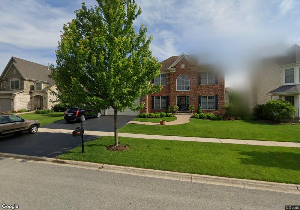
38W563 Berquist Dr Geneva, IL 60134
Southwest Geneva NeighborhoodEstimated Value: $695,769 - $761,000
4
Beds
3
Baths
3,275
Sq Ft
$223/Sq Ft
Est. Value
About This Home
This home is located at 38W563 Berquist Dr, Geneva, IL 60134 and is currently estimated at $729,590, approximately $222 per square foot. 38W563 Berquist Dr is a home located in Kane County with nearby schools including Heartland Elementary School, Geneva Community High School, and St. Peter School.
Ownership History
Date
Name
Owned For
Owner Type
Purchase Details
Closed on
Nov 7, 2011
Sold by
Sho Deen Inc
Bought by
Sofiak Richard M and Sofiak Sharon
Current Estimated Value
Home Financials for this Owner
Home Financials are based on the most recent Mortgage that was taken out on this home.
Original Mortgage
$364,000
Outstanding Balance
$248,213
Interest Rate
4.02%
Mortgage Type
New Conventional
Estimated Equity
$481,377
Create a Home Valuation Report for This Property
The Home Valuation Report is an in-depth analysis detailing your home's value as well as a comparison with similar homes in the area
Home Values in the Area
Average Home Value in this Area
Purchase History
| Date | Buyer | Sale Price | Title Company |
|---|---|---|---|
| Sofiak Richard M | $455,000 | Chicago Title Insurance Co |
Source: Public Records
Mortgage History
| Date | Status | Borrower | Loan Amount |
|---|---|---|---|
| Open | Sofiak Richard M | $364,000 |
Source: Public Records
Tax History Compared to Growth
Tax History
| Year | Tax Paid | Tax Assessment Tax Assessment Total Assessment is a certain percentage of the fair market value that is determined by local assessors to be the total taxable value of land and additions on the property. | Land | Improvement |
|---|---|---|---|---|
| 2024 | $15,471 | $199,130 | $44,780 | $154,350 |
| 2023 | $15,063 | $181,027 | $40,709 | $140,318 |
| 2022 | $14,384 | $168,210 | $37,827 | $130,383 |
| 2021 | $13,998 | $161,958 | $36,421 | $125,537 |
| 2020 | $13,716 | $159,486 | $35,865 | $123,621 |
| 2019 | $13,615 | $156,466 | $35,186 | $121,280 |
| 2018 | $14,326 | $164,689 | $35,186 | $129,503 |
| 2017 | $14,095 | $160,297 | $34,248 | $126,049 |
| 2016 | $14,010 | $158,130 | $33,785 | $124,345 |
| 2015 | -- | $150,342 | $32,121 | $118,221 |
| 2014 | -- | $139,898 | $32,121 | $107,777 |
| 2013 | -- | $139,898 | $32,121 | $107,777 |
Source: Public Records
Map
Nearby Homes
- 38W335 Killey Ln
- N288 Armstrong Ln
- N289 Hilts Dr
- 0N401 Taylor Dr
- 948 Bluestem Dr
- 823 Sunflower Dr
- 0N553 Armstrong Ln
- 0N776 W Curtis Square
- 3459 Wild Prairie Ln
- 39W380 Armstrong Ln
- 715 Samantha Cir
- 0N404 N Mill Creek Dr
- 39W644 Harvey Square
- 2927 Caldwell Ln Unit 2
- Abigail Ranch Plan at Mill Creek North - Mill Creek
- The Northstar Ranch Plan at Mill Creek North - Mill Creek
- Carrington Plan at Mill Creek North - Mill Creek
- Chickory Plan at Mill Creek North - Mill Creek
- Blue Stem Plan at Mill Creek North - Mill Creek
- 2827 Caldwell Ln Unit 2
- 38W543 Berquist Dr
- 38W583 Berquist Dr
- 38W582 Mcquire Place
- 38W562 Mcquire Place
- 38W533 Berquist Dr
- 38W533 Berquist Dr
- 38W603 Berquist Dr
- 38W602 Mcquire Place
- 38W558 Berquist Dr
- 38W538 Berquist Dr
- 38W598 Berquist Dr
- 38W578 Berquist Dr
- 38w Berquist Dr
- 38W513 Berquist Dr
- 38W569 Mcquire Place
- 38W512 Mcquire Place
- 38W589 Mcquire Place
- 38W559 Mcquire Place
- 38W539 Mcquire Place
- 38W599 Mcquire Place