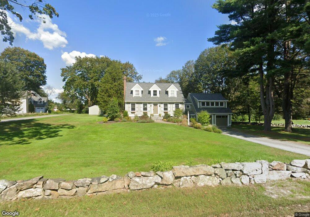
39 High Plain Rd Andover, MA 01810
West Andover NeighborhoodEstimated Value: $857,000 - $1,000,000
3
Beds
2
Baths
2,418
Sq Ft
$374/Sq Ft
Est. Value
About This Home
This home is located at 39 High Plain Rd, Andover, MA 01810 and is currently estimated at $905,127, approximately $374 per square foot. 39 High Plain Rd is a home located in Essex County with nearby schools including West Elementary School, Andover West Middle School, and Andover High School.
Ownership History
Date
Name
Owned For
Owner Type
Purchase Details
Closed on
Dec 4, 2025
Sold by
Gibson Scott M and Gibson Jo A
Bought by
Gibson Ft and Gibson
Current Estimated Value
Purchase Details
Closed on
Jan 24, 2013
Sold by
Welch Gerard E
Bought by
Carolina Props Llc
Purchase Details
Closed on
Dec 21, 2012
Sold by
Gibson Scott M and Gibson Jo A
Bought by
Welch Gerard E
Purchase Details
Closed on
Feb 18, 2005
Sold by
Gibson Scott M and Iarrobino Jo Anne
Bought by
Gibson Scott M and Gibson Jo Anne
Purchase Details
Closed on
Oct 13, 1993
Sold by
Cahill Virginia
Bought by
Gibson Scott M
Create a Home Valuation Report for This Property
The Home Valuation Report is an in-depth analysis detailing your home's value as well as a comparison with similar homes in the area
Home Values in the Area
Average Home Value in this Area
Purchase History
| Date | Buyer | Sale Price | Title Company |
|---|---|---|---|
| Gibson Ft | -- | -- | |
| Carolina Props Llc | -- | -- | |
| Carolina Props Llc | -- | -- | |
| Welch Gerard E | $300,000 | -- | |
| Gibson Scott M | -- | -- | |
| Gibson Scott M | -- | -- | |
| Gibson Scott M | $158,000 | -- | |
| Gibson Scott M | $158,000 | -- |
Source: Public Records
Mortgage History
| Date | Status | Borrower | Loan Amount |
|---|---|---|---|
| Previous Owner | Gibson Scott M | $289,000 |
Source: Public Records
Tax History
| Year | Tax Paid | Tax Assessment Tax Assessment Total Assessment is a certain percentage of the fair market value that is determined by local assessors to be the total taxable value of land and additions on the property. | Land | Improvement |
|---|---|---|---|---|
| 2024 | $9,878 | $766,900 | $409,100 | $357,800 |
| 2023 | $8,830 | $646,400 | $368,500 | $277,900 |
| 2022 | $8,415 | $576,400 | $326,200 | $250,200 |
| 2021 | $7,801 | $510,200 | $296,600 | $213,600 |
| 2020 | $7,514 | $500,600 | $289,500 | $211,100 |
| 2019 | $7,305 | $478,400 | $272,900 | $205,500 |
| 2018 | $6,977 | $446,100 | $257,500 | $188,600 |
| 2017 | $6,717 | $442,500 | $252,400 | $190,100 |
| 2016 | $6,301 | $425,200 | $236,200 | $189,000 |
| 2015 | $6,066 | $405,200 | $227,100 | $178,100 |
Source: Public Records
Map
Nearby Homes
- 31 Crenshaw Ln Unit 31
- 37 Crenshaw Ln Unit 37
- 20 Robert Dr Unit 20
- 54 Birch Rd
- 40 Chandler Cir
- 25 Clubview Dr Unit 25
- 22 Bobby Jones Dr
- 6 Exeter Way
- 241 Lowell St Unit 3
- 3 Caileigh Ct
- 21 Clubview Dr Unit 21
- 58 Chandler Rd
- 53 Martingale Ln
- 34 Martingale Ln Unit 34
- 10 Dartmouth Rd
- 29 Westchester Dr
- 4 Weeping Willow Dr
- 5 Weeping Willow Dr
- 2 Weeping Willow Dr
- 11 Cuba St
- 43 High Plain Rd Unit 2
- 43 High Plain Rd
- 52 Beacon St
- 47 High Plain Rd
- 33 High Plain Rd
- 33 High Plain Rd Unit 33
- 48 Beacon St
- 53 High Plain Rd
- 44 High Plain Rd
- 44 Beacon St
- 36 High Plain Rd
- 27 High Plain Rd
- 40 Beacon St
- 32 High Plain Rd
- 32 High Plain Rd
- 57 High Plain Rd
- 54 High Plain Rd
- 21 High Plain Rd
- 26 High Plain Rd
- 36 Beacon St
Your Personal Tour Guide
Ask me questions while you tour the home.