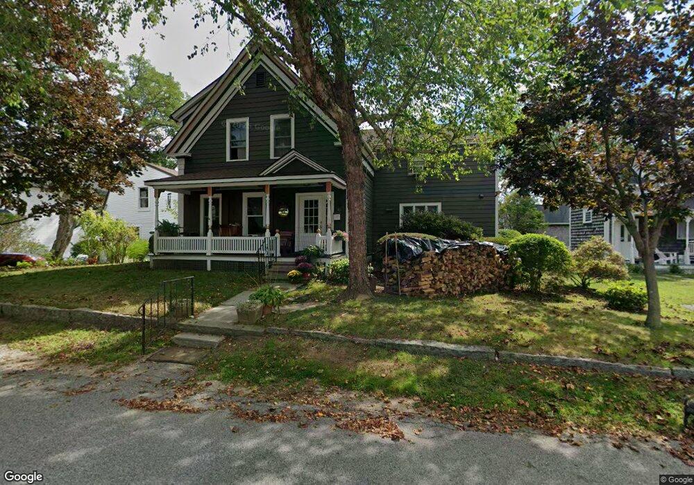
39 High St Gloucester, MA 01930
Estimated Value: $728,000 - $1,007,133
5
Beds
4
Baths
3,271
Sq Ft
$270/Sq Ft
Est. Value
About This Home
This home is located at 39 High St, Gloucester, MA 01930 and is currently estimated at $882,283, approximately $269 per square foot. 39 High St is a home located in Essex County with nearby schools including Plum Cove School, Ralph B O'maley Middle School, and Gloucester High School.
Ownership History
Date
Name
Owned For
Owner Type
Purchase Details
Closed on
Sep 10, 2025
Sold by
Nadel Kirsten P and Nadel Lee
Bought by
Nadel Ft and Nadel
Current Estimated Value
Purchase Details
Closed on
Jun 1, 2001
Sold by
Wonson Peter G and Wonson Nancy E
Bought by
Nadel Lee and Nadel Pia
Create a Home Valuation Report for This Property
The Home Valuation Report is an in-depth analysis detailing your home's value as well as a comparison with similar homes in the area
Purchase History
| Date | Buyer | Sale Price | Title Company |
|---|---|---|---|
| Nadel Ft | -- | -- | |
| Nadel Lee | $380,000 | -- |
Source: Public Records
Mortgage History
| Date | Status | Borrower | Loan Amount |
|---|---|---|---|
| Previous Owner | Nadel Lee | $260,274 | |
| Previous Owner | Nadel Lee | $150,000 |
Source: Public Records
Tax History
| Year | Tax Paid | Tax Assessment Tax Assessment Total Assessment is a certain percentage of the fair market value that is determined by local assessors to be the total taxable value of land and additions on the property. | Land | Improvement |
|---|---|---|---|---|
| 2025 | $7,869 | $809,600 | $270,500 | $539,100 |
| 2024 | $7,752 | $796,700 | $257,600 | $539,100 |
| 2023 | $8,227 | $776,900 | $230,100 | $546,800 |
| 2022 | $7,418 | $632,400 | $195,600 | $436,800 |
| 2021 | $7,169 | $576,300 | $177,800 | $398,500 |
| 2020 | $6,822 | $553,300 | $177,800 | $375,500 |
| 2019 | $6,405 | $504,700 | $177,800 | $326,900 |
| 2018 | $6,029 | $466,300 | $177,800 | $288,500 |
| 2017 | $5,768 | $437,300 | $169,300 | $268,000 |
| 2016 | $5,550 | $407,800 | $169,800 | $238,000 |
| 2015 | $5,464 | $400,300 | $169,800 | $230,500 |
Source: Public Records
Map
Nearby Homes
- 43 High St Unit B
- 9 Hickory St
- 1030 Washington St
- 7 Colburn St
- 4 Ciaramitaro Ct
- 136 Leonard St
- 14 1/2 Story St Unit B
- 94 Phillips Ave
- 13 Phillips Ave
- 165 Granite St
- 33 Quarry Ridge Ln Unit 33
- 32 Haven Ave
- 5 Boulder Top
- 3 Vine Ave
- 13 Rowe Point
- 672 Washington St
- 5 Smith St Unit R
- 15 Beach St
- 1 Charte Ct
- 20 Main St Unit 12
Your Personal Tour Guide
Ask me questions while you tour the home.