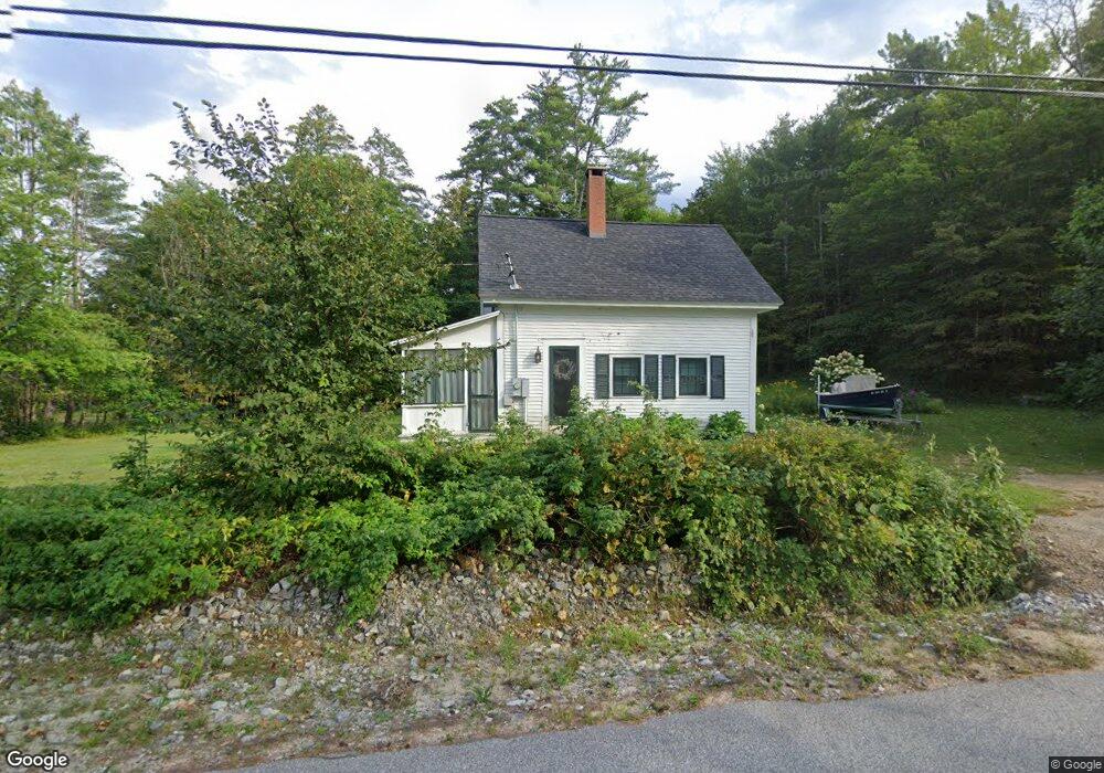
39 Hobart Hill Rd Hebron, NH 03241
Estimated Value: $452,000 - $582,000
3
Beds
1
Bath
1,231
Sq Ft
$412/Sq Ft
Est. Value
About This Home
This home is located at 39 Hobart Hill Rd, Hebron, NH 03241 and is currently estimated at $507,728, approximately $412 per square foot. 39 Hobart Hill Rd is a home located in Grafton County with nearby schools including Bridgewater-Hebron Village School.
Ownership History
Date
Name
Owned For
Owner Type
Purchase Details
Closed on
Feb 1, 2010
Sold by
Deyoung Robert C
Bought by
Sullivan Christopher J and Sullivan Nicole M
Current Estimated Value
Home Financials for this Owner
Home Financials are based on the most recent Mortgage that was taken out on this home.
Original Mortgage
$174,800
Outstanding Balance
$115,224
Interest Rate
4.95%
Mortgage Type
Purchase Money Mortgage
Estimated Equity
$392,504
Create a Home Valuation Report for This Property
The Home Valuation Report is an in-depth analysis detailing your home's value as well as a comparison with similar homes in the area
Home Values in the Area
Average Home Value in this Area
Purchase History
| Date | Buyer | Sale Price | Title Company |
|---|---|---|---|
| Sullivan Christopher J | $122,900 | -- |
Source: Public Records
Mortgage History
| Date | Status | Borrower | Loan Amount |
|---|---|---|---|
| Open | Sullivan Christopher J | $174,800 |
Source: Public Records
Tax History Compared to Growth
Tax History
| Year | Tax Paid | Tax Assessment Tax Assessment Total Assessment is a certain percentage of the fair market value that is determined by local assessors to be the total taxable value of land and additions on the property. | Land | Improvement |
|---|---|---|---|---|
| 2024 | $1,896 | $271,200 | $87,600 | $183,600 |
| 2023 | $1,732 | $271,500 | $87,600 | $183,900 |
| 2022 | $1,854 | $271,500 | $87,600 | $183,900 |
| 2021 | $1,770 | $271,500 | $87,600 | $183,900 |
| 2020 | $1,910 | $199,000 | $71,600 | $127,400 |
| 2019 | $1,928 | $199,000 | $71,600 | $127,400 |
| 2018 | $2,111 | $199,000 | $71,600 | $127,400 |
| 2017 | $1,898 | $199,000 | $71,600 | $127,400 |
| 2016 | $1,656 | $199,000 | $71,600 | $127,400 |
| 2015 | $1,606 | $201,700 | $73,000 | $128,700 |
| 2014 | $1,650 | $201,700 | $73,000 | $128,700 |
| 2013 | $1,624 | $201,700 | $73,000 | $128,700 |
Source: Public Records
Map
Nearby Homes
- 0 Skyline Dr Unit 19
- Lot 26 Skyline Dr
- 10 Merrill Rd
- 497 W Shore Rd
- 00 Ledgewood Cir Unit 7
- 4 Birchwood Dr Unit A
- 431 George Rd
- 341 Perkins Hill Rd
- 301 Perkins Hill Rd
- 1678 Fowler River Rd
- 582 N Groton Rd
- 33 Winterberry Ln
- 613 Mayhew Turnpike Unit 227-024 & 227-023
- 125 Verrill Rd
- 40 Adams Rd
- 715 N Groton Rd
- 76 Davis Rd Unit 3
- 862 Mayhew Turnpike Unit 1
- 383 Wulamat Rd
- 171 Bell Rd
- 47 Hobart Hill Rd
- 46 Hobart Hill Rd
- 51 Hobart Hill Rd
- 19 Hobart Hill Rd
- 19 Hobart Hill Rd Unit 19-1
- 23 Hobart Hill Rd
- 42 Hobart Hill Rd
- 48 Hobart Hill Rd
- 67 Hobart Hill Rd
- 24 W Shore Rd
- 32 W Shore Rd
- 5 Pine Top Rd
- 6 Hobart Hill Rd
- 7 Groton Rd
- 23 W Shore Rd
- 0 W Shore Rd
- 000 W Shore Rd
- 0 W Shore Rd Unit 4007169
- 0 W Shore Rd Unit 4051109
- 34 W Shore Rd