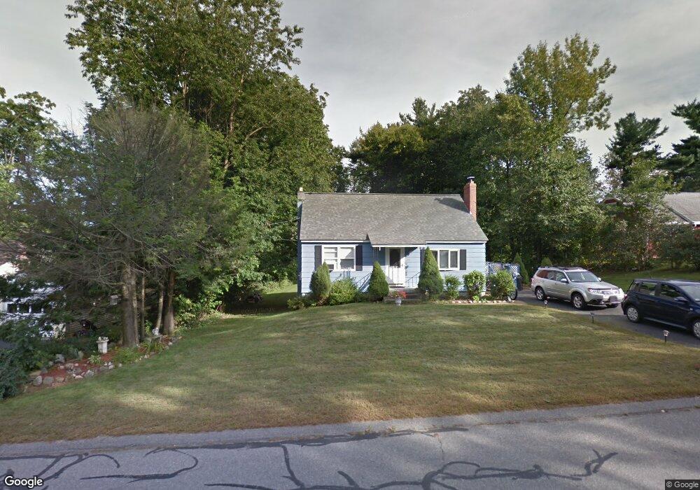
39 N Common Rd Westminster, MA 01473
Estimated Value: $408,775 - $479,000
3
Beds
2
Baths
1,326
Sq Ft
$336/Sq Ft
Est. Value
About This Home
This home is located at 39 N Common Rd, Westminster, MA 01473 and is currently estimated at $446,194, approximately $336 per square foot. 39 N Common Rd is a home located in Worcester County with nearby schools including Oakmont Regional High School and Wachusett Hills Christian School.
Ownership History
Date
Name
Owned For
Owner Type
Purchase Details
Closed on
Apr 12, 2024
Sold by
Leonard Ronald J
Bought by
Leonard Ronald J and Leonard Patricia E
Current Estimated Value
Purchase Details
Closed on
Oct 8, 2004
Sold by
Ruffino Bradley J and Ruffino Cheryl A
Bought by
Leonard Ronald J
Home Financials for this Owner
Home Financials are based on the most recent Mortgage that was taken out on this home.
Original Mortgage
$188,000
Interest Rate
5.84%
Mortgage Type
Purchase Money Mortgage
Purchase Details
Closed on
Oct 22, 1999
Sold by
Gullage Ronald J and Gullage Donna L
Bought by
Okerman Cheryl A
Purchase Details
Closed on
Sep 25, 1987
Sold by
Adams Ruthanne A
Bought by
Gullage Ronald J
Create a Home Valuation Report for This Property
The Home Valuation Report is an in-depth analysis detailing your home's value as well as a comparison with similar homes in the area
Home Values in the Area
Average Home Value in this Area
Purchase History
| Date | Buyer | Sale Price | Title Company |
|---|---|---|---|
| Leonard Ronald J | -- | None Available | |
| Leonard Ronald J | -- | None Available | |
| Leonard Ronald J | $235,000 | -- | |
| Leonard Ronald J | $235,000 | -- | |
| Okerman Cheryl A | $149,000 | -- | |
| Okerman Cheryl A | $149,000 | -- | |
| Gullage Ronald J | $126,900 | -- |
Source: Public Records
Mortgage History
| Date | Status | Borrower | Loan Amount |
|---|---|---|---|
| Previous Owner | Leonard Ronald J | $188,000 | |
| Previous Owner | Gullage Ronald J | $35,000 |
Source: Public Records
Tax History
| Year | Tax Paid | Tax Assessment Tax Assessment Total Assessment is a certain percentage of the fair market value that is determined by local assessors to be the total taxable value of land and additions on the property. | Land | Improvement |
|---|---|---|---|---|
| 2025 | $3,833 | $311,600 | $115,100 | $196,500 |
| 2024 | $3,689 | $300,900 | $115,100 | $185,800 |
| 2023 | $3,687 | $282,300 | $107,600 | $174,700 |
| 2022 | $3,595 | $227,500 | $93,500 | $134,000 |
| 2021 | $3,443 | $205,400 | $78,400 | $127,000 |
| 2020 | $21,095 | $191,200 | $71,200 | $120,000 |
| 2019 | $3,261 | $178,700 | $58,700 | $120,000 |
| 2018 | $19,337 | $167,000 | $58,700 | $108,300 |
| 2017 | $19,043 | $164,700 | $58,700 | $106,000 |
| 2016 | $2,890 | $153,900 | $49,000 | $104,900 |
| 2015 | $3,051 | $161,000 | $49,000 | $112,000 |
| 2014 | $3,056 | $161,000 | $49,000 | $112,000 |
Source: Public Records
Map
Nearby Homes
- 0 Syd Smith Rd Unit 73395578
- 0 Syd Smith Rd (Rear)
- 0 Syd Smith Rd Map 71 Lot 4-2
- 0
- 2 Roberts Way
- 2 Seaver St
- 17 Leominster St
- 0 Worcester Rd Unit 73326124
- 170 N Common Rd
- 100A W Main St
- 29 Dawley Rd
- 9 Knower Rd
- 38 Knower Rd
- Lot 0 Narrows Rd
- 2 Taymax Rd
- 6 Shady Ave
- 29 Sunset Rd
- Lot 3 Sunset Rd
- Lot 5 Sunset Rd
- 97 Worcester Rd
- 41 N Common Rd
- 37 N Common Rd
- 40 N Common Rd
- 42 N Common Rd
- 35 N Common Rd
- 38 N Common Rd
- 44 N Common Rd
- 45 N Common Rd
- 46 N Common Rd
- 34 N Common Rd
- 33 N Common Rd
- 33 N Common Rd
- 51 N Common Rd
- 50 N Common Rd
- 0 Livermore Hill Unit 70689771
- Lot 19A Tommy Francis
- L1-6 Pierce Rd and Bragg Hill Rd
- Lot28 Old Mill Cir Unit Townsend
- 32 N Common Rd
- 52 N Common Rd
Your Personal Tour Guide
Ask me questions while you tour the home.