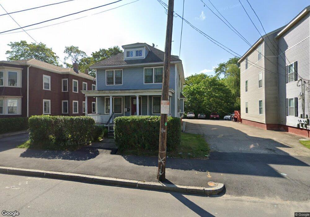
39 Stafford St Worcester, MA 01603
Webster Square NeighborhoodEstimated Value: $464,150 - $516,000
5
Beds
2
Baths
2,328
Sq Ft
$213/Sq Ft
Est. Value
About This Home
This home is located at 39 Stafford St, Worcester, MA 01603 and is currently estimated at $495,788, approximately $212 per square foot. 39 Stafford St is a home located in Worcester County with nearby schools including Gates Lane, Jacob Hiatt Magnet School, and Chandler Magnet.
Ownership History
Date
Name
Owned For
Owner Type
Purchase Details
Closed on
May 29, 2007
Sold by
Novastar Mortgage Inc
Bought by
Devos Rt
Current Estimated Value
Purchase Details
Closed on
Aug 7, 2006
Sold by
Novastar Mortgage Inc
Bought by
Novastar Mtg Inc
Purchase Details
Closed on
Jul 23, 1997
Sold by
Israel Leonard
Bought by
Koomson Frederick
Home Financials for this Owner
Home Financials are based on the most recent Mortgage that was taken out on this home.
Original Mortgage
$60,000
Interest Rate
7.7%
Mortgage Type
Purchase Money Mortgage
Create a Home Valuation Report for This Property
The Home Valuation Report is an in-depth analysis detailing your home's value as well as a comparison with similar homes in the area
Home Values in the Area
Average Home Value in this Area
Purchase History
| Date | Buyer | Sale Price | Title Company |
|---|---|---|---|
| Devos Rt | $135,000 | -- | |
| Novastar Mtg Inc | $207,113 | -- | |
| Koomson Frederick | $80,000 | -- |
Source: Public Records
Mortgage History
| Date | Status | Borrower | Loan Amount |
|---|---|---|---|
| Previous Owner | Koomson Frederick | $126,000 | |
| Previous Owner | Koomson Frederick | $88,000 | |
| Previous Owner | Koomson Frederick | $60,000 |
Source: Public Records
Tax History Compared to Growth
Tax History
| Year | Tax Paid | Tax Assessment Tax Assessment Total Assessment is a certain percentage of the fair market value that is determined by local assessors to be the total taxable value of land and additions on the property. | Land | Improvement |
|---|---|---|---|---|
| 2025 | $5,850 | $443,500 | $94,600 | $348,900 |
| 2024 | $5,537 | $402,700 | $94,600 | $308,100 |
| 2023 | $5,359 | $373,700 | $82,300 | $291,400 |
| 2022 | $4,983 | $327,600 | $65,800 | $261,800 |
| 2021 | $5,188 | $318,700 | $52,700 | $266,000 |
| 2020 | $4,901 | $288,300 | $52,300 | $236,000 |
| 2019 | $4,684 | $260,200 | $45,600 | $214,600 |
| 2018 | $4,623 | $244,500 | $45,600 | $198,900 |
| 2017 | $4,382 | $228,000 | $45,600 | $182,400 |
| 2016 | $4,470 | $216,900 | $32,700 | $184,200 |
| 2015 | $4,353 | $216,900 | $32,700 | $184,200 |
| 2014 | $4,238 | $216,900 | $32,700 | $184,200 |
Source: Public Records
Map
Nearby Homes
- 3 Arbor Vitae St
- 23 Lakewood St
- 28 Baker St
- 40 Lakewood St
- 114 Henshaw St
- 170 Stafford St
- 68 Crest Cir
- 21 Hitchcock Rd
- 12 Stoneland Rd
- 5 Stoneland Rd
- 35 Genessee St Unit I
- 1022 Main St
- 19 Monticello Dr
- 24 Meena Dr
- 141 Cambridge St
- 45 Wildwood Ave
- 21 Healy Rd
- 53 James St
- 5 Freeland Terrace
- 21 Clement St
- 37 Stafford St
- 41 Stafford St
- 41 Stafford St Unit 3
- 41 Stafford St Unit 2
- 41 Stafford St Unit 2
- 43 Stafford St
- 35 Stafford St
- 47 Stafford St
- 44 Stafford St
- 44 Stafford St Unit 1
- 42 Stafford St
- 51 Stafford St
- 55 Stafford St
- 7 Young St
- 57 Stafford St
- 54 Stafford St
- 73 Illinois St Unit G1
- 10 Young St
- 59 Stafford St
- 1205 Main St