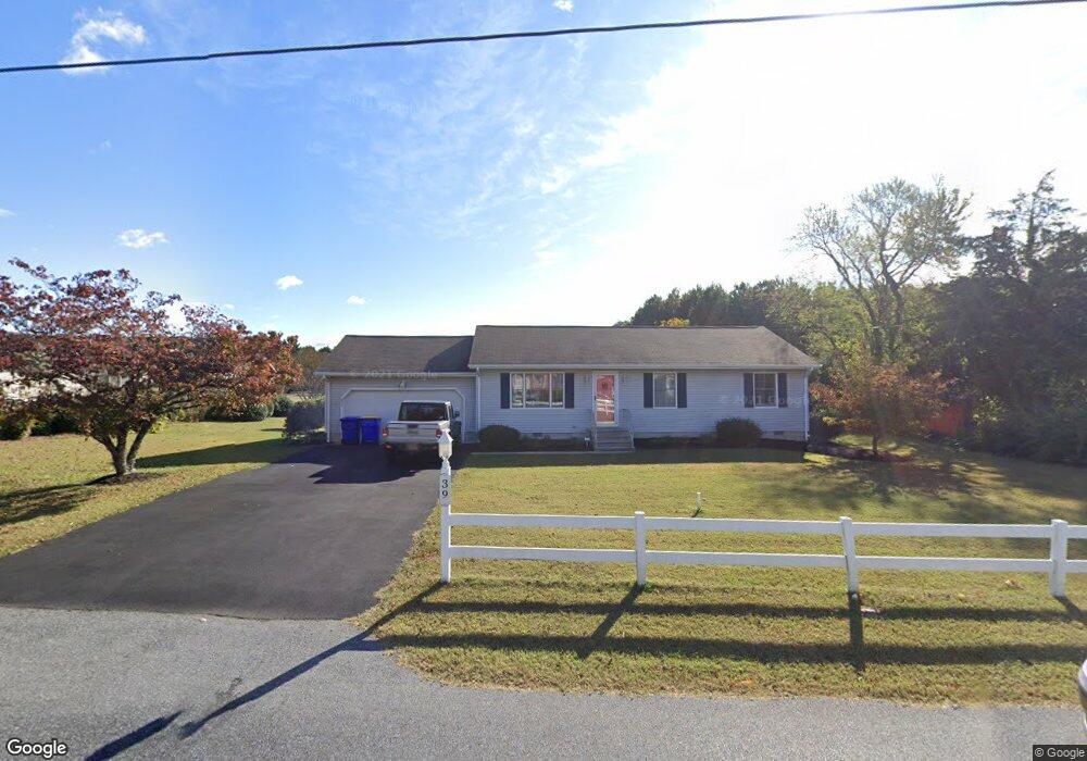
39 West Ave Ocean View, DE 19970
Estimated Value: $388,000 - $471,000
2
Beds
--
Bath
1,232
Sq Ft
$337/Sq Ft
Est. Value
About This Home
This home is located at 39 West Ave, Ocean View, DE 19970 and is currently estimated at $415,294, approximately $337 per square foot. 39 West Ave is a home with nearby schools including Lord Baltimore Elementary School, Selbyville Middle School, and Indian River High School.
Ownership History
Date
Name
Owned For
Owner Type
Purchase Details
Closed on
Dec 9, 2020
Sold by
Ward Patricia
Bought by
Dougherty Joell C
Current Estimated Value
Home Financials for this Owner
Home Financials are based on the most recent Mortgage that was taken out on this home.
Original Mortgage
$252,200
Outstanding Balance
$226,231
Interest Rate
2.8%
Mortgage Type
New Conventional
Estimated Equity
$189,063
Purchase Details
Closed on
Dec 7, 2020
Sold by
Ward Robert J and Ward Patricia
Bought by
Ward Patricia
Home Financials for this Owner
Home Financials are based on the most recent Mortgage that was taken out on this home.
Original Mortgage
$252,200
Outstanding Balance
$226,231
Interest Rate
2.8%
Mortgage Type
New Conventional
Estimated Equity
$189,063
Purchase Details
Closed on
Aug 4, 1983
Bought by
Ward Eleanor M
Create a Home Valuation Report for This Property
The Home Valuation Report is an in-depth analysis detailing your home's value as well as a comparison with similar homes in the area
Home Values in the Area
Average Home Value in this Area
Purchase History
| Date | Buyer | Sale Price | Title Company |
|---|---|---|---|
| Dougherty Joell C | -- | None Available | |
| Ward Patricia | -- | None Available | |
| Ward Eleanor M | $14,000 | -- |
Source: Public Records
Mortgage History
| Date | Status | Borrower | Loan Amount |
|---|---|---|---|
| Open | Dougherty Joell C | $252,200 |
Source: Public Records
Tax History
| Year | Tax Paid | Tax Assessment Tax Assessment Total Assessment is a certain percentage of the fair market value that is determined by local assessors to be the total taxable value of land and additions on the property. | Land | Improvement |
|---|---|---|---|---|
| 2025 | $840 | $15,500 | $2,500 | $13,000 |
| 2024 | $653 | $15,500 | $2,500 | $13,000 |
| 2023 | $652 | $15,500 | $2,500 | $13,000 |
| 2022 | $642 | $15,500 | $2,500 | $13,000 |
| 2021 | $623 | $15,500 | $2,500 | $13,000 |
| 2020 | $583 | $15,500 | $2,500 | $13,000 |
| 2019 | $948 | $15,500 | $2,500 | $13,000 |
| 2018 | $954 | $15,500 | $0 | $0 |
| 2017 | $959 | $15,500 | $0 | $0 |
| 2016 | $889 | $15,500 | $0 | $0 |
| 2015 | $905 | $15,500 | $0 | $0 |
| 2014 | $897 | $15,500 | $0 | $0 |
Source: Public Records
Map
Nearby Homes
- 36047 Jackson St
- 36032 Jackson St
- 36022 Jackson St
- 15 West Ave
- 21 Central Ave
- 4 Jordyn Ct
- 34 Woodland Ave
- 263 Oyster Shell Cove
- 43 Stingray Harbor Dr
- 236 Oyster Shell Cove
- 18 Ocean Mist Dr
- 10 Mitchell Ave
- 13 Johnsons Glade Ln
- 38 Hudson Ave
- 380 Scranton
- 880 Garfield Pkwy Unit B
- 11 Jodi Ct
- 670 Bethany Loop
- 305 Drake
- 2 Assawoman Ave
- 37 West Ave
- 41 West Ave
- 42 West Ave
- 44 West Ave
- 45 West Ave
- 20 Osprey Ln
- 18 Osprey Ln
- 47 West Ave
- 4 Oakwood Ave
- 3 Stingray Harbor Dr Unit 2
- 3 Stingray Harbor Dr
- 33 West Ave
- 5 Stingray Harbor Dr Unit 3
- 5 Stingray Harbor Dr
- 48 West Ave
- 26 Osprey Ln
- 50 West Ave
- 7 Stingray Harbor Dr Unit 4
- 7 Stingray Harbor Dr
- 16 Osprey Ln
Your Personal Tour Guide
Ask me questions while you tour the home.