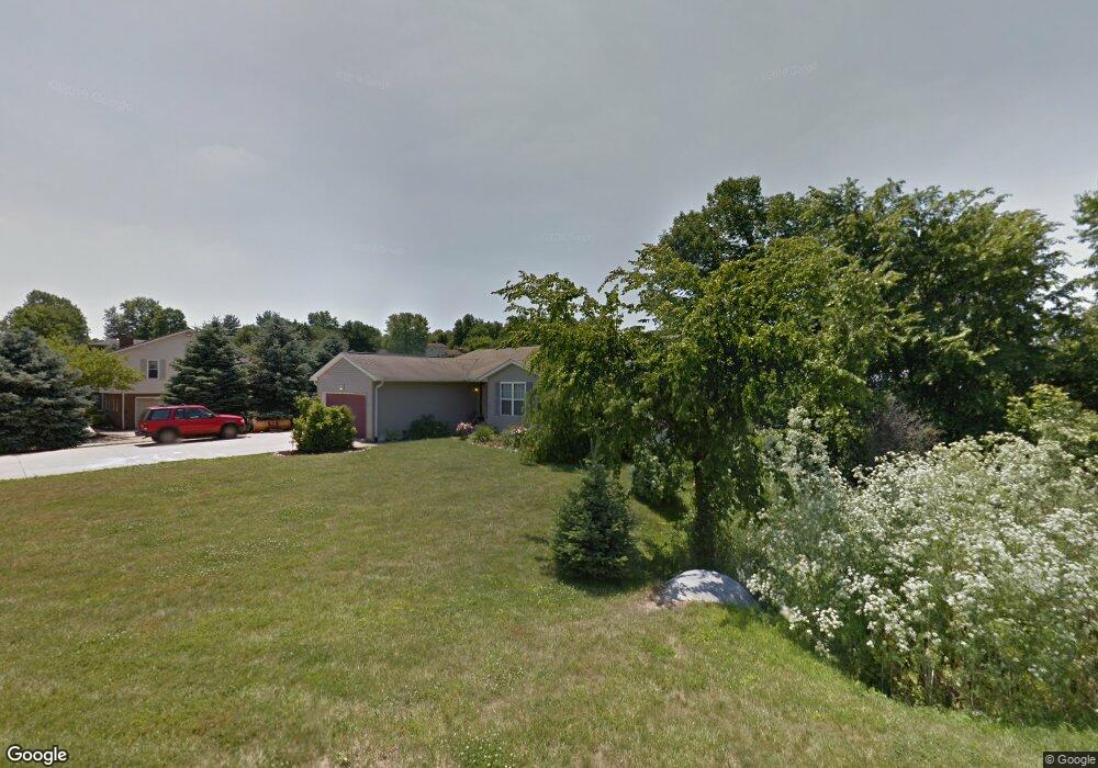
390 Maple Ln Mansfield, OH 44906
Estimated Value: $239,000 - $275,000
3
Beds
2
Baths
1,762
Sq Ft
$148/Sq Ft
Est. Value
About This Home
This home is located at 390 Maple Ln, Mansfield, OH 44906 and is currently estimated at $260,632, approximately $147 per square foot. 390 Maple Ln is a home located in Richland County with nearby schools including Stingel Elementary School, Ontario Middle School, and Ontario High School.
Ownership History
Date
Name
Owned For
Owner Type
Purchase Details
Closed on
Feb 25, 2021
Sold by
Bise Jeremy Lee and Bise Ann Marie
Bought by
Bise Jeremy Lee
Current Estimated Value
Home Financials for this Owner
Home Financials are based on the most recent Mortgage that was taken out on this home.
Original Mortgage
$140,600
Interest Rate
2.9%
Mortgage Type
New Conventional
Purchase Details
Closed on
Sep 10, 1998
Sold by
Hunter Richard N
Bought by
Phalor Michael E and Phalor Sherrie L
Create a Home Valuation Report for This Property
The Home Valuation Report is an in-depth analysis detailing your home's value as well as a comparison with similar homes in the area
Home Values in the Area
Average Home Value in this Area
Purchase History
| Date | Buyer | Sale Price | Title Company |
|---|---|---|---|
| Bise Jeremy Lee | -- | None Available | |
| Phalor Michael E | $7,000 | -- |
Source: Public Records
Mortgage History
| Date | Status | Borrower | Loan Amount |
|---|---|---|---|
| Previous Owner | Bise Jeremy Lee | $140,600 |
Source: Public Records
Tax History
| Year | Tax Paid | Tax Assessment Tax Assessment Total Assessment is a certain percentage of the fair market value that is determined by local assessors to be the total taxable value of land and additions on the property. | Land | Improvement |
|---|---|---|---|---|
| 2024 | $3,149 | $64,570 | $9,290 | $55,280 |
| 2023 | $3,220 | $64,570 | $9,290 | $55,280 |
| 2022 | $3,526 | $60,850 | $9,670 | $51,180 |
| 2021 | $3,533 | $60,850 | $9,670 | $51,180 |
| 2020 | $3,771 | $60,850 | $9,670 | $51,180 |
| 2019 | $4,459 | $51,900 | $8,200 | $43,700 |
| 2018 | $3,902 | $51,900 | $8,200 | $43,700 |
| 2017 | $3,878 | $51,900 | $8,200 | $43,700 |
| 2016 | $3,926 | $53,740 | $7,960 | $45,780 |
| 2015 | $3,891 | $53,740 | $7,960 | $45,780 |
| 2014 | $3,931 | $53,740 | $7,960 | $45,780 |
| 2012 | $1,865 | $55,390 | $8,200 | $47,190 |
Source: Public Records
Map
Nearby Homes
- 1706 Kenmore Dr
- 175 Maple Ln
- 78 S Home Rd
- 64 Maple Ln
- 43 Eleanor Ave
- 0 Millsboro Rd Unit 9067349
- 0 Millsboro Rd Unit 9066844
- 1277 Deer Run Rd
- 840 Home Rd S
- 1157 Deer Run Rd
- 1781 Alta West Rd
- 1861 August Dr
- 1068 Linwood Place
- 173 Brookwood Way N
- 2585 Deerfield Ln
- 216 S Trimble Rd Unit 218
- 244 S Trimble Rd Unit 246
- 232 S Trimble Rd Unit 234
- 960 W Linden Cir
- 125 Hilltop Rd