Estimated Value: $269,151 - $314,000
3
Beds
2
Baths
1,320
Sq Ft
$220/Sq Ft
Est. Value
About This Home
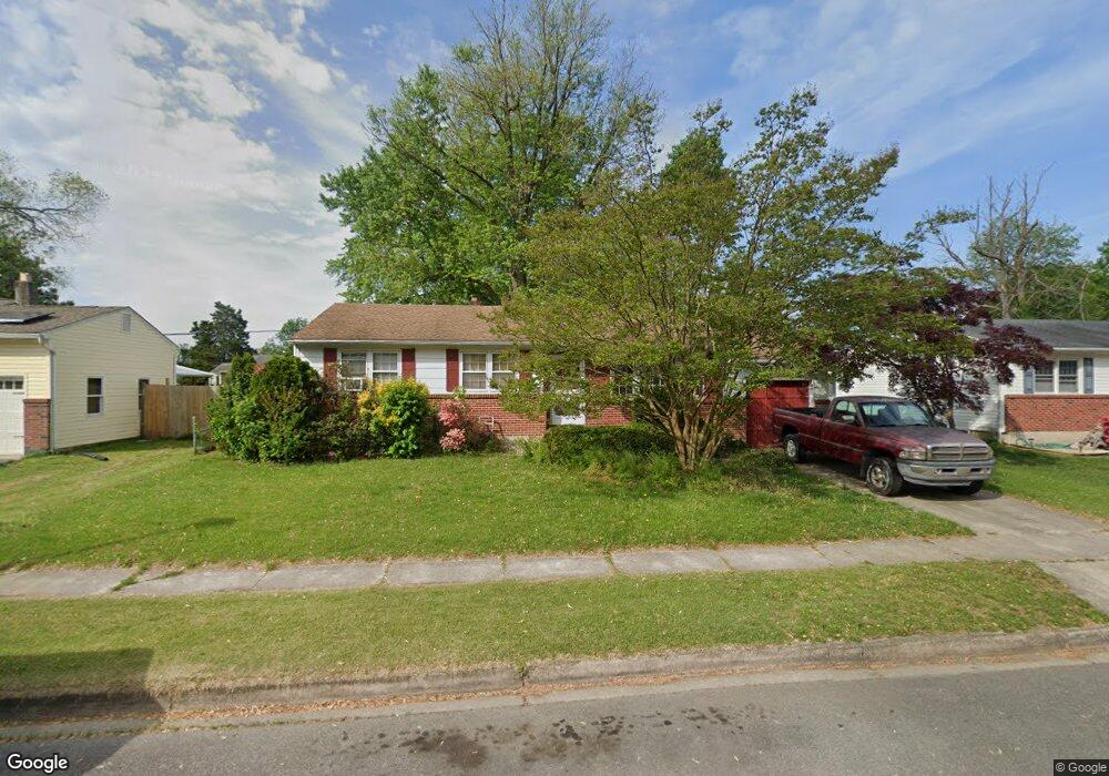
This home is located at 390 Nimitz Rd, Dover, DE 19901 and is currently estimated at $290,038, approximately $219 per square foot. 390 Nimitz Rd is a home located in Kent County with nearby schools including Towne Point Elementary School, William Henry Middle School, and Central Middle School.
Ownership History
Date
Name
Owned For
Owner Type
Purchase Details
Closed on
Nov 16, 2009
Sold by
Doll Roger C and Doll Jeannette K
Bought by
Hylton Wayne L and Salik Annastasia
Current Estimated Value
Home Financials for this Owner
Home Financials are based on the most recent Mortgage that was taken out on this home.
Original Mortgage
$149,458
Outstanding Balance
$96,889
Interest Rate
4.86%
Mortgage Type
VA
Estimated Equity
$193,149
Create a Home Valuation Report for This Property
The Home Valuation Report is an in-depth analysis detailing your home's value as well as a comparison with similar homes in the area
Home Values in the Area
Average Home Value in this Area
Purchase History
| Date | Buyer | Sale Price | Title Company |
|---|---|---|---|
| Hylton Wayne L | $155,000 | None Available |
Source: Public Records
Mortgage History
| Date | Status | Borrower | Loan Amount |
|---|---|---|---|
| Open | Hylton Wayne L | $149,458 |
Source: Public Records
Tax History
| Year | Tax Paid | Tax Assessment Tax Assessment Total Assessment is a certain percentage of the fair market value that is determined by local assessors to be the total taxable value of land and additions on the property. | Land | Improvement |
|---|---|---|---|---|
| 2025 | $1,424 | $242,300 | $91,000 | $151,300 |
| 2024 | $1,375 | $242,300 | $91,000 | $151,300 |
| 2023 | $1,024 | $34,800 | $9,600 | $25,200 |
| 2022 | $990 | $34,800 | $9,600 | $25,200 |
| 2021 | $954 | $34,800 | $9,600 | $25,200 |
| 2020 | $921 | $34,800 | $9,600 | $25,200 |
| 2019 | $871 | $34,800 | $9,600 | $25,200 |
| 2018 | $795 | $34,800 | $9,600 | $25,200 |
| 2017 | $782 | $34,800 | $0 | $0 |
| 2016 | $785 | $34,800 | $0 | $0 |
| 2015 | $784 | $34,800 | $0 | $0 |
| 2014 | $786 | $34,800 | $0 | $0 |
Source: Public Records
Map
Nearby Homes
- 959 Mcdowell Dr
- 348 W Wind Dr
- 40 Anchor Ln
- 1014 White Oak Rd
- 196 Willis Rd
- 108 N Halsey Rd
- 809 Bacon Ave
- 813 Bacon Ave
- 263 Tea Party Trail
- 33 Spruance Rd
- 71 Chatham Ct
- 630 Maple Pkwy
- 57 Chatham Ct
- 915 E Division St
- 139 Acorn Ln
- 920 E Division St
- 10 Loockerman Ct
- 125 Linden Ct
- 662 Vista Ave
- 668 Vista Ave
- 394 Nimitz Rd
- 388 Nimitz Rd
- 329 Macarthur Dr
- 333 Macarthur Dr
- 325 Macarthur Dr
- 382 Nimitz Rd
- 1432 Garfield Dr
- 393 Nimitz Rd
- 321 Macarthur Dr
- 385 Nimitz Rd
- 374 Nimitz Rd
- 381 Nimitz Rd
- 317 Macarthur Dr
- 399 Nimitz Rd
- 334 Macarthur Dr
- 338 Macarthur Dr
- 330 Macarthur Dr
- 373 Nimitz Rd
- 330 W Wind Dr
- 332 W Wind Dr
Your Personal Tour Guide
Ask me questions while you tour the home.