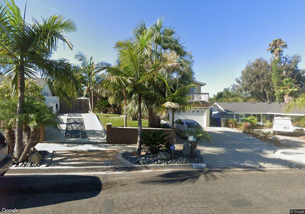
3901 Shenandoah Dr Oceanside, CA 92056
Mira Costa NeighborhoodEstimated Value: $844,000 - $934,927
4
Beds
2
Baths
1,598
Sq Ft
$553/Sq Ft
Est. Value
About This Home
This home is located at 3901 Shenandoah Dr, Oceanside, CA 92056 and is currently estimated at $883,482, approximately $552 per square foot. 3901 Shenandoah Dr is a home located in San Diego County with nearby schools including Christa McAuliffe Elementary School, Martin Luther King Jr. Middle School, and El Camino High School.
Ownership History
Date
Name
Owned For
Owner Type
Purchase Details
Closed on
Jul 24, 2024
Sold by
Vinyard Samantha Ann Hall and Hall Samantha Ann
Bought by
Hall Samantha Ann and Vinyard Elizabeth Marie
Current Estimated Value
Home Financials for this Owner
Home Financials are based on the most recent Mortgage that was taken out on this home.
Original Mortgage
$500,000
Outstanding Balance
$493,913
Interest Rate
6.89%
Mortgage Type
New Conventional
Estimated Equity
$389,569
Purchase Details
Closed on
Aug 15, 2014
Sold by
Vinyard Daniel and Vinyard Samantha
Bought by
Vinyard Samantha Ann Hall
Purchase Details
Closed on
Dec 23, 2002
Sold by
Vinyard Samantha
Bought by
Vinyard Daniel and Vinyard Samantha
Home Financials for this Owner
Home Financials are based on the most recent Mortgage that was taken out on this home.
Original Mortgage
$220,000
Interest Rate
7.62%
Purchase Details
Closed on
Nov 19, 1998
Sold by
Salsido Edward S
Bought by
Vinyard Samantha
Home Financials for this Owner
Home Financials are based on the most recent Mortgage that was taken out on this home.
Original Mortgage
$136,171
Interest Rate
6.82%
Mortgage Type
FHA
Purchase Details
Closed on
Jan 24, 1997
Sold by
Vinyard Daniel
Bought by
Vinyard Samantha
Home Financials for this Owner
Home Financials are based on the most recent Mortgage that was taken out on this home.
Original Mortgage
$138,037
Interest Rate
7.66%
Mortgage Type
FHA
Purchase Details
Closed on
Jan 17, 1997
Sold by
Duncan Laurie E and Singh Mohinder J
Bought by
Vinyard Samantha and Salsido Edward S
Home Financials for this Owner
Home Financials are based on the most recent Mortgage that was taken out on this home.
Original Mortgage
$138,037
Interest Rate
7.66%
Mortgage Type
FHA
Purchase Details
Closed on
May 1, 1991
Purchase Details
Closed on
Jul 3, 1989
Purchase Details
Closed on
Dec 7, 1983
Create a Home Valuation Report for This Property
The Home Valuation Report is an in-depth analysis detailing your home's value as well as a comparison with similar homes in the area
Home Values in the Area
Average Home Value in this Area
Purchase History
We collect this data history from publicly available records. To have your information removed, we recommend requesting removal directly through your county’s website.
| Date | Buyer | Sale Price | Title Company |
|---|---|---|---|
| Hall Samantha Ann | -- | Western Resources Title | |
| Vinyard Samantha Ann Hall | -- | None Available | |
| Vinyard Daniel | -- | Chicago Title Co | |
| Vinyard Samantha | -- | California Title Company | |
| Vinyard Samantha | -- | First American Title Co | |
| Vinyard Samantha | $140,000 | First American Title Co | |
| -- | $164,000 | -- | |
| -- | $150,000 | -- | |
| -- | $93,500 | -- |
Source: Public Records
Mortgage History
We collect this data history from publicly available records. To have your information removed, we recommend requesting removal directly through your county’s website.
| Date | Status | Borrower | Loan Amount |
|---|---|---|---|
| Open | Hall Samantha Ann | $500,000 | |
| Previous Owner | Vinyard Daniel | $220,000 | |
| Previous Owner | Vinyard Samantha | $136,171 | |
| Previous Owner | Vinyard Samantha | $138,037 |
Source: Public Records
Tax History
| Year | Tax Paid | Tax Assessment Tax Assessment Total Assessment is a certain percentage of the fair market value that is determined by local assessors to be the total taxable value of land and additions on the property. | Land | Improvement |
|---|---|---|---|---|
| 2025 | $3,019 | $267,122 | $71,659 | $195,463 |
| 2024 | $7,792 | $267,122 | $71,659 | $195,463 |
| 2023 | $7,699 | $261,885 | $70,254 | $191,631 |
| 2022 | $7,634 | $256,751 | $68,877 | $187,874 |
| 2021 | $7,644 | $251,718 | $67,527 | $184,191 |
| 2020 | $7,556 | $249,138 | $66,835 | $182,303 |
| 2019 | $7,476 | $244,254 | $65,525 | $178,729 |
| 2018 | $7,446 | $239,466 | $64,241 | $175,225 |
| 2017 | $7,397 | $234,772 | $62,982 | $171,790 |
| 2016 | $7,311 | $230,170 | $61,748 | $168,422 |
| 2015 | $2,426 | $226,714 | $60,821 | $165,893 |
| 2014 | $2,332 | $222,274 | $59,630 | $162,644 |
Source: Public Records
Map
Nearby Homes
- 3927 Bedford Ave
- 2801 College Blvd
- 4062 Lewis St
- 4079 Wooster Dr
- 2858 Lehigh Ct
- 3164 Carr Dr
- 3023 Linda Dr
- 3027 Linda Dr
- 2846 Cedar Rd
- 4009 Genine Dr
- 4168 Terry St
- 407 Sea Cliff Way
- 3404 Cameo Dr Unit 2
- 3511 Cameo Dr Unit 78
- 3266 San Helena Dr
- 4158 Esperanza Way
- 3278 San Tomas Dr
- 3133 Morningside Dr
- 3248 San Helena Dr
- 2116 Wedgewood Dr
- 3899 Shenandoah Dr
- 3903 Shenandoah Dr
- 3900 Sherbourne Dr
- 3902 Sherbourne Dr
- 3905 Shenandoah Dr
- 3897 Shenandoah Dr
- 3900 Shenandoah Dr
- 2751 Pauline Way
- 3895 Shenandoah Dr
- 2747 Pauline Way
- 3907 Bedford Ave
- 3915 Shenandoah Dr
- 3903 Bedford Ave
- 3901 Sherbourne Dr
- 3893 Shenandoah Dr
- 3905 Sherbourne Dr
- 3914 Shenandoah Dr
- 2745 Pauline Way
- 3917 Shenandoah Dr
- 3911 Sherbourne Dr
Your Personal Tour Guide
Ask me questions while you tour the home.