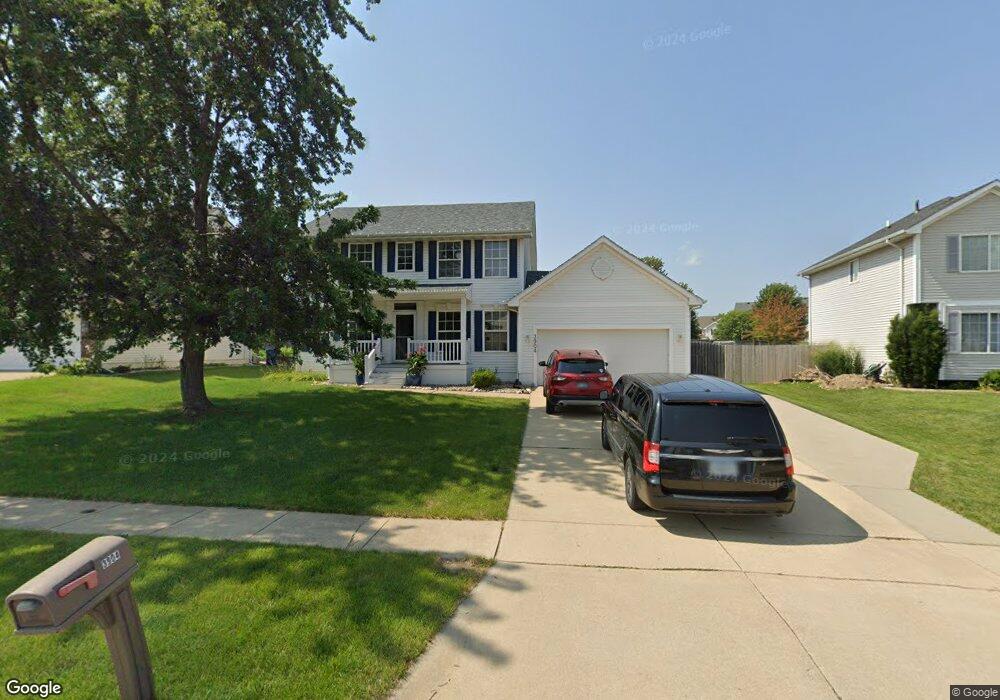
3904 124th St Urbandale, IA 50323
Estimated Value: $348,000 - $382,854
3
Beds
3
Baths
1,716
Sq Ft
$212/Sq Ft
Est. Value
About This Home
This home is located at 3904 124th St, Urbandale, IA 50323 and is currently estimated at $364,214, approximately $212 per square foot. 3904 124th St is a home located in Polk County with nearby schools including Webster Elementary School, Urbandale Middle School, and Urbandale High School.
Ownership History
Date
Name
Owned For
Owner Type
Purchase Details
Closed on
May 18, 2021
Sold by
Kimberley Matthew Sean
Bought by
Kimberley Jody L
Current Estimated Value
Purchase Details
Closed on
Jan 25, 2000
Sold by
Midland Homes Lc
Bought by
Kimberley Matthew S and Kimberley Jody L
Home Financials for this Owner
Home Financials are based on the most recent Mortgage that was taken out on this home.
Original Mortgage
$159,050
Outstanding Balance
$51,446
Interest Rate
8.08%
Estimated Equity
$312,768
Purchase Details
Closed on
Jan 18, 2000
Sold by
Douglas Parkway Developers Lc
Bought by
Regency Land Company Lc
Home Financials for this Owner
Home Financials are based on the most recent Mortgage that was taken out on this home.
Original Mortgage
$159,050
Outstanding Balance
$51,446
Interest Rate
8.08%
Estimated Equity
$312,768
Create a Home Valuation Report for This Property
The Home Valuation Report is an in-depth analysis detailing your home's value as well as a comparison with similar homes in the area
Home Values in the Area
Average Home Value in this Area
Purchase History
| Date | Buyer | Sale Price | Title Company |
|---|---|---|---|
| Kimberley Jody L | -- | None Available | |
| Kimberley Matthew S | $167,000 | -- | |
| Midland Homes Lc | -- | -- | |
| Regency Land Company Lc | $32,000 | -- |
Source: Public Records
Mortgage History
| Date | Status | Borrower | Loan Amount |
|---|---|---|---|
| Open | Kimberley Matthew S | $159,050 |
Source: Public Records
Tax History Compared to Growth
Tax History
| Year | Tax Paid | Tax Assessment Tax Assessment Total Assessment is a certain percentage of the fair market value that is determined by local assessors to be the total taxable value of land and additions on the property. | Land | Improvement |
|---|---|---|---|---|
| 2025 | $5,992 | $358,600 | $82,800 | $275,800 |
| 2024 | $5,992 | $341,300 | $77,700 | $263,600 |
| 2023 | $5,692 | $341,300 | $77,700 | $263,600 |
| 2022 | $5,626 | $274,200 | $63,100 | $211,100 |
| 2021 | $5,790 | $274,200 | $63,100 | $211,100 |
| 2020 | $5,538 | $267,700 | $61,300 | $206,400 |
| 2019 | $5,174 | $260,900 | $61,300 | $199,600 |
| 2018 | $4,988 | $230,100 | $52,900 | $177,200 |
| 2017 | $4,378 | $230,100 | $52,900 | $177,200 |
| 2016 | $4,270 | $199,100 | $49,300 | $149,800 |
| 2015 | $4,270 | $199,100 | $49,300 | $149,800 |
| 2014 | $4,140 | $191,400 | $46,600 | $144,800 |
Source: Public Records
Map
Nearby Homes
- 12220 Horton Ave
- 12515 Airline Ave
- 12324 Sunflower Dr
- 12527 Airline Ave
- 12510 Prairie Dr
- 12202 Madison Ave
- 3935 122nd St
- 12723 Sunflower Dr
- 4016 127th St
- 14311 Catalpa Dr
- 14212 Catalpa Dr
- 14216 Catalpa Dr
- 4143 122nd St
- 12335 Tanglewood Dr
- 4412 125th St
- 12912 Hammontree Dr
- 12926 Timberline Dr
- 4309 129th St
- 12993 Oak Brook Dr
- 13114 Iltis Dr
- 3908 124th St
- 3900 124th St
- 3917 125th St
- 3882 124th St
- 3911 125th St
- 3912 124th St
- 12410 Airline Ave
- 12317 Horton Ave
- 3907 125th St
- 3878 124th St
- 3921 125th St
- 12404 Airline Ave
- 3911 124th St
- 12674 Horton Ave
- 3903 125th St
- 3874 124th St
- 12320 Horton Ave
- 12309 Horton Ave
- 3905 Belair Dr
- 12316 Horton Ave