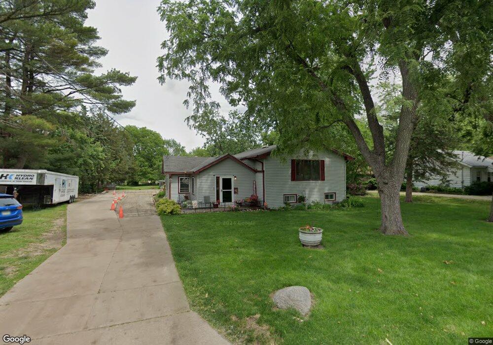
3905 Lay St Des Moines, IA 50317
Douglas Acres NeighborhoodEstimated Value: $230,000 - $255,448
2
Beds
2
Baths
1,717
Sq Ft
$141/Sq Ft
Est. Value
About This Home
This home is located at 3905 Lay St, Des Moines, IA 50317 and is currently estimated at $241,612, approximately $140 per square foot. 3905 Lay St is a home located in Polk County with nearby schools including Garton Elementary School, Goodrell Middle School, and North High School.
Ownership History
Date
Name
Owned For
Owner Type
Purchase Details
Closed on
Apr 4, 2023
Sold by
Bryant Julie K
Bought by
Julie K Bryant Revocable Trust
Current Estimated Value
Purchase Details
Closed on
Jul 1, 1998
Sold by
Bryant Donald L
Bought by
Bryant Julie K
Create a Home Valuation Report for This Property
The Home Valuation Report is an in-depth analysis detailing your home's value as well as a comparison with similar homes in the area
Home Values in the Area
Average Home Value in this Area
Purchase History
| Date | Buyer | Sale Price | Title Company |
|---|---|---|---|
| Julie K Bryant Revocable Trust | -- | -- | |
| Bryant Julie K | -- | -- |
Source: Public Records
Tax History Compared to Growth
Tax History
| Year | Tax Paid | Tax Assessment Tax Assessment Total Assessment is a certain percentage of the fair market value that is determined by local assessors to be the total taxable value of land and additions on the property. | Land | Improvement |
|---|---|---|---|---|
| 2025 | $3,892 | $257,900 | $55,200 | $202,700 |
| 2024 | $3,892 | $208,300 | $47,700 | $160,600 |
| 2023 | $3,894 | $208,300 | $47,700 | $160,600 |
| 2022 | $3,862 | $174,100 | $41,700 | $132,400 |
| 2021 | $3,912 | $174,100 | $41,700 | $132,400 |
| 2020 | $4,060 | $165,400 | $39,300 | $126,100 |
| 2019 | $3,552 | $165,400 | $39,300 | $126,100 |
| 2018 | $3,512 | $140,700 | $32,900 | $107,800 |
| 2017 | $3,508 | $140,700 | $32,900 | $107,800 |
| 2016 | $3,412 | $138,200 | $31,700 | $106,500 |
| 2015 | $3,412 | $138,200 | $31,700 | $106,500 |
| 2014 | $3,286 | $132,400 | $29,700 | $102,700 |
Source: Public Records
Map
Nearby Homes
- 2483 E Douglas Ave
- 4010 E 23rd St
- 4032 E 23rd St
- 2519 E Aurora Ave
- 3315 E 25th St
- 2511 E Ovid Ave
- 2407 E Tiffin Ave
- 2704 Wedgewood Rd
- 4300 NE 27th St
- 2822 Wedgewood Rd
- 2722 E Tiffin Ave
- 2719 E Tiffin Ave
- 2746 E Tiffin Ave
- 2718 Richmond Ave
- 2680 Hull Ave
- 4140 E 30th St
- 2776 NE Norwood Ln
- 2817 Richmond Ave
- 2809 E 24th St
- 2114 Boyd St