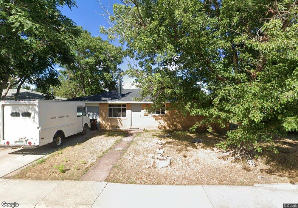
3905 Martin Dr Boulder, CO 80305
South Boulder NeighborhoodEstimated Value: $700,587 - $852,000
3
Beds
2
Baths
1,152
Sq Ft
$685/Sq Ft
Est. Value
About This Home
This home is located at 3905 Martin Dr, Boulder, CO 80305 and is currently estimated at $789,147, approximately $685 per square foot. 3905 Martin Dr is a home located in Boulder County with nearby schools including Creekside Elementary School, Manhattan Middle School of the Arts & Academics, and Fairview High School.
Ownership History
Date
Name
Owned For
Owner Type
Purchase Details
Closed on
Aug 31, 1994
Sold by
Robichaud Thomas G and Robichaud Stacey
Bought by
Freitik Ralph
Current Estimated Value
Home Financials for this Owner
Home Financials are based on the most recent Mortgage that was taken out on this home.
Original Mortgage
$124,650
Interest Rate
8.46%
Purchase Details
Closed on
Oct 4, 1989
Bought by
Freitik Ralph
Purchase Details
Closed on
Sep 24, 1985
Bought by
Freitik Ralph
Purchase Details
Closed on
Nov 19, 1975
Bought by
Freitik Ralph
Create a Home Valuation Report for This Property
The Home Valuation Report is an in-depth analysis detailing your home's value as well as a comparison with similar homes in the area
Home Values in the Area
Average Home Value in this Area
Purchase History
| Date | Buyer | Sale Price | Title Company |
|---|---|---|---|
| Freitik Ralph | $138,500 | Commonwealth Land Title Ins | |
| Freitik Ralph | $77,400 | -- | |
| Freitik Ralph | $75,000 | -- | |
| Freitik Ralph | $32,000 | -- |
Source: Public Records
Mortgage History
| Date | Status | Borrower | Loan Amount |
|---|---|---|---|
| Closed | Freitik Ralph | $124,650 |
Source: Public Records
Tax History
| Year | Tax Paid | Tax Assessment Tax Assessment Total Assessment is a certain percentage of the fair market value that is determined by local assessors to be the total taxable value of land and additions on the property. | Land | Improvement |
|---|---|---|---|---|
| 2025 | $3,282 | $42,081 | $32,681 | $9,400 |
| 2024 | $3,282 | $42,081 | $32,681 | $9,400 |
| 2023 | $3,225 | $44,046 | $38,103 | $9,628 |
| 2022 | $3,491 | $37,593 | $28,419 | $9,174 |
| 2021 | $3,329 | $38,674 | $29,236 | $9,438 |
| 2020 | $3,274 | $37,616 | $23,881 | $13,735 |
| 2019 | $3,224 | $37,616 | $23,881 | $13,735 |
| 2018 | $3,038 | $35,035 | $22,464 | $12,571 |
| 2017 | $2,942 | $38,733 | $24,835 | $13,898 |
| 2016 | $2,700 | $31,187 | $15,442 | $15,745 |
| 2015 | $2,556 | $24,835 | $11,701 | $13,134 |
| 2014 | $2,088 | $24,835 | $11,701 | $13,134 |
Source: Public Records
Map
Nearby Homes
- 210 S 39th St
- 3805 Martin Dr
- 345 S 38th St
- 450 S 41st St
- 4453 Hamilton Ct
- 4595 Moorhead Ave
- 4835 Moorhead Ave
- 3000 Dartmouth Ave
- 725 S 45th St
- 2955 Stanford Ave
- 4763 Tantra Dr Unit B
- 4800 Osage Dr Unit B-16
- 750 W Moorhead Cir Unit A
- 800 W Moorhead Cir Unit E
- 4475 Laguna Place Unit 206
- 2585 Kohler Dr
- 860 W Moorhead Cir Unit 2K
- 860 W Moorhead Cir Unit 1I
- 860 W Moorhead Cir Unit 2H
- 4415 Laguna Place Unit 201
- 3935 Martin Dr
- 3895 Martin Dr
- 3830 Elmhurst Place
- 3820 Elmhurst Place
- 3965 Martin Dr
- 3845 Martin Dr
- 205 S 39th St
- 3810 Elmhurst Place
- 3840 Elmhurst Place
- 220 S 39th St
- 3995 Martin Dr
- 225 S 40th St
- 215 S 39th St
- 3968 Fuller Ct
- 3800 Elmhurst Place
- 180 S 38th St
- 3966 Fuller Ct
- 235 S 40th St
- 230 S 39th St
- 4005 Martin Dr
Your Personal Tour Guide
Ask me questions while you tour the home.