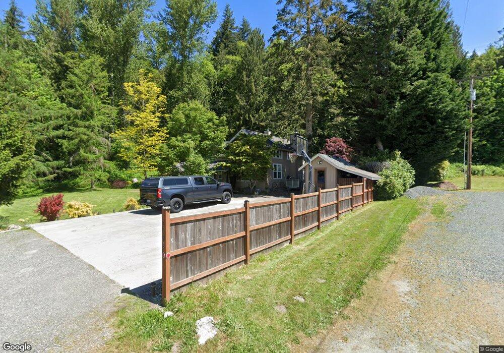
3906 E Hoff Rd Everson, WA 98247
Estimated Value: $676,000 - $959,000
3
Beds
3
Baths
2,647
Sq Ft
$299/Sq Ft
Est. Value
About This Home
This home is located at 3906 E Hoff Rd, Everson, WA 98247 and is currently estimated at $790,810, approximately $298 per square foot. 3906 E Hoff Rd is a home located in Whatcom County with nearby schools including Mount Baker Senior High School.
Ownership History
Date
Name
Owned For
Owner Type
Purchase Details
Closed on
Jun 24, 2008
Sold by
Brown Alyson J
Bought by
Hanstead Dustin T and Hanstead Danielle K
Current Estimated Value
Home Financials for this Owner
Home Financials are based on the most recent Mortgage that was taken out on this home.
Original Mortgage
$240,000
Outstanding Balance
$151,511
Interest Rate
5.99%
Mortgage Type
Purchase Money Mortgage
Estimated Equity
$639,299
Purchase Details
Closed on
Apr 3, 2002
Sold by
Brown Michael F
Bought by
Brown Michael F and Brown Alyson J
Home Financials for this Owner
Home Financials are based on the most recent Mortgage that was taken out on this home.
Original Mortgage
$212,000
Interest Rate
6.78%
Purchase Details
Closed on
Sep 16, 1999
Sold by
Brown Laura Paige
Bought by
Brown Michael F
Purchase Details
Closed on
Jun 23, 1999
Sold by
Brown Laura Paige
Bought by
Brown Michael F
Create a Home Valuation Report for This Property
The Home Valuation Report is an in-depth analysis detailing your home's value as well as a comparison with similar homes in the area
Purchase History
| Date | Buyer | Sale Price | Title Company |
|---|---|---|---|
| Hanstead Dustin T | $300,280 | Whatcom Land Title | |
| Brown Michael F | -- | Chicago Title Insurance | |
| Brown Michael F | -- | -- | |
| Brown Michael F | -- | -- |
Source: Public Records
Mortgage History
| Date | Status | Borrower | Loan Amount |
|---|---|---|---|
| Open | Hanstead Dustin T | $240,000 | |
| Previous Owner | Brown Michael F | $212,000 | |
| Closed | Brown Michael F | $23,000 |
Source: Public Records
Tax History
| Year | Tax Paid | Tax Assessment Tax Assessment Total Assessment is a certain percentage of the fair market value that is determined by local assessors to be the total taxable value of land and additions on the property. | Land | Improvement |
|---|---|---|---|---|
| 2025 | $4,884 | $637,886 | $232,774 | $405,112 |
| 2024 | $5,221 | $626,847 | $231,616 | $395,231 |
| 2023 | $5,221 | $721,828 | $337,817 | $384,011 |
| 2022 | $4,570 | $591,648 | $276,892 | $314,756 |
| 2021 | $4,126 | $477,131 | $223,298 | $253,833 |
| 2020 | $3,799 | $404,347 | $189,235 | $215,112 |
| 2019 | $3,391 | $356,260 | $166,730 | $189,530 |
| 2018 | $3,790 | $343,482 | $160,750 | $182,732 |
| 2017 | $3,428 | $300,234 | $133,085 | $167,149 |
| 2016 | $3,298 | $289,810 | $128,464 | $161,346 |
| 2015 | $3,041 | $276,779 | $122,688 | $154,091 |
| 2014 | -- | $260,620 | $115,525 | $145,095 |
| 2013 | -- | $260,620 | $115,525 | $145,095 |
Source: Public Records
Map
Nearby Homes
- 3772 E Hoff Rd
- 5947 Lawrence Rd
- 3999 Deming Rd
- 3557 Cedarville Rd Unit 25
- 4730 Mt Baker Hwy
- 3067 E Smith Rd
- 10211 Mount Baker Hwy
- 5242 Scarlett Way
- 0 Mt Baker Hwy Unit NWM2371192
- 0 Mt Baker Hwy Unit NWM2489013
- 0 Mt Baker Hwy Unit NWM2230071
- 3395 Mack Rd
- 5196 Sand Rd
- 2749 Murphy Place
- 3090 Cole Rd
- 7406 Oat Coles Rd
- 3037 Massey Rd
- 2495 River Rock Dr
- 2200 E Smith Rd
- 5818 Everson Goshen Rd
Your Personal Tour Guide
Ask me questions while you tour the home.