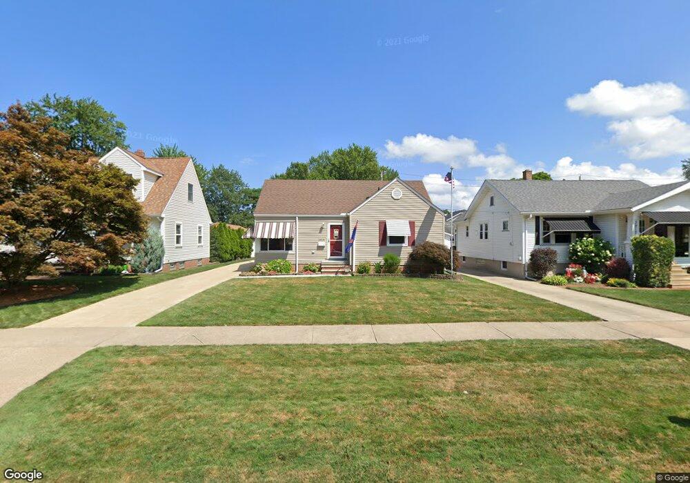
3909 W 210th St Cleveland, OH 44126
Estimated Value: $231,520 - $257,000
4
Beds
1
Bath
1,224
Sq Ft
$201/Sq Ft
Est. Value
About This Home
This home is located at 3909 W 210th St, Cleveland, OH 44126 and is currently estimated at $246,380, approximately $201 per square foot. 3909 W 210th St is a home located in Cuyahoga County with nearby schools including Gilles-Sweet Elementary School, Lewis F Mayer Middle School, and Fairview High School.
Ownership History
Date
Name
Owned For
Owner Type
Purchase Details
Closed on
Apr 3, 1985
Sold by
James Shuttleworth
Bought by
Shuttleworth William
Current Estimated Value
Purchase Details
Closed on
Mar 16, 1983
Sold by
Shuttleworth James
Bought by
James Shuttleworth
Purchase Details
Closed on
Feb 23, 1983
Sold by
Shuttleworth Duane R
Bought by
Shuttleworth James
Purchase Details
Closed on
Jun 9, 1981
Sold by
Shuttleworth Duane R
Bought by
Shuttleworth Duane R
Purchase Details
Closed on
Jan 1, 1975
Bought by
Shuttleworth Duane R
Create a Home Valuation Report for This Property
The Home Valuation Report is an in-depth analysis detailing your home's value as well as a comparison with similar homes in the area
Home Values in the Area
Average Home Value in this Area
Purchase History
| Date | Buyer | Sale Price | Title Company |
|---|---|---|---|
| Shuttleworth William | -- | -- | |
| James Shuttleworth | $26,000 | -- | |
| Shuttleworth James | -- | -- | |
| Shuttleworth Duane R | -- | -- | |
| Shuttleworth Duane R | -- | -- |
Source: Public Records
Tax History Compared to Growth
Tax History
| Year | Tax Paid | Tax Assessment Tax Assessment Total Assessment is a certain percentage of the fair market value that is determined by local assessors to be the total taxable value of land and additions on the property. | Land | Improvement |
|---|---|---|---|---|
| 2024 | $4,427 | $63,700 | $11,865 | $51,835 |
| 2023 | $4,525 | $55,930 | $10,150 | $45,780 |
| 2022 | $4,414 | $55,930 | $10,150 | $45,780 |
| 2021 | $4,501 | $55,930 | $10,150 | $45,780 |
| 2020 | $4,143 | $45,120 | $8,190 | $36,930 |
| 2019 | $3,686 | $128,900 | $23,400 | $105,500 |
| 2018 | $3,561 | $45,120 | $8,190 | $36,930 |
| 2017 | $3,599 | $40,710 | $7,320 | $33,390 |
| 2016 | $3,575 | $40,710 | $7,320 | $33,390 |
| 2015 | $3,377 | $40,710 | $7,320 | $33,390 |
| 2014 | $3,377 | $38,790 | $6,970 | $31,820 |
Source: Public Records
Map
Nearby Homes
- 3712 Addington Ct
- 20778 Woodstock Ave
- 21236 Northwood Ave
- 20663 Woodstock Ave
- 3740 W 214th St
- 3420 W 210th St
- 21143 Westwood Rd
- 21237 Westwood Rd
- 3340 W 210th St
- 3733 River Ln
- 21872 Addington Blvd Unit 15
- 4348 W 202nd St
- 4352 W 211th St
- 2888 Pease Dr Unit 110
- 2885 Pease Dr Unit 106
- 20187 Grannis Rd
- 20877 Fairpark Dr
- 4036 W 219th St
- 3167 Linden Rd Unit 503
- 3167 Linden Rd Unit 309
- 3901 W 210th St
- 3925 W 210th St
- 3893 W 210th St
- 20968 Belvidere Ave
- 3929 W 210th St
- 20960 Belvidere Ave
- 3910 W 210th St
- 20952 Belvidere Ave
- 3900 W 210th St
- 3877 W 210th St
- 3920 W 210th St
- 3894 W 210th St
- 3928 W 210th St
- 3945 W 210th St
- 20894 Belvidere Ave
- 3869 W 210th St
- 3936 W 210th St
- 3953 W 210th St
- 3880 W 210th St
- 20880 Belvidere Ave