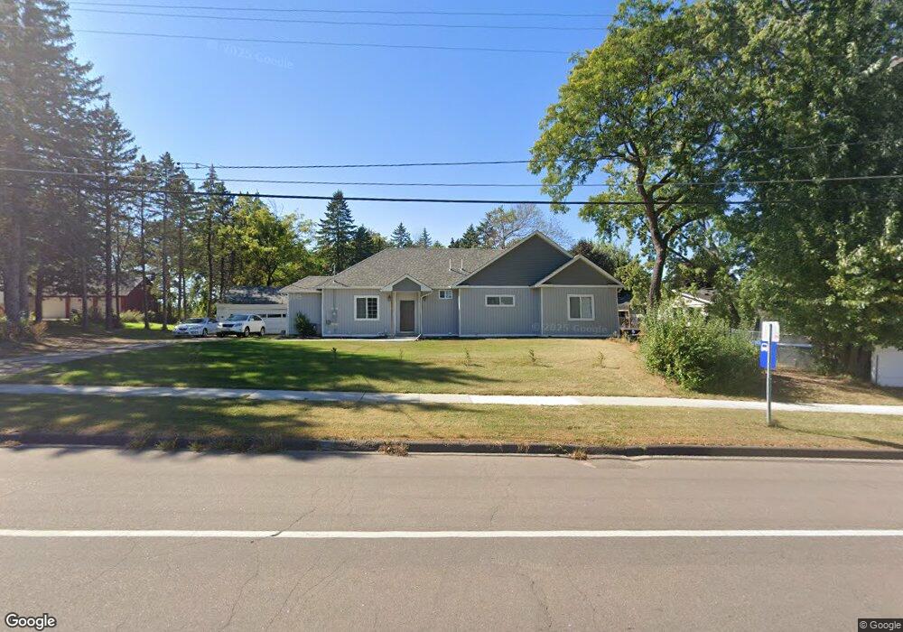
391 391 McKnight-road-s St. Paul, MN 55119
Battle Creek NeighborhoodEstimated Value: $342,000 - $440,000
2
Beds
1
Bath
1,899
Sq Ft
$206/Sq Ft
Est. Value
About This Home
This home is located at 391 391 McKnight-road-s, St. Paul, MN 55119 and is currently estimated at $391,804, approximately $206 per square foot. 391 391 McKnight-road-s is a home located in Ramsey County with nearby schools including Highwood Hills Elementary School, Battle Creek Middle School, and Harding Senior High School.
Ownership History
Date
Name
Owned For
Owner Type
Purchase Details
Closed on
Dec 7, 2020
Sold by
Swanson Richard and Swanson Michelle M
Bought by
Vang Cecilia and Vang Nou
Current Estimated Value
Home Financials for this Owner
Home Financials are based on the most recent Mortgage that was taken out on this home.
Original Mortgage
$251,750
Interest Rate
2.71%
Mortgage Type
New Conventional
Create a Home Valuation Report for This Property
The Home Valuation Report is an in-depth analysis detailing your home's value as well as a comparison with similar homes in the area
Home Values in the Area
Average Home Value in this Area
Purchase History
| Date | Buyer | Sale Price | Title Company |
|---|---|---|---|
| Vang Cecilia | $265,000 | Titlesmart Inc | |
| Vang Cecilia Cecilia | $265,000 | -- |
Source: Public Records
Mortgage History
| Date | Status | Borrower | Loan Amount |
|---|---|---|---|
| Previous Owner | Vang Cecilia | $251,750 | |
| Closed | Vang Cecilia Cecilia | $251,750 |
Source: Public Records
Tax History Compared to Growth
Tax History
| Year | Tax Paid | Tax Assessment Tax Assessment Total Assessment is a certain percentage of the fair market value that is determined by local assessors to be the total taxable value of land and additions on the property. | Land | Improvement |
|---|---|---|---|---|
| 2025 | $5,444 | $457,200 | $174,200 | $283,000 |
| 2023 | $5,444 | $322,900 | $174,200 | $148,700 |
| 2022 | $4,304 | $283,900 | $174,200 | $109,700 |
| 2021 | $4,776 | $230,500 | $174,200 | $56,300 |
| 2020 | $4,700 | $246,800 | $174,200 | $72,600 |
| 2019 | $4,202 | $232,200 | $174,200 | $58,000 |
| 2018 | $3,716 | $202,300 | $174,200 | $28,100 |
| 2017 | $4,338 | $185,700 | $174,200 | $11,500 |
| 2016 | $4,778 | $0 | $0 | $0 |
| 2015 | $5,184 | $217,200 | $174,200 | $43,000 |
| 2014 | $5,006 | $0 | $0 | $0 |
Source: Public Records
Map
Nearby Homes
- 2321 Pond Ave E Unit 36
- 2363 Dorland Ln E
- 2365 Dorland Ln E Unit 62
- 2445 Londin Ln E Unit 310
- 567 Lakewood Dr S
- 408 Totem Rd
- 371, 377, 381 Totem Rd
- 515 Marnie St S
- 2338 Hillwood Dr E
- 2485 Londin Ln E Unit 323
- 2485 Londin Ln E Unit 418
- 491 Burlington Rd
- 2169 Glenridge Ave
- 2250 Edgebrook Ave
- 688 Burlington Rd
- 479 Mary St S
- 2243 Edgebrook Ave
- 0 Oakridge St
- 2070 Oakridge St
- 2227 Vivian Ln
- 389 Londin Place
- 388 Londin Cir
- 386 Londin Cir
- 385 Londin Place
- 395 395 McKnight-road-s
- 388 Londin Place
- 395 Mcknight Rd S
- 391 Mcknight Rd S
- 387 Londin Cir
- 381 Londin Place
- 380 Londin Cir
- 407 407 McKnight-road-s
- 407 Mcknight Rd S
- 384 Londin Place
- 373 Londin Place
- 385 Londin Cir
- 374 Londin Cir
- 380 Londin Place
- 425 Mcknight Rd S
- 381 Londin Cir