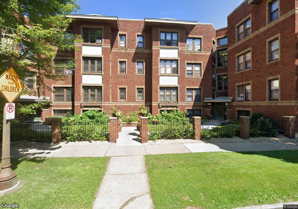
391 Laurel Ave Unit 112 Saint Paul, MN 55102
Summit-University NeighborhoodEstimated Value: $147,937 - $177,000
1
Bed
1
Bath
636
Sq Ft
$255/Sq Ft
Est. Value
About This Home
This home is located at 391 Laurel Ave Unit 112, Saint Paul, MN 55102 and is currently estimated at $162,234, approximately $255 per square foot. 391 Laurel Ave Unit 112 is a home located in Ramsey County with nearby schools including Jackson Elementary, Maxfield Magnet Elementary School, and Hidden River Middle School.
Ownership History
Date
Name
Owned For
Owner Type
Purchase Details
Closed on
Jul 6, 2018
Sold by
Rockstad Timothy
Bought by
Rocksted Stephen D
Current Estimated Value
Purchase Details
Closed on
Apr 28, 2017
Sold by
Adams Elizabeth N and Boyle James R
Bought by
Rockstad Timothy
Home Financials for this Owner
Home Financials are based on the most recent Mortgage that was taken out on this home.
Original Mortgage
$114,000
Interest Rate
4.03%
Purchase Details
Closed on
Sep 19, 2008
Sold by
Stirn Laura A
Bought by
Adams Elizabeth N
Purchase Details
Closed on
Apr 12, 2002
Sold by
Jochum Julie
Bought by
Stirn Melissa R and Gartrell Daniel J
Purchase Details
Closed on
Jul 16, 1998
Sold by
Johnson Gerald J
Bought by
Jochum Julie
Create a Home Valuation Report for This Property
The Home Valuation Report is an in-depth analysis detailing your home's value as well as a comparison with similar homes in the area
Home Values in the Area
Average Home Value in this Area
Purchase History
| Date | Buyer | Sale Price | Title Company |
|---|---|---|---|
| Rocksted Stephen D | -- | None Available | |
| Rockstad Timothy | $123,636 | Edina Realty Title Inc | |
| Adams Elizabeth N | $146,000 | -- | |
| Stirn Melissa R | $112,400 | -- | |
| Jochum Julie | $65,000 | -- |
Source: Public Records
Mortgage History
| Date | Status | Borrower | Loan Amount |
|---|---|---|---|
| Previous Owner | Rockstad Timothy | $114,000 |
Source: Public Records
Tax History Compared to Growth
Tax History
| Year | Tax Paid | Tax Assessment Tax Assessment Total Assessment is a certain percentage of the fair market value that is determined by local assessors to be the total taxable value of land and additions on the property. | Land | Improvement |
|---|---|---|---|---|
| 2025 | $2,456 | $149,600 | $1,000 | $148,600 |
| 2023 | $2,456 | $149,000 | $1,000 | $148,000 |
| 2022 | $2,230 | $152,000 | $1,000 | $151,000 |
| 2021 | $2,110 | $135,800 | $1,000 | $134,800 |
| 2020 | $2,046 | $133,100 | $1,000 | $132,100 |
| 2019 | $2,072 | $119,800 | $1,000 | $118,800 |
| 2018 | $1,890 | $119,800 | $1,000 | $118,800 |
| 2017 | $1,342 | $110,700 | $1,000 | $109,700 |
| 2016 | $1,794 | $0 | $0 | $0 |
| 2015 | $1,806 | $105,700 | $10,600 | $95,100 |
| 2014 | $1,680 | $0 | $0 | $0 |
Source: Public Records
Map
Nearby Homes
- 112 Western Ave N Unit 4
- 112 Western Ave N Unit 3
- 355 Laurel Ave
- 422 Laurel Ave
- 102 Western Ave N Unit 4
- 115 Western Ave N Unit 3M
- 80 Western Ave N Unit 310
- 79 Western Ave N Unit 304
- 76 Western Ave N
- 370 Marshall Ave Unit 308
- 370 Marshall Ave Unit 301
- 56 Arundel St Unit 10
- 297 Laurel Ave
- 301 Selby Ave
- 182 MacKubin St Unit 1
- 305 Dayton Ave Unit 7
- 304 Marshall Ave Unit 5
- 438 Portland Ave Unit 4
- 438 Portland Ave Unit 7
- 487 Dayton Ave Unit 1
- 385 Laurel Ave Unit 2
- 385 Laurel Ave Unit 10
- 385 Laurel Ave Unit 107
- 385 Laurel Ave Unit 310
- 385 Laurel Ave Unit 309
- 385 Laurel Ave Unit 211
- 385 Laurel Ave Unit 209
- 385 Laurel Ave Unit 110
- 385 Laurel Ave Unit 308
- 385 Laurel Ave Unit 306
- 385 Laurel Ave Unit 109
- 385 Laurel Ave Unit 311
- 385 Laurel Ave Unit 111
- 385 Laurel Ave Unit 210
- 385 Laurel Ave Unit 208
- 385 Laurel Ave Unit 108
- 385 Laurel Ave Unit 307
- 385 Laurel Ave Unit 207
- 385 Laurel Ave Unit 206
- 385 Laurel Ave Unit 106